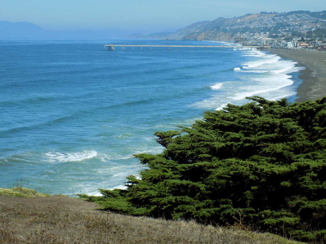
 Mori Point is part of Golden Gate National Recreation Area in the town of Pacifica, next to Sharp Park. It has a 0.5-mile handicapped-accessible trail to the bluffs overlooking the black sands of Sharp Park Beach but there are also more challenging trails the climb up to the peaks of the ridges that form Mori Point.
0 Comments
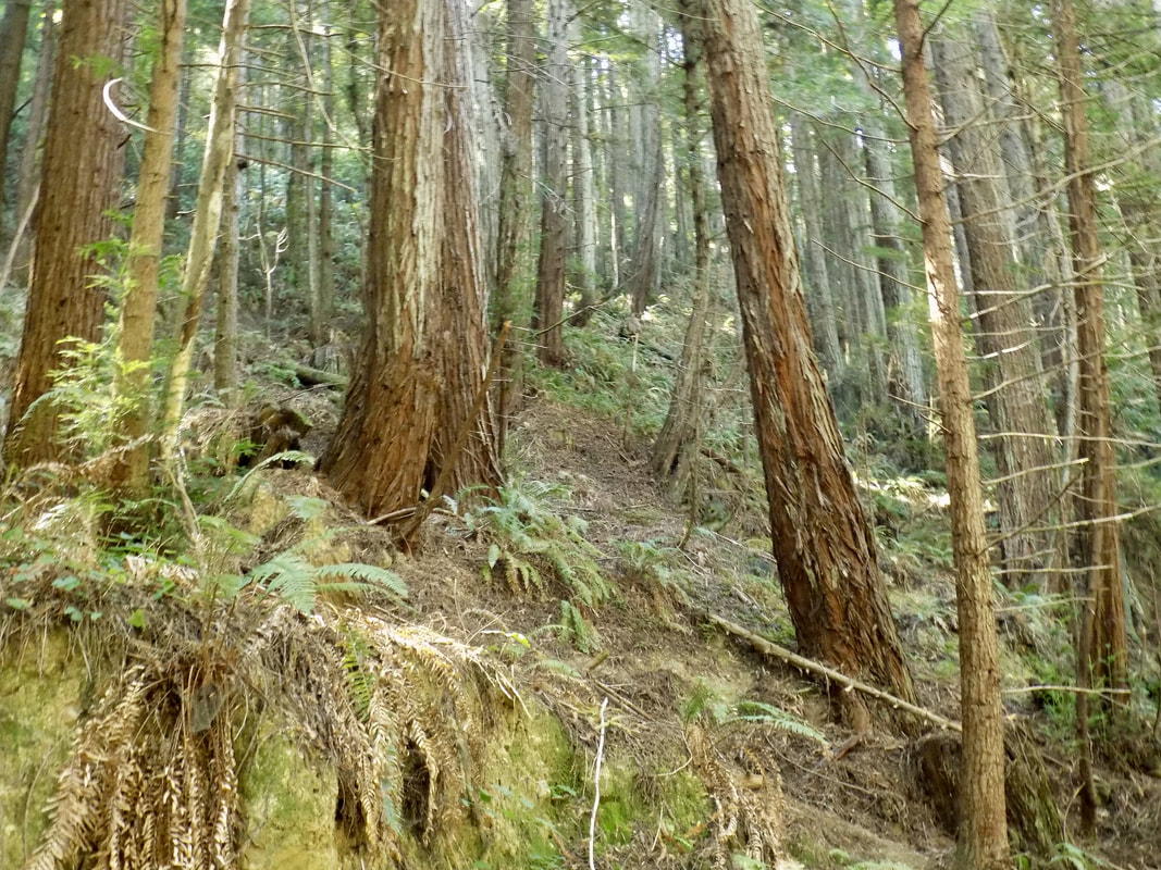 This was a return visit to Purisima Creek Redwoods Open Space Preserve. Last time, I made a 7-mile loop; this time I took it a little easy because I had my 2-month old with me!
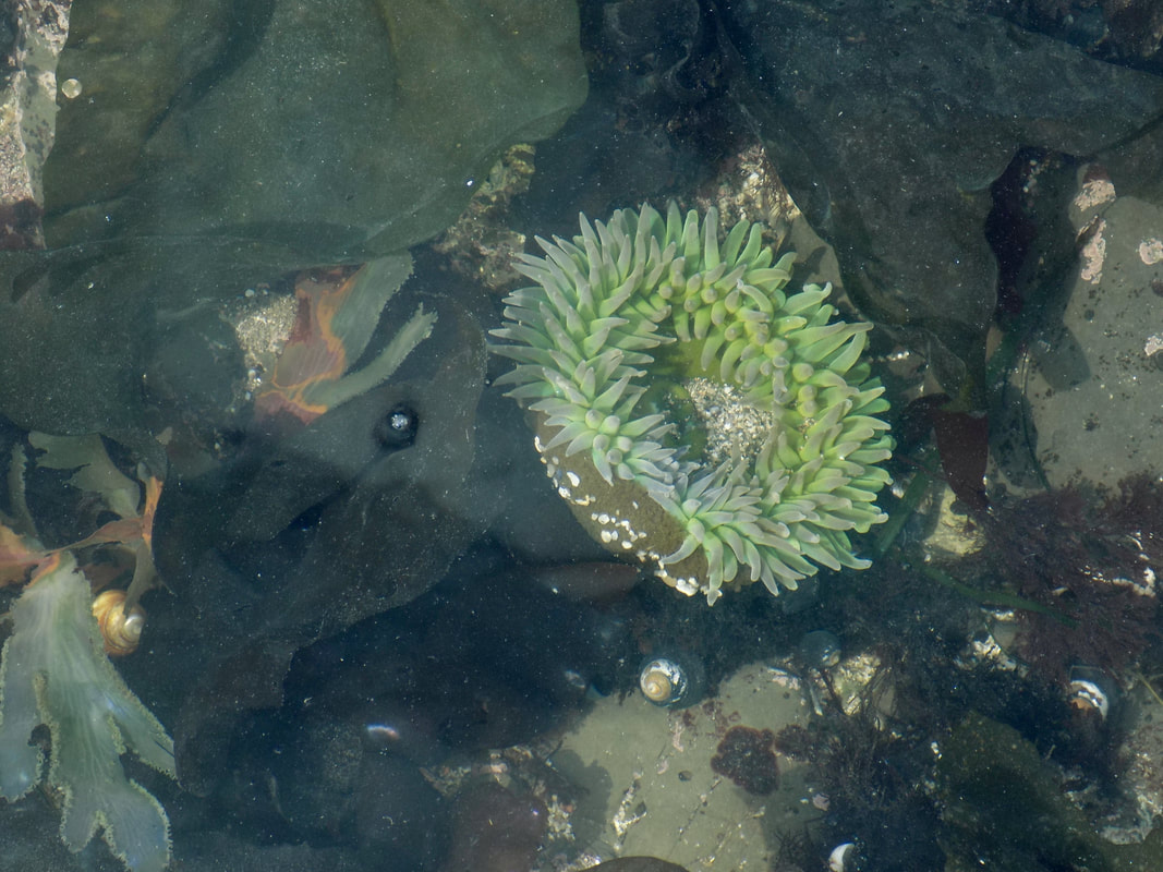 I've written about the Pillar Point Bluff and the Fitzgerald Marine Reserve before, but that blog post was mostly about the trails along the bluffs. We had the good luck to visit the Moss Beach marine reserve at low tide recently, and we were treated to anchovies, anemones, and harbor seals among other things!
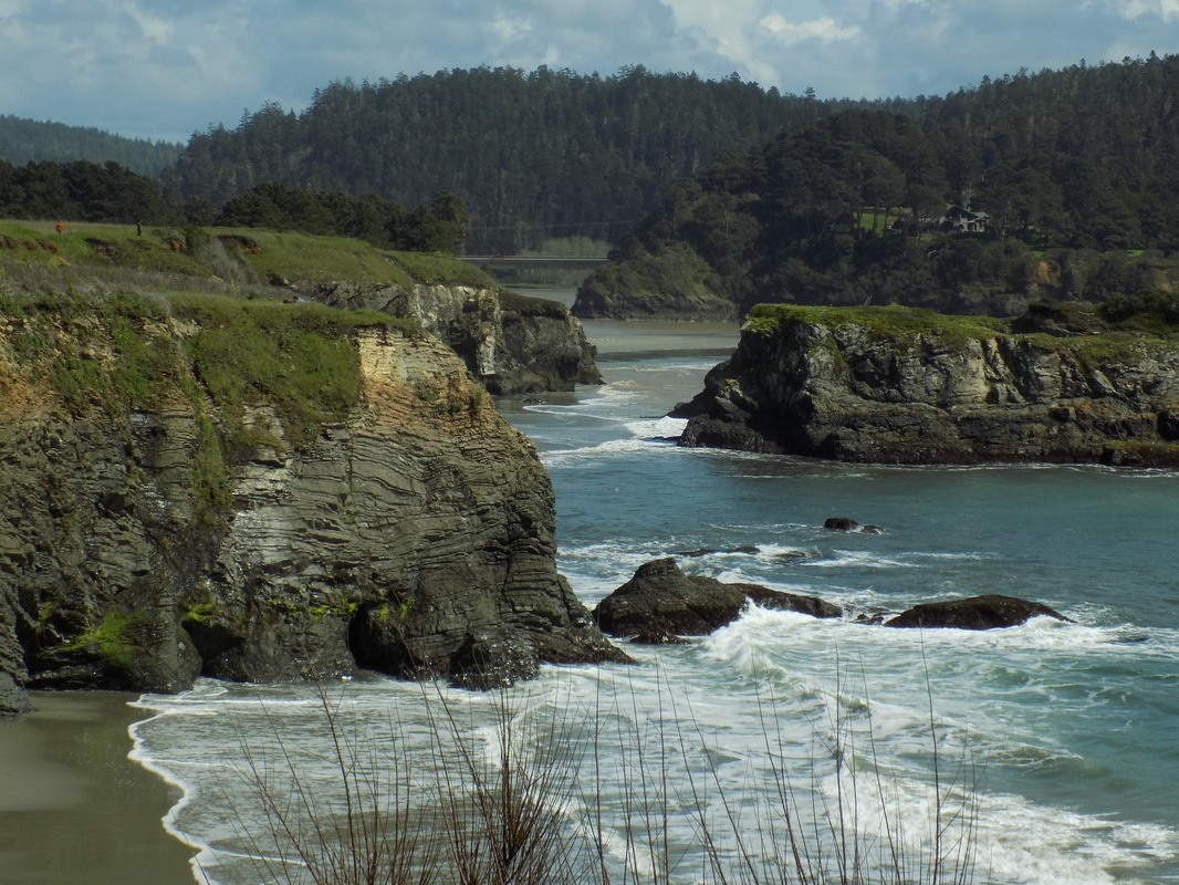 One of my dear friends just had a milestone birthday, and she celebrated by throwing a weekend-long birthday extravaganza in beautiful Mendocino, CA. She and her extended family stayed at Spring Ranch in nearby Little River, which abuts part of the property now owned by Van Damme State Park. My husband and I stayed at the JD House in Mendocino, where we were within walking distance to both great food (such as at the Trillium Cafe) and picturesque Mendocino Headlands State Park. The lede photo shows the coastline from Mendocino Headlands State Park. See photos from the town of Mendocino (with its many water towers) after the jump.
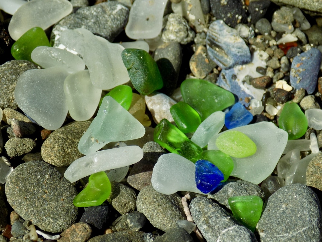 Glass Beach is technically part of MacKerricher State Park, but it's actually easier to access the main beach from Noyo Heandlands Park in the city of Fort Bragg, CA. If you want to hike up to 10 miles (5 miles and back) then you can check out the new Coastal Trail, which also connects to additional trails in MacKerricher.
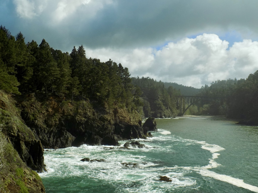 This was a return visit for me to Russian Gulch State Park. The last time that I was here, I did the more intense waterfall hike, but this time I kept things short and sweet with a 1-mile loop along the headlands to the sinkhole named Devil's Punch Bowl. It was really cool to see this sinkhole again--it was much greener in March than it was in June last year. On top of greener spring grasses, the sun was out; this made for some beautiful photographs of the water and the wildflowers! See those after the jump.
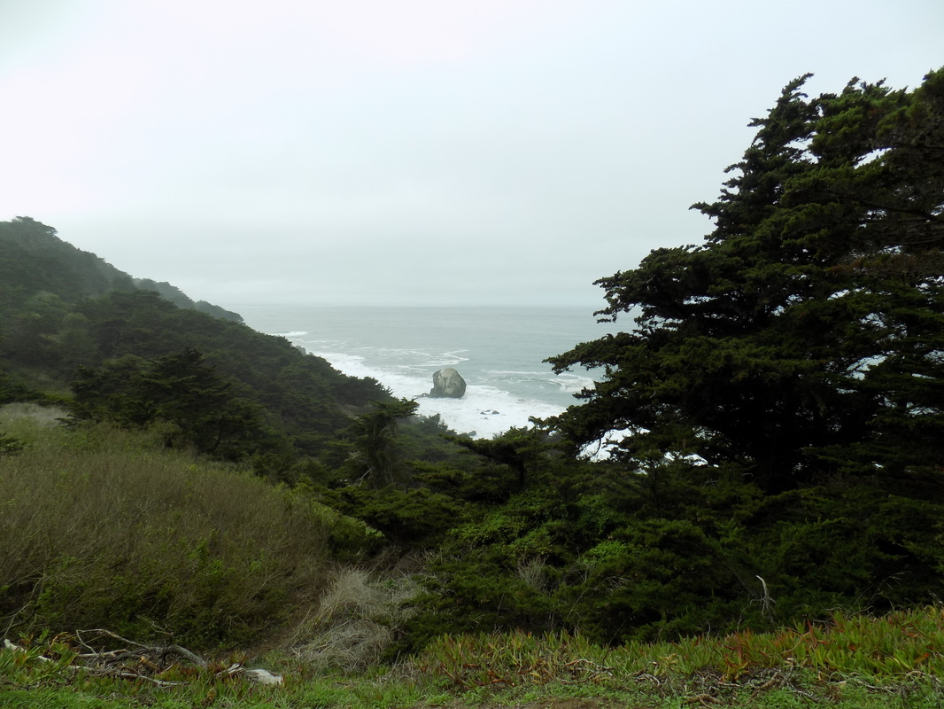
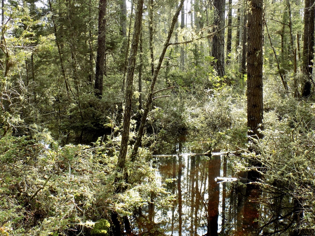 This was a return visit for me to Van Damme State Park. I had a quick stop there last summer to walk along the small beach near the entrance to the park after I had already completed a longer hike at near-by Russian Gulch. I finally had a chance to explore the Pygmy Forest!
This trail is located off Little River Airport Road instead of in the main part of the park (although you can hike to it from inside the main part of the park). Per the state park's website: "check out the bonsai trees in bog-like conditions on soils so old they are nearly bereft of nutrients." The trail is handicap-accessible and the entire thing is on a raised boardwalk, which was great for us because all of the heavy rains this winter had turned the area into a very swampy area. This Louisiana-native very much enjoyed seeing some impromptu wetlands in this ecosystem called a coastal terrace. One of the highlights of the walk was seeing the Mendocino Cypress (aka the Pygmy Cypress). It is found only on coastal terraces between Fort Bragg and Anchor Bay. Normal coastal cypresses can grow to be over a hundred feet tall, but the leeching of the nutrients out of the soil keeps the Mendocino Cypresses from growing more than about a foot or two--even at the age of 100+ years! 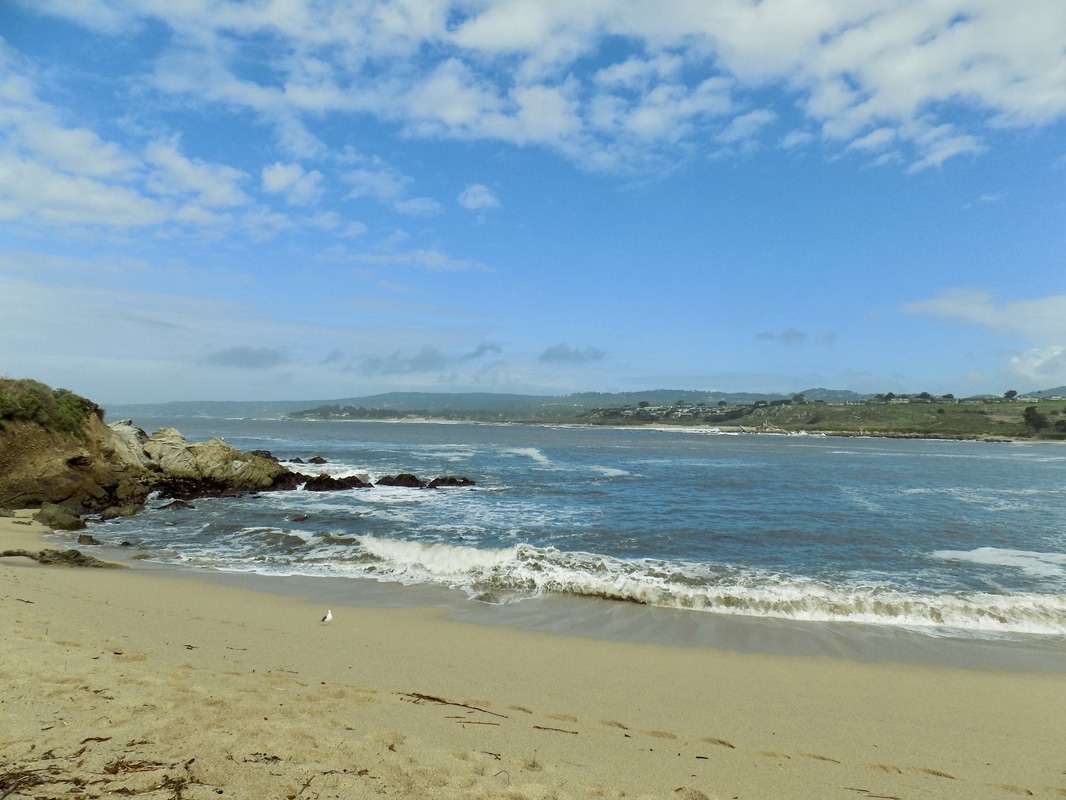 This one-mile stretch of beach near where the Carmel River empties into the ocean has a few nicknames. One is "Monastery Beach," for the Carmelite Monastery across the highway. The other is "Mortuary Beach," because so many people have died here.
The steeply sloping beach and a deep shore trough cause waves to break literally on the shore (rather than a dozen yards out like on most sandy beaches). The waves can knock unsuspecting visitors down and then, as they attempt to regain their feet, repeatedly knock them down again, dragging them into the ocean. (Source) The State Beach is very accessible to the public from CA Highway 1, but there is no trail other than to walk along the beach. If you do opt to walk along the beach, be careful; keep a safe distance from the water, and do not turn your back to the ocean.  My husband and I recently had our 8th wedding anniversary, and to celebrate it we stayed at the Sanctuary Beach Resort in Marina, CA. This hotel is right on the beach in the Marina Dunes Natural Preserve and the property abuts Marina State Beach, just a few miles north of the city of Monterey. We had a particularly rainy anniversary weekend, but luckily the sun came out long enough for a hike along the state beach. The wind was pretty spectacular--you could easily see how these large dunes came to stand so tall!
 Lands End is one of the many lovely parks that is incorporated into Golden Gate National Recreation Area. This national park is broken into smaller campuses that are all over the San Francisco Peninsula and Marin County. This out-and-back hike is about 3 miles (~1.5 miles each direction). You can start from the Lands End Parking lot (680 Point Lobos Ave, San Francisco, CA 94121). Jane Huber, the author of the blog Bay Area Hiker, has a really nice write-up of the hike here, and the department of tourism has a gorgeous photo spread here, along with some information about the nearby historic site of the Sutro Baths ruins. See a map and some more photos after the jump.
|
Archives
December 2020
Categories
All
|
 RSS Feed
