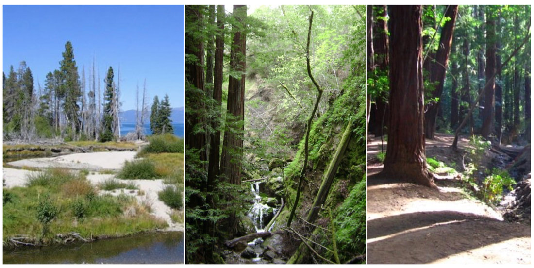
 I've been working on building a landing page for all of the California State Parks that I have visited, and in sorting through the many parks of Northern California, I started to notice that there were several parks that I visited many years ago that have not made it into my blog. Although I do have photos from those trips, they are from older cameras and the quality of the images is not as good as the camera I am using now. So this is a single post to remember three trips from years past: 1) Armstrong Redwoods State Natural Reserve (in Guerneville), 2) Ed Z'berg Sugar Pine Point State Park (in Tahoe), and 3) Pfeiffer Big Sur State Park (in Big Sur). The photos are not as good as what I can do now, but the memories of these places sure are powerful and dear.
0 Comments
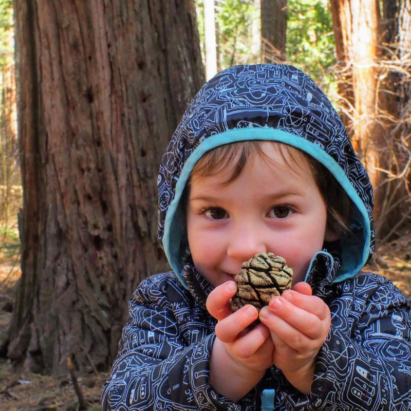
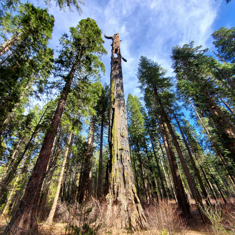
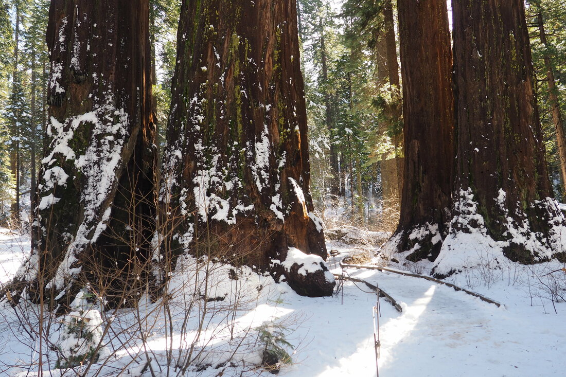
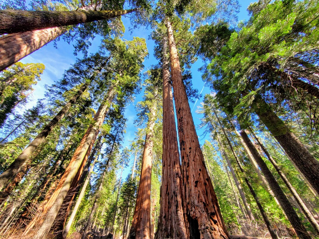 The last time I went to Calaveras Big Trees State Park, I kept thinking about how much I wanted to come back with my family. Well, we finally make it over the long Presidents Day weekend! Although it's about a two-hour drive for us from Livermore to Arnold (pretty long for a 2-year old to be in the car), it was well worth it. The photos from this blog post are all taken by my husband. Click "read more" to see more photos of the sequoias.
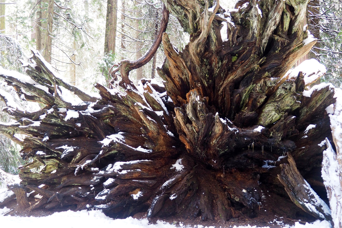
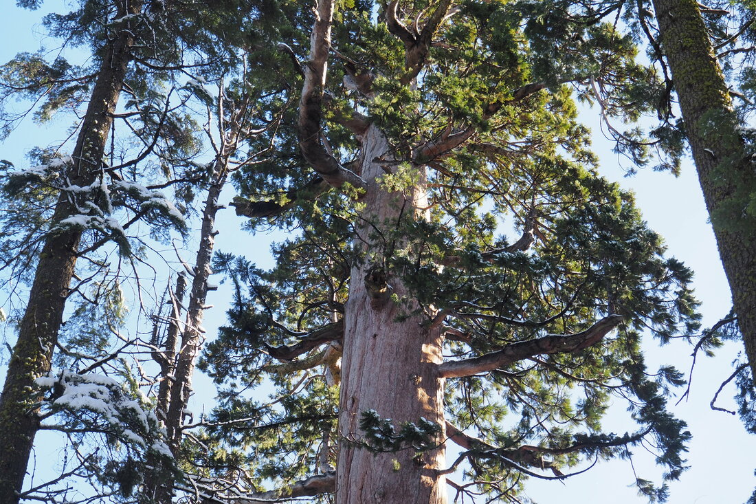
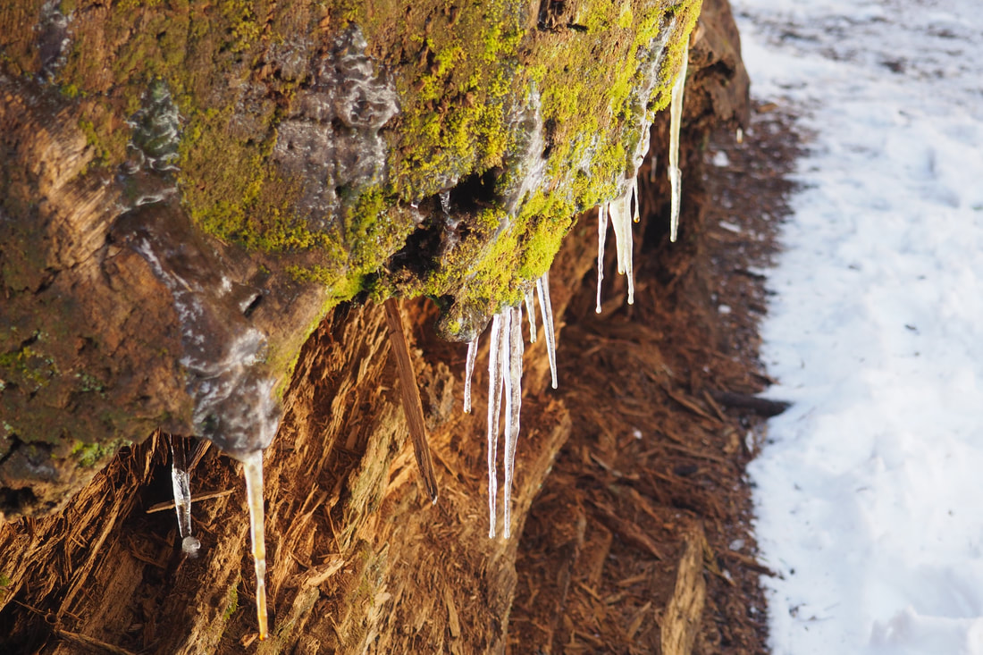
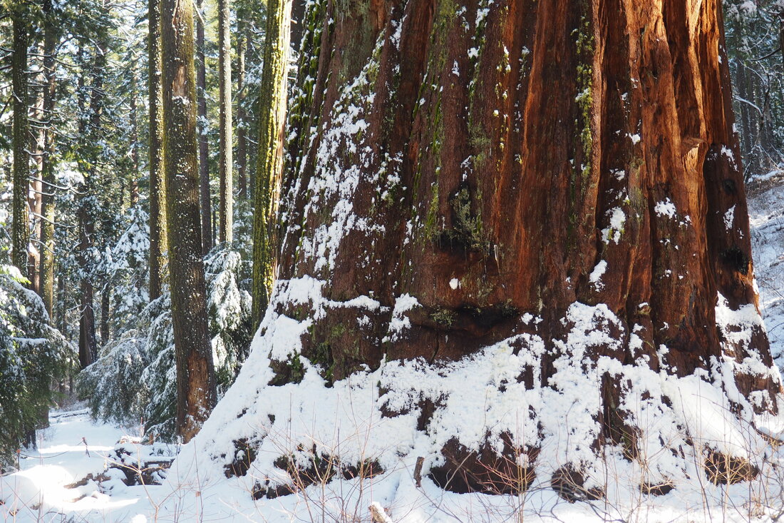 Over the long weekend, I did something that I have never done before: I drove to the Sierras in the winter to hike in the snow! I am from Louisiana originally, and I moved to California in 2005 where I lived first in the Davis-Sacramento area and then in the greater San Francisco Bay Area. I have never had to deal with driving in the snow, and the idea of taking a winding mountain road in icy conditions just terrified me. But I have been hankering to see the sequoias for a while now, and so I planned and I waited until just the right conditions to visit Calaveras Big Trees State Park. Boy, am I glad that I that I went for it; it was MAGICAL.
Click "read more" to see more photos after the jump. It was insanely beautiful.
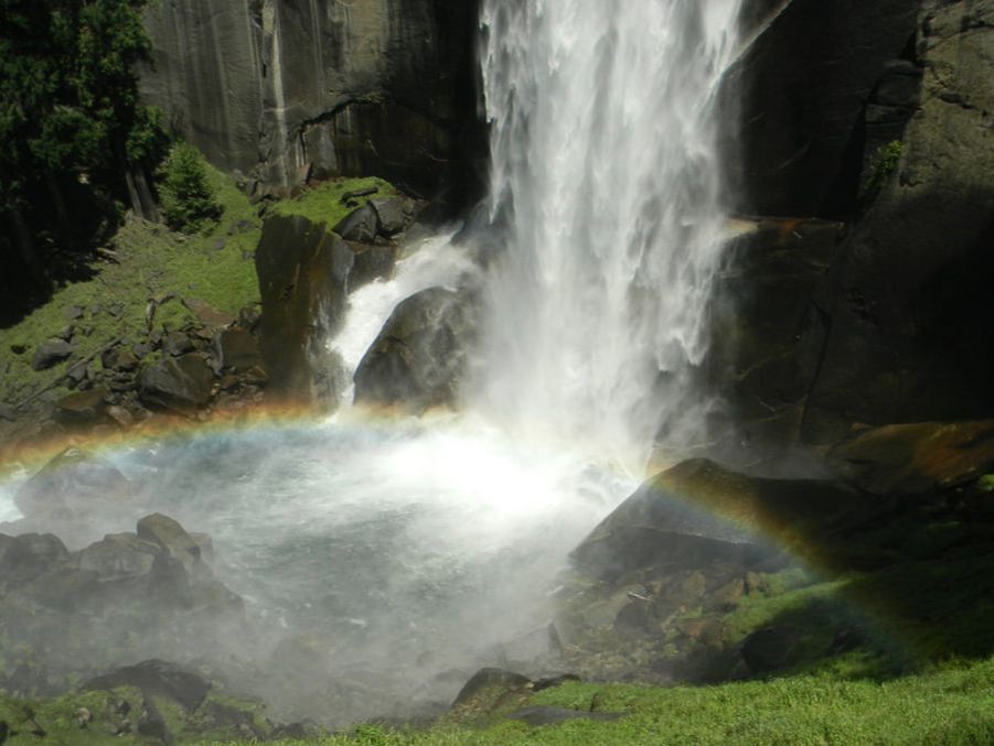 I've been sprucing up the website over the past month, and while doing that I stumbled upon some photos of Yosemite from 2011. The waterfalls that year were so nice, that I thought I would post a throwback blogpost!
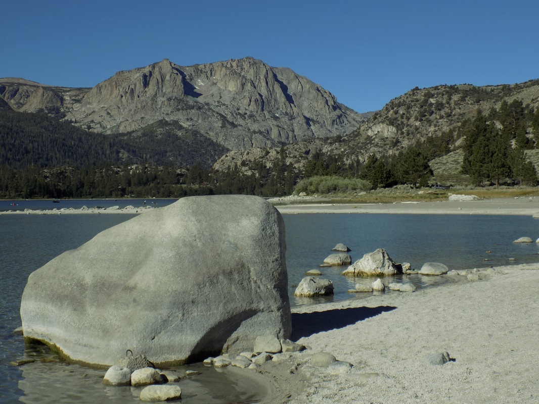
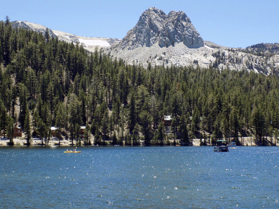 The last day of our Eastern Sierra camping adventure, my husband and I took a scenic gondola ride up to the top of Mammoth Mountain. When we were at the top of the 11,053-ft. peak, we met a naturalist from Inyo National Forest, who talked to us about the volcanic and glacial events that formed the mountains that we were walking on and observing. He pointed out to us the Mammoth Lakes Basin, which we had somehow missed on the day that we went to Devils Postpile National Monument. After we descended the mountain on the gondola, we drove the loop around Lake Mary (in the lede photo, along with Crystal Crag) to check out these beautiful terraced lakes.
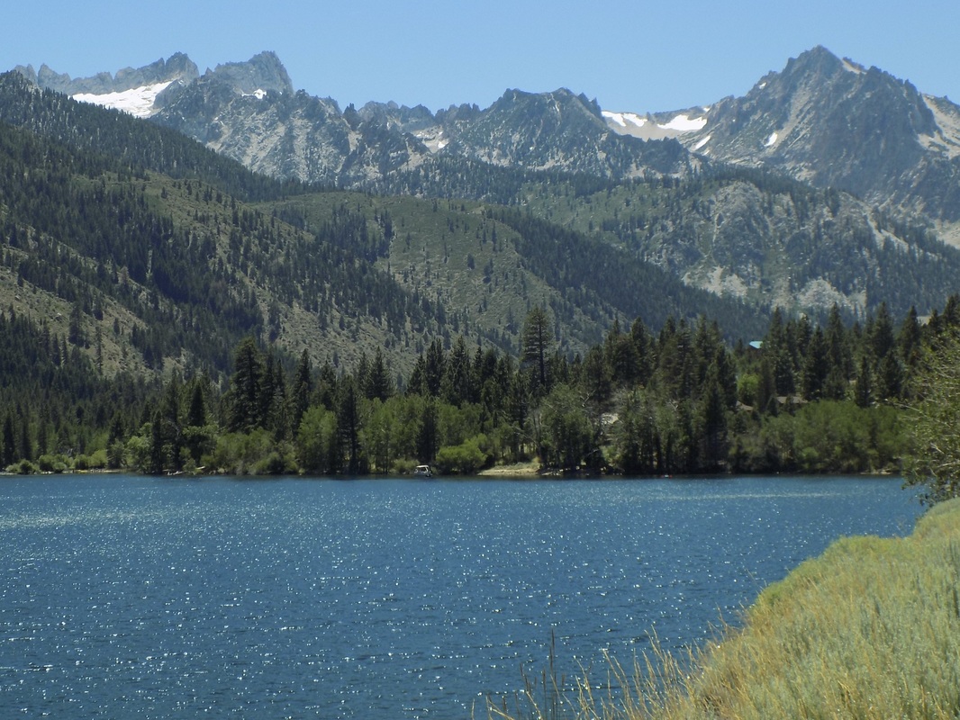 This area is one that we've only begun to explore. There are two places called "Twin Lakes" in the Eastern Sierras: one near the town of Mammoth Lakes and another near the town of Bridgeport, CA in Humboldt-Toiyabe National Forest. This post features the latter.
There are loads of campgrounds in the area, but the best one (which also had a day use area for kayakers and picnickers) was the Lower Twin Lakes Campground (make reservations here), which is right on the banks of Robinson Creek and a very short walk from Lower Twin Lake. From the lakes, you can see the Sawtooth Ridge. This ridge forms the northernmost boundary of Yosemite. The tallest peak in this ridge is Matterhorn Peak, which is featured in Jack Kerouac's 1958 novel, The Dharma Bums. The ridge also supports the Sierra's northernmost glacier system. See more photos after the jump! 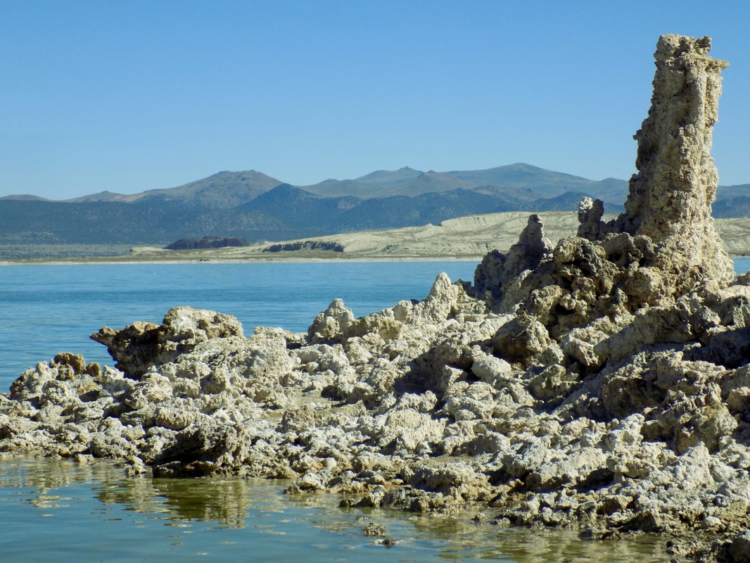 The South Tufa Area of Mono Lake is run cooperatively by Mono Lake Tufa State Natural Reserve (a California State Park) and the Mono Basin National Forest Scenic Area (part of Inyo National Forest). This area is an excellent area to visit if you want to see impressive tufa towers, calcium-carbonate spires and knobs formed by interaction of freshwater springs and alkaline lake water.
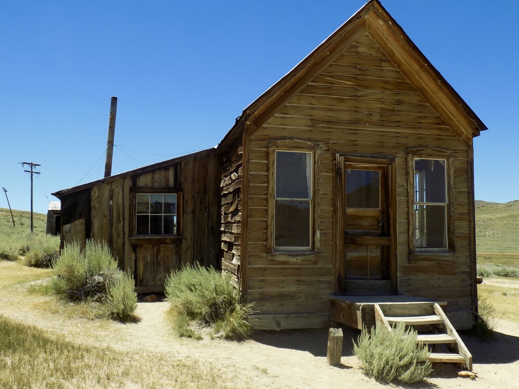 Bodie State Historic Park is, to quote the California State Park website, "a genuine California gold-mining ghost town... preserved in a state of arrested decay." Although there is some debate about it, the California State Park system has claimed that, in 1880, Bodie was the second or third largest city in California, with 5,000-7,000 people and over 2,000 buildings. As the gold began to dwindle, the Wild West boom town began to decay; after a devastating fire in 1932 (which burned 90% of the structures of the city), Bodie was doomed. The last residents left in the 1940s, and it became a state park in 1962.
 Oh Ridge Campground, near the charming town of June Lake, is one of the few reservable campgrounds near Mono Lake (see a partially outdated list of campgrounds here). Oh Ridge is in the high desert of the Mono Basin (elevation 7,600 ft). Most of the campsites are in the exposed sagebrush, but some of the loops do face the beautiful glacial lake of June Lake and there are a few trees to provide shade.
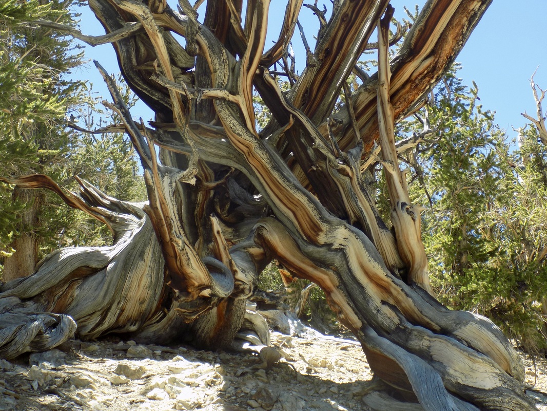 The Methuselah Trail in Ancient Bristlecone Pine Forest (part of Inyo National Forest) contains the oldest known trees in the entire world! This 4.5-mile hike (with a 900 ft. elevation gain) brings you through a grove of ancients. Even though the specific Methuselah Tree remains unmarked (to protect it from damage), you will have fun trying to guess which one of these magnificent trees might be the world's oldest, almost 5,000 years old.
|
Archives
December 2020
Categories
All
|

 RSS Feed
