Lonely Hiker
  • Home
  • About
  • Regions
  • Parks
  • Trails
  • Photography

Trails

Ancient Bristlecone Pine Forest

7/28/2016

2 Comments

 
Picture
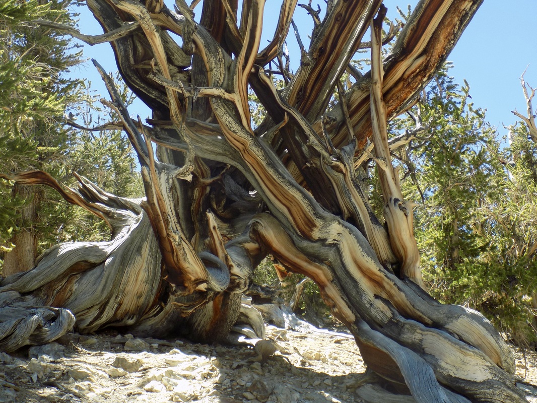
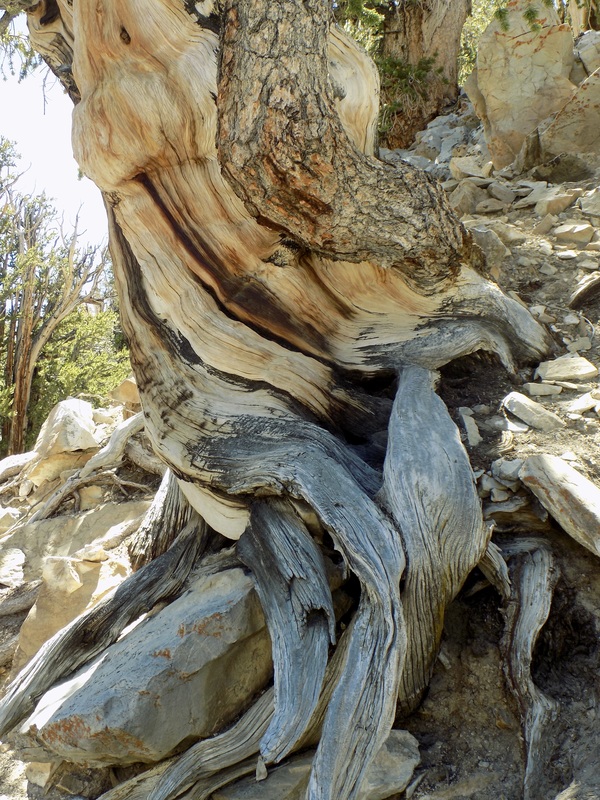
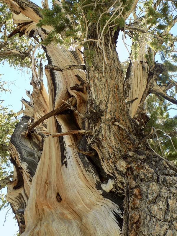
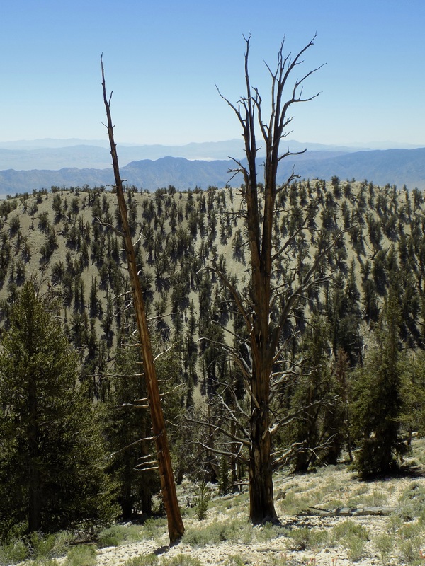
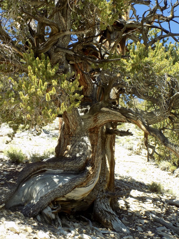
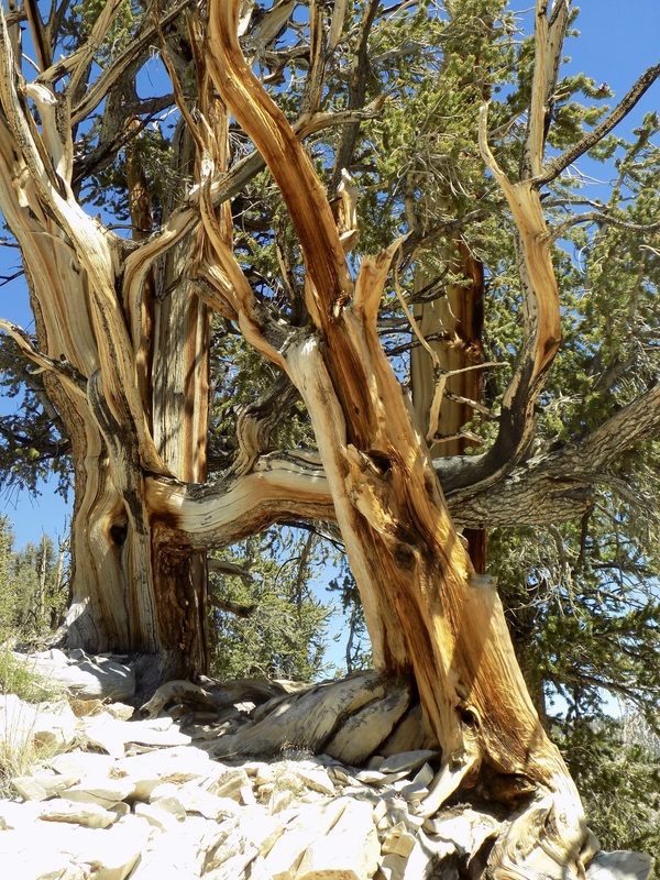
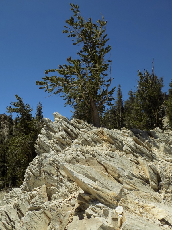
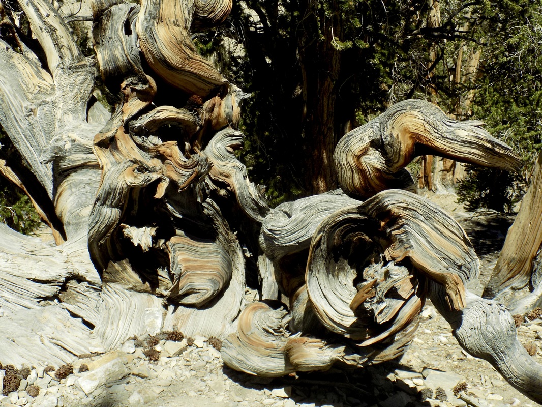
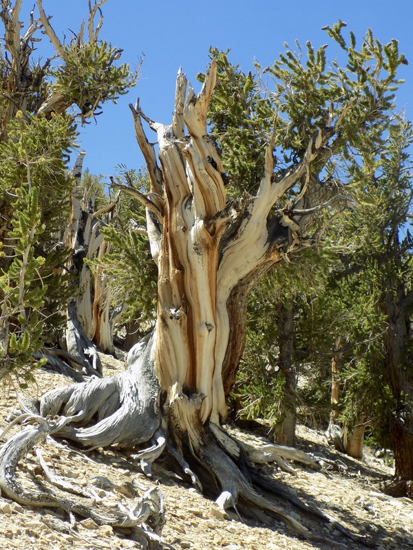
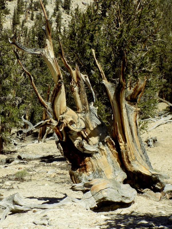
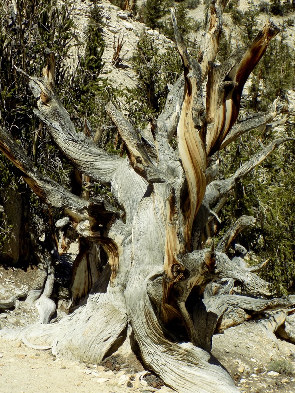
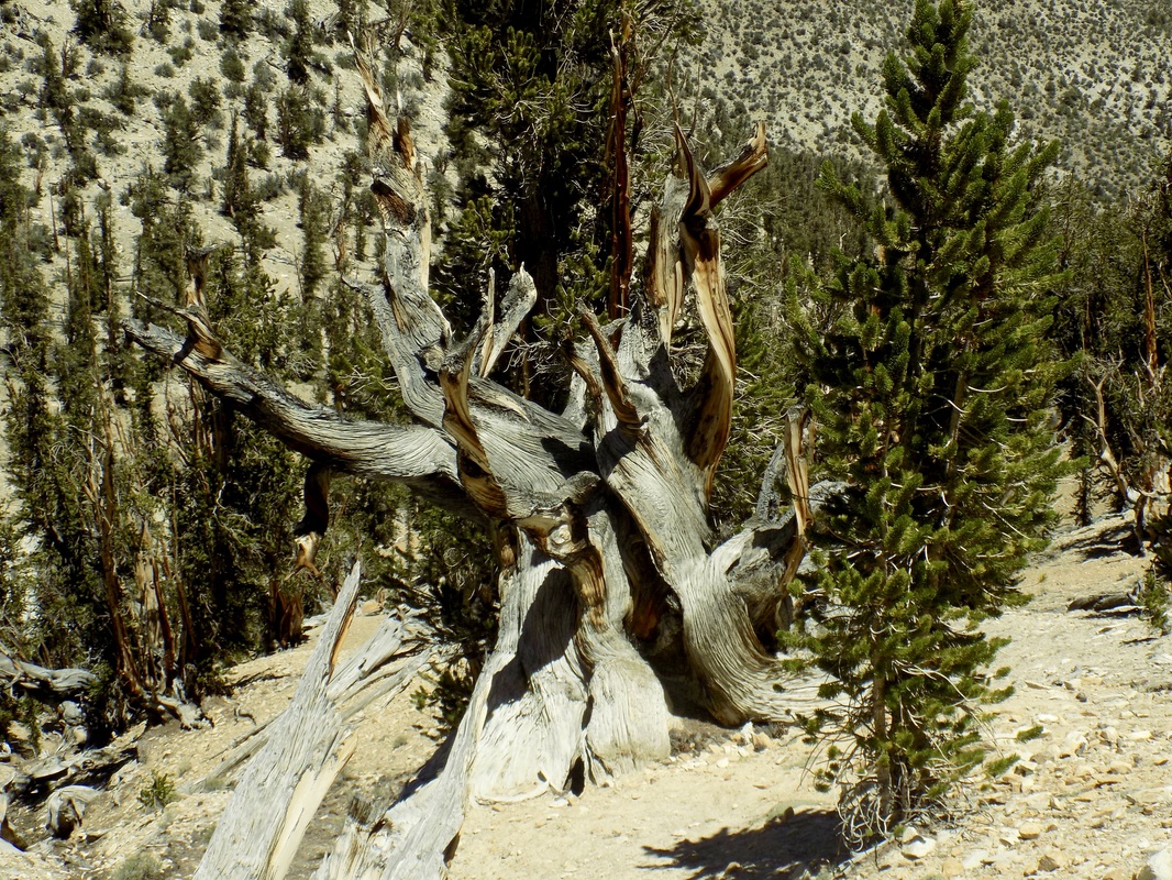
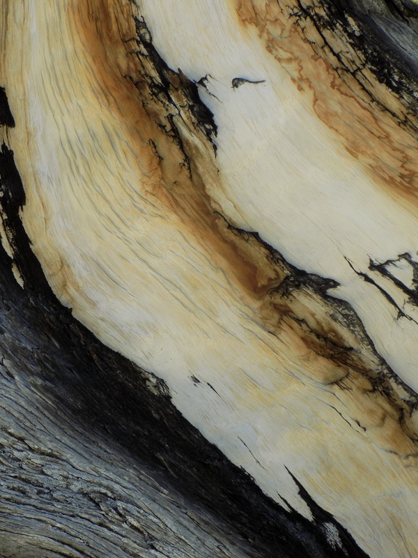
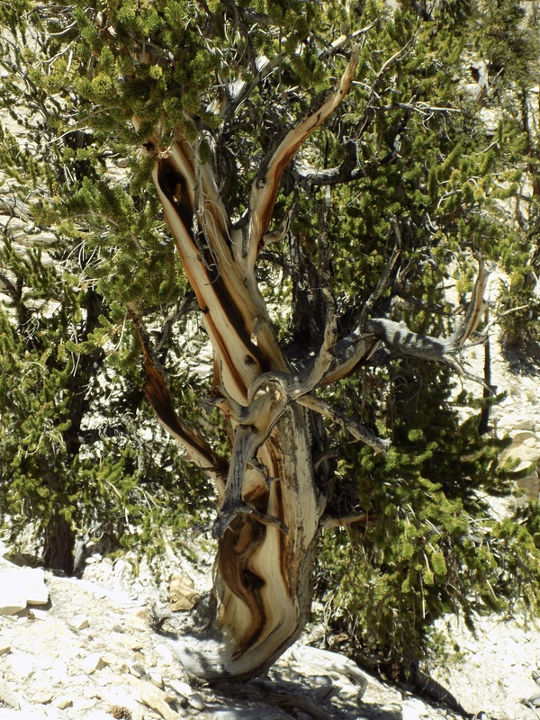
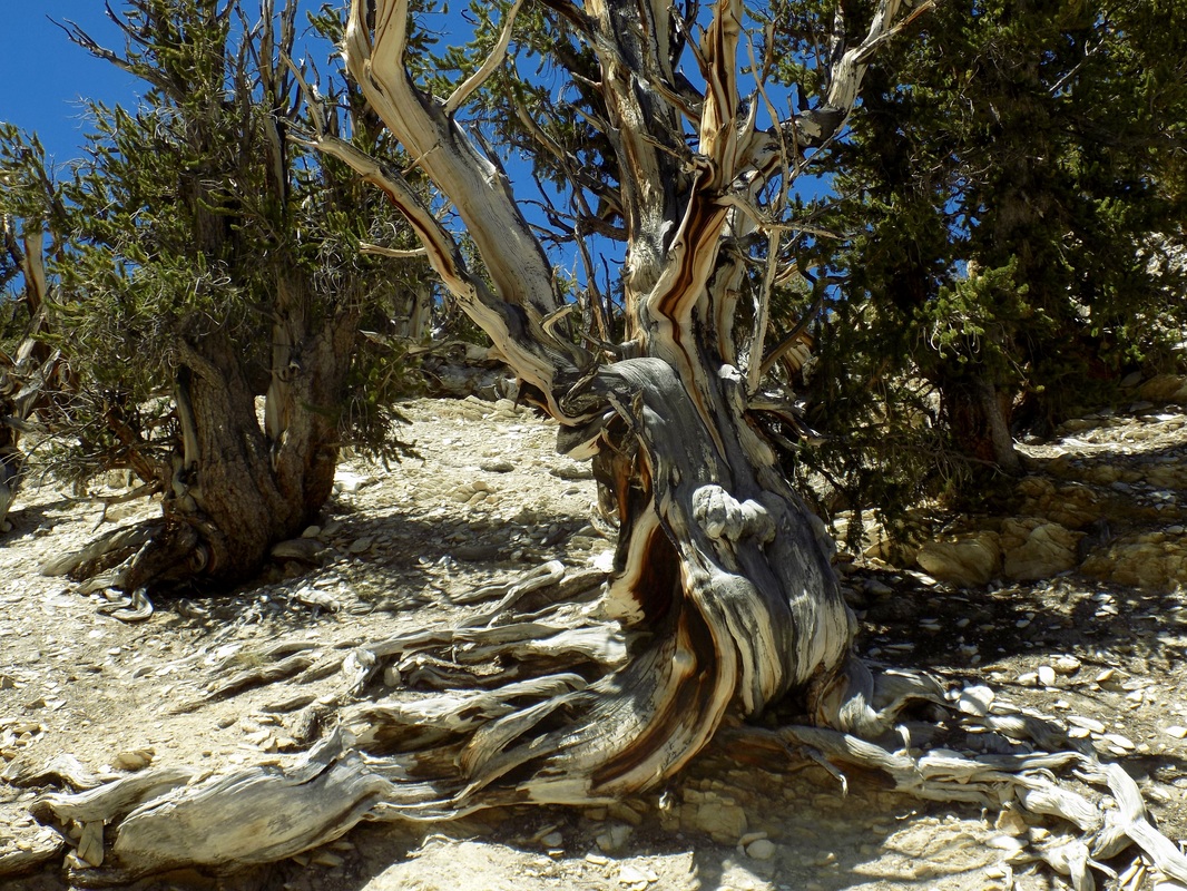
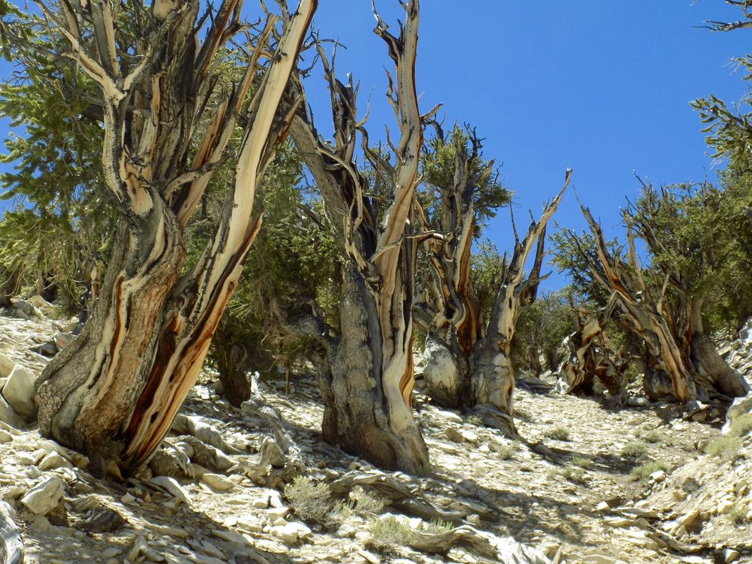
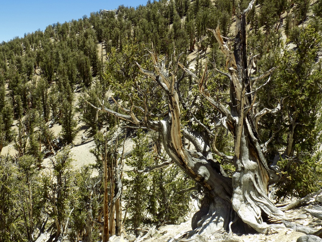
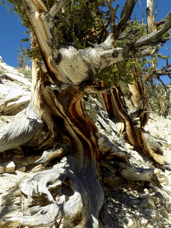
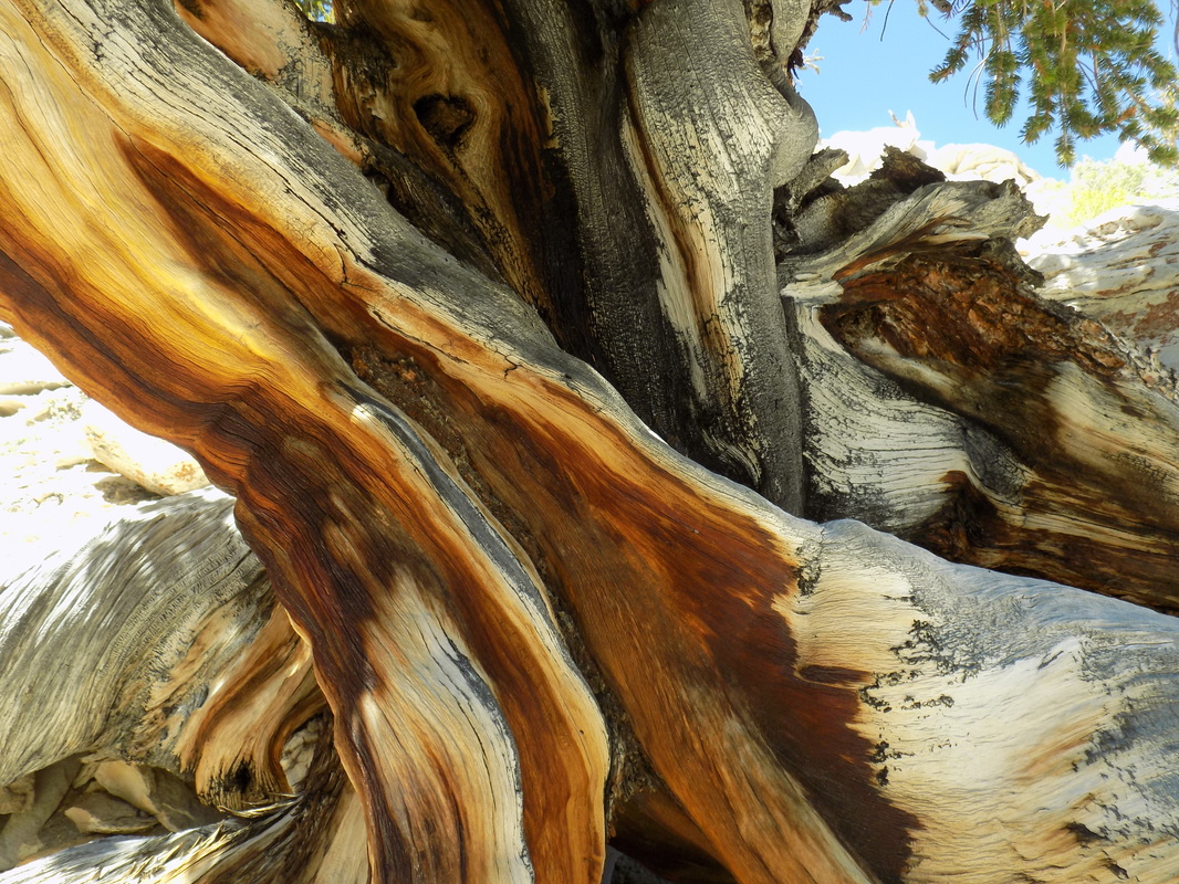
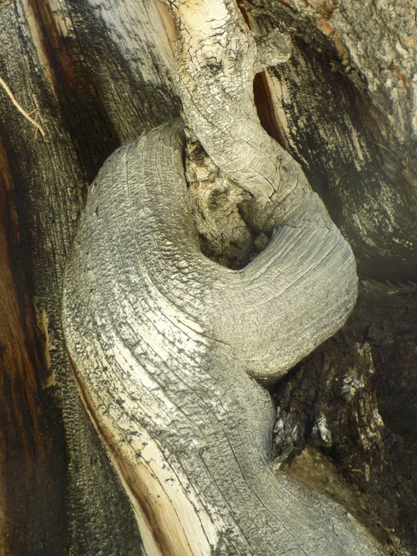
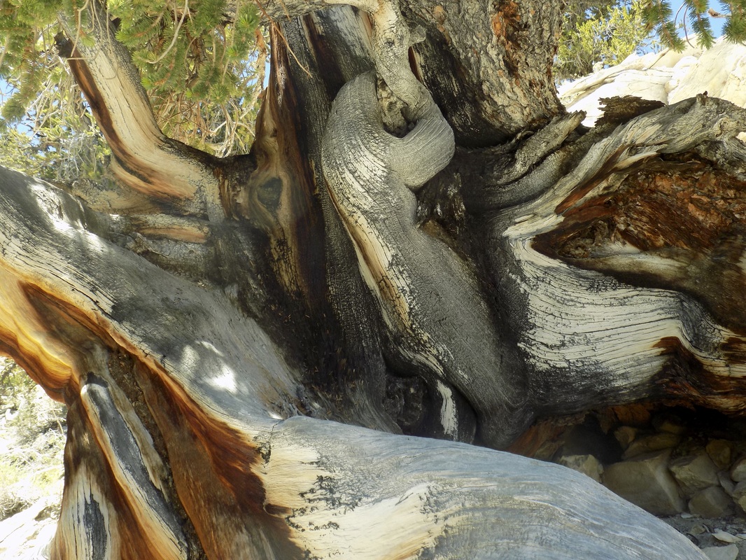
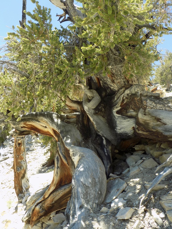
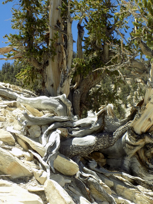
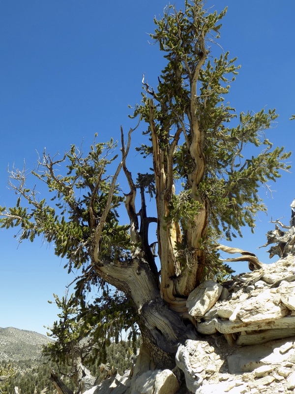
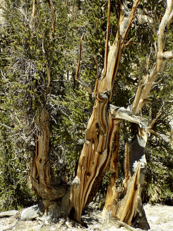
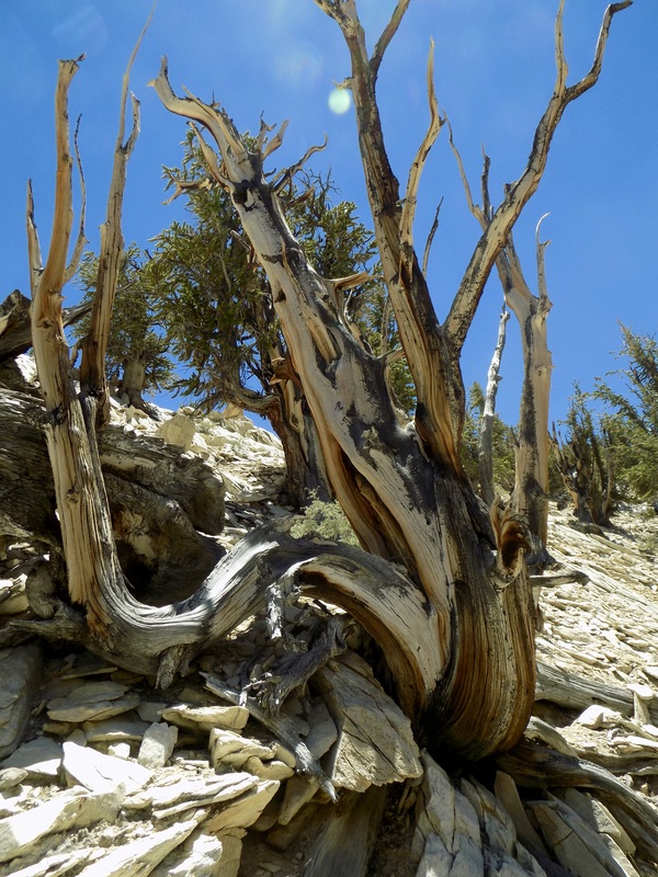
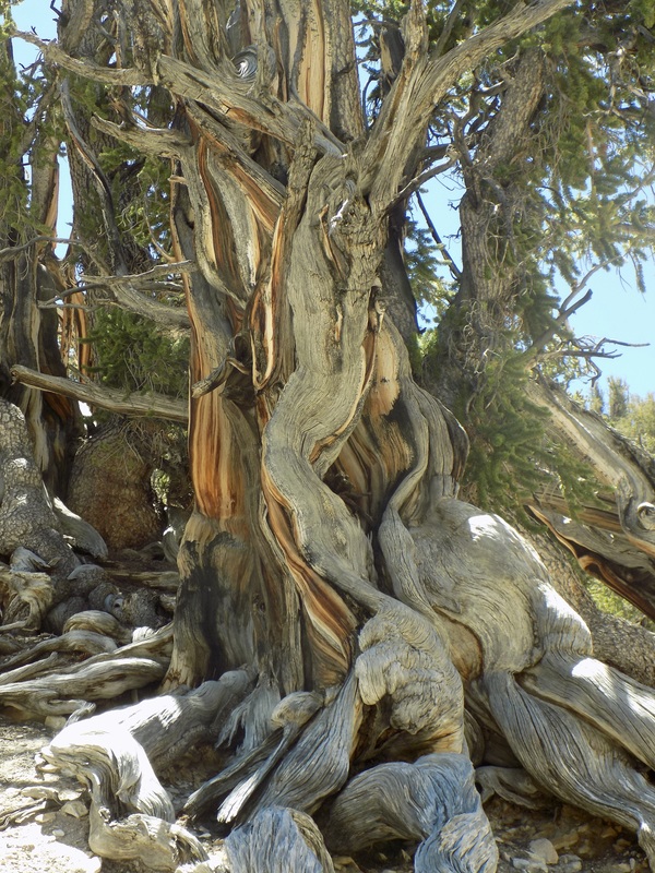
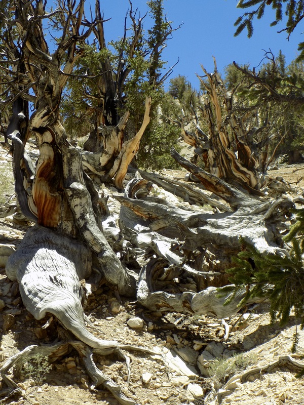
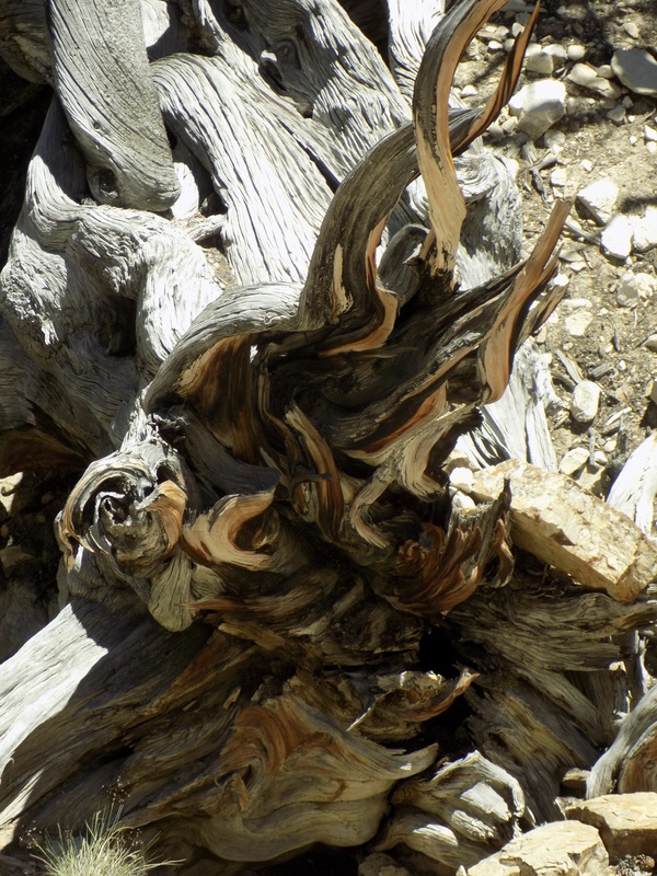
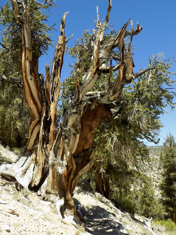
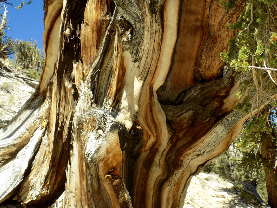
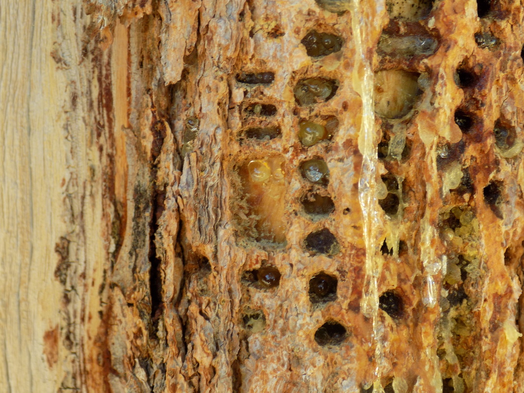
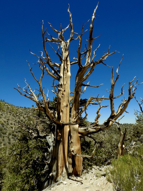
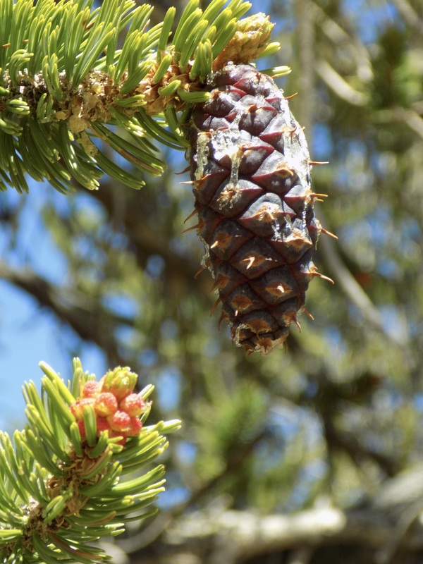
The Methuselah Trail in Ancient Bristlecone Pine Forest (part of Inyo National Forest) contains the oldest known trees in the entire world! This 4.5-mile hike (with a 900 ft. elevation gain) brings you through a grove of ancients. Even though the specific Methuselah Tree remains unmarked (to protect it from damage), you will have fun trying to guess which one of these magnificent trees might be the world's oldest, almost 5,000 years old.
Picture
Start your hike at the Schulman Grove Visitor Center. To get to this lovely interpretive center, run by the Eastern Sierra Interpretive Association and the National Forest Service, exit Highway 395 near Big Pine and take 168 east toward Deep Springs. Near Westgard Pass, take White Moutain Rd. all the way until the pavement ends. The roads are all well marked. (More info here)

This is a fee area, so you will need to bring $3 per person or $6 per car. There are pit toilets at the center, but no water or food. Make sure you prepare by bringing whatever you need for the day: water, food, sunscreen, and hats.  The center (and the hike) are at 10,000 ft., so the sun is pretty intense.
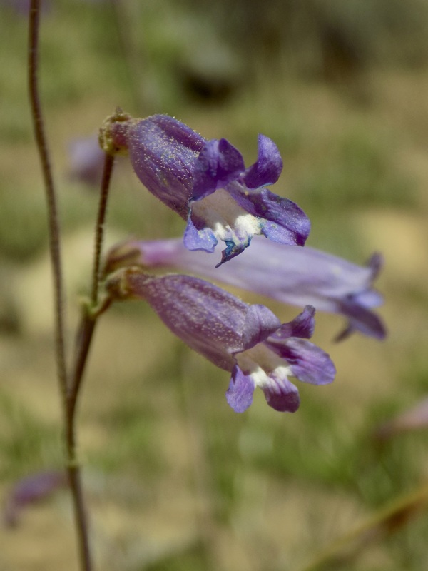
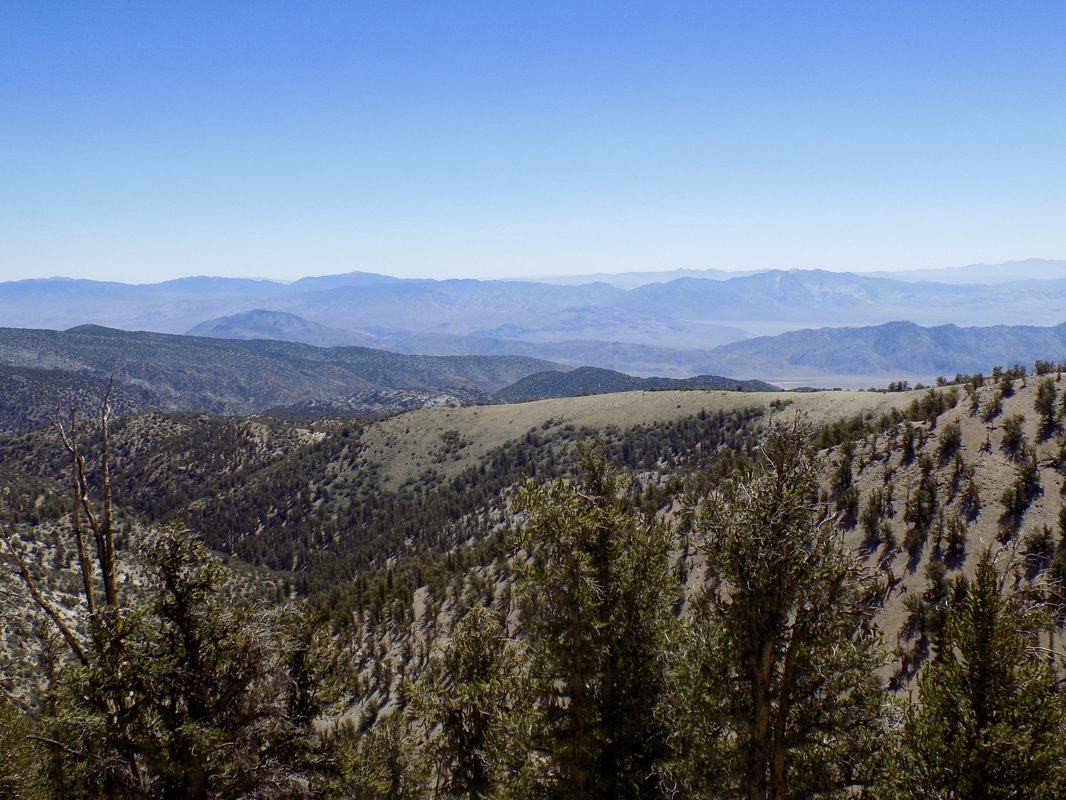
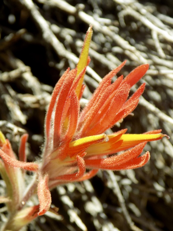
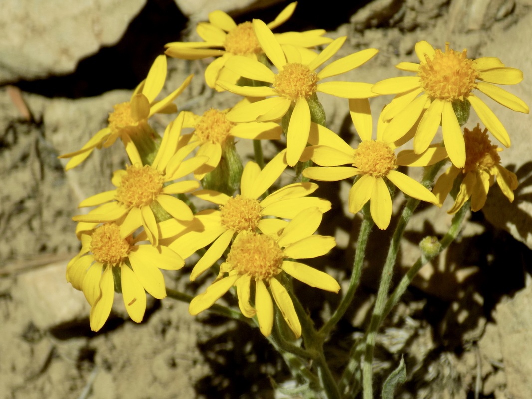
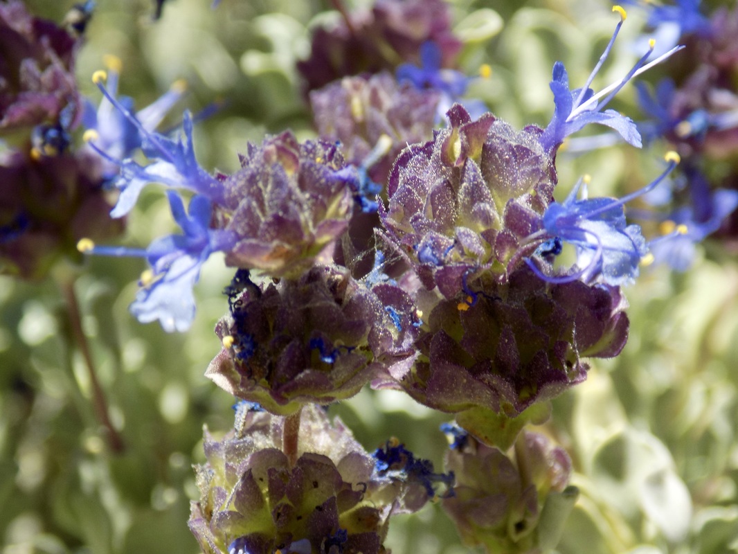
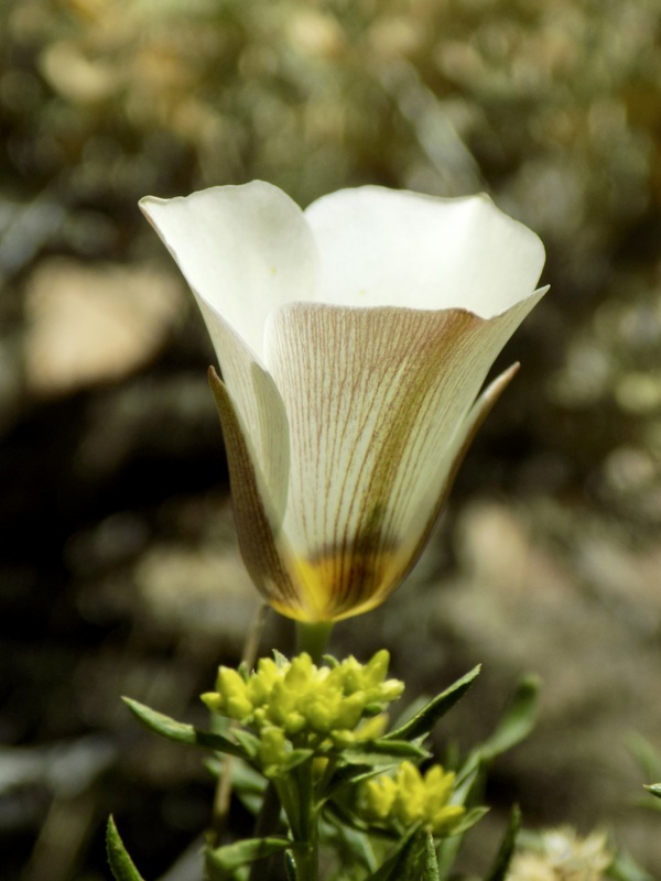
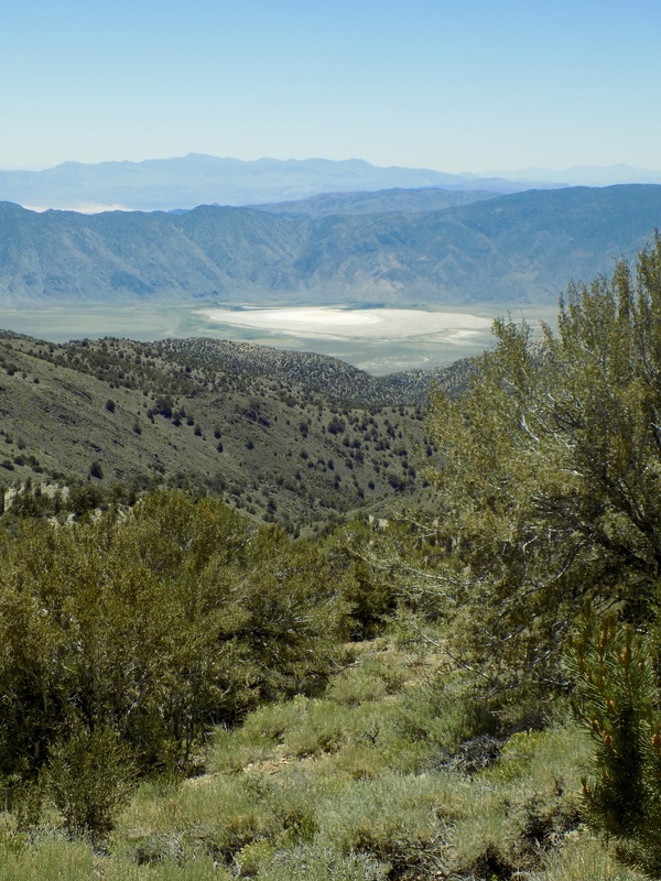
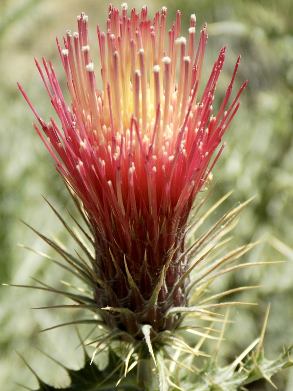
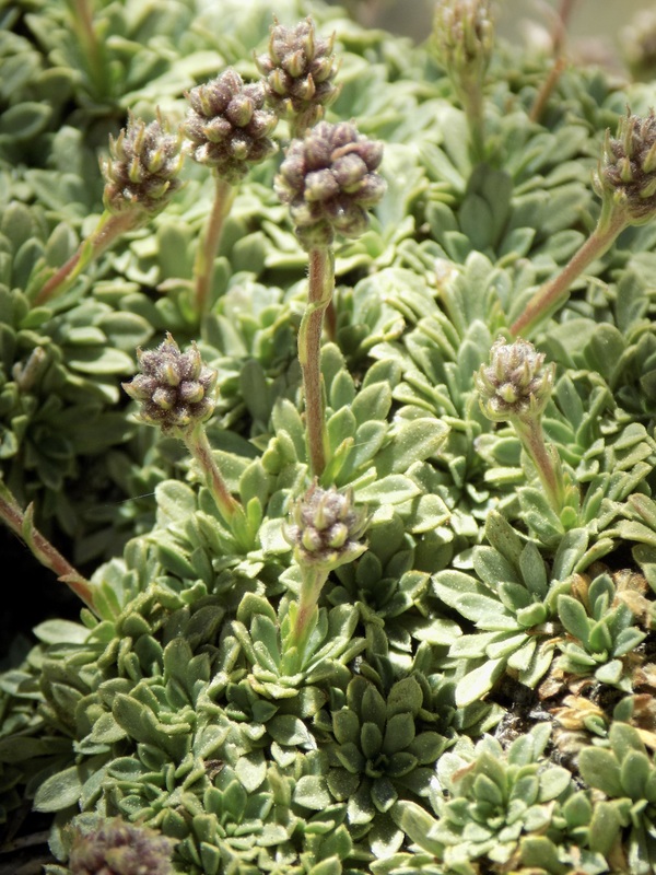
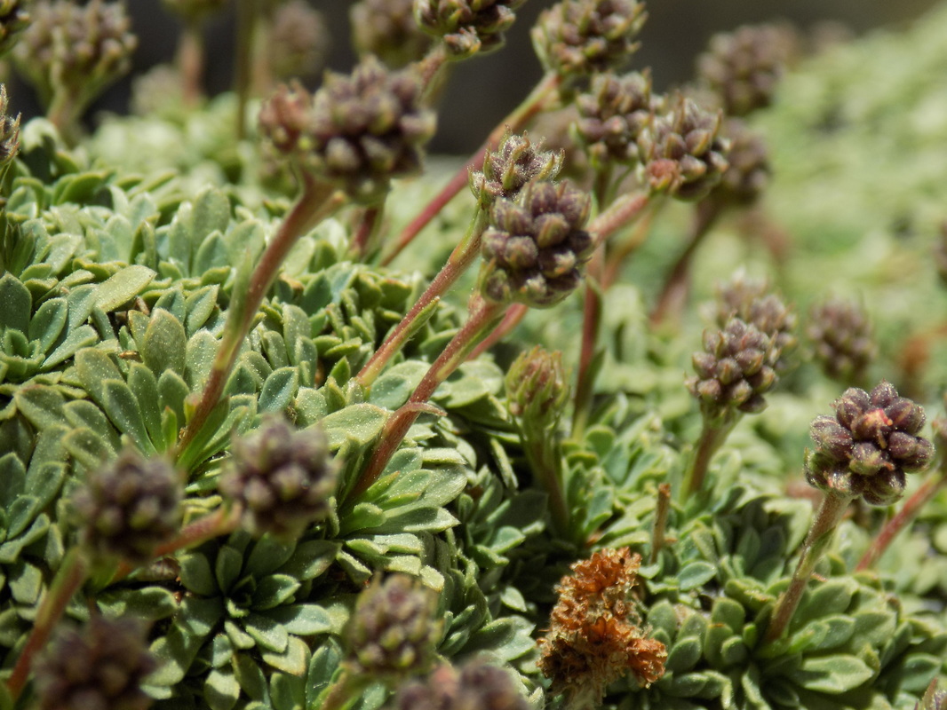
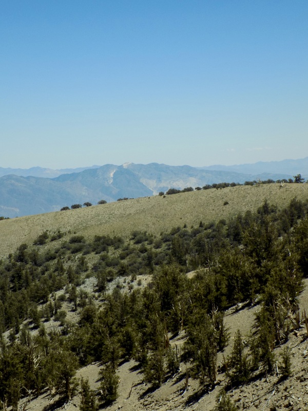
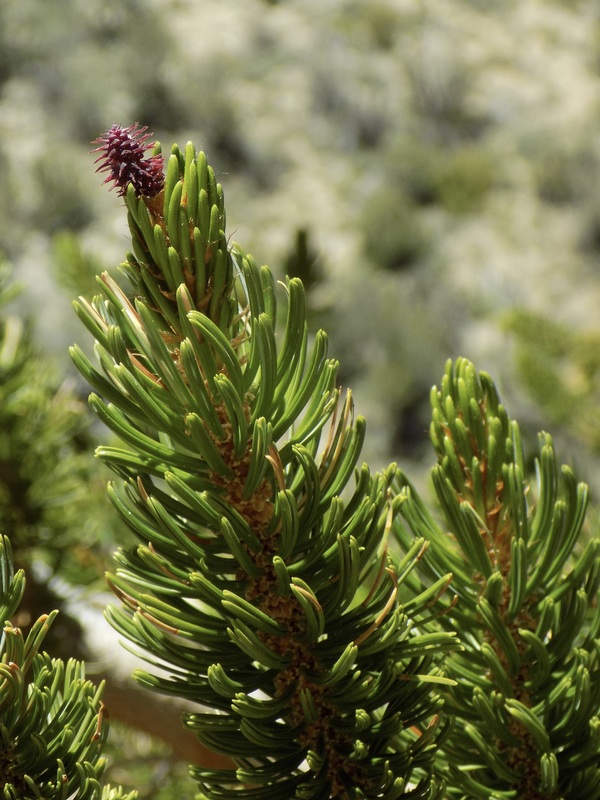
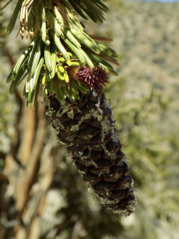
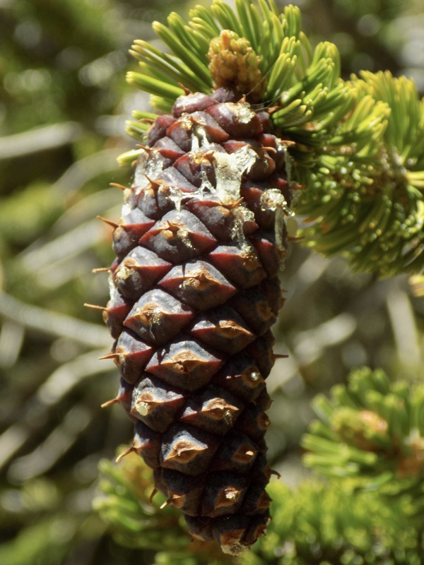
I was expecting this hike to be spectacular because of the trees (and it was). What I wasn't anticipating was that it would also be spectacular for both its wildflowers and its stunning vistas of Owens Valley and the Eastern Sierras to the west, and Death Valley and the Great Basin to the east. This was my favorite part of the camping expedition with my husband.

I recommend that you stop and get the brochure for the nature hike while you walk the Methuselah Trail. It's a very well written nature guide, filled with educational information about the life cycle of these fantastic trees that thrive because of adversity not despite of it.
2 Comments
Stephen link
8/6/2021 03:48:37 pm

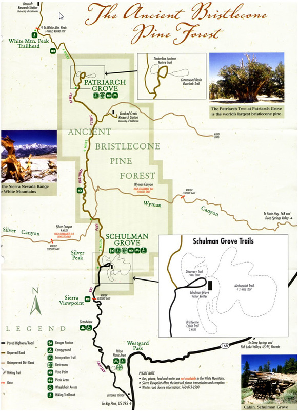
Hi, I really like this blog post and the map you used. I am working on a book about the wildflowers of the Bristlecone forests in the White Mountains, and would like to use the map you published here. Did you make it, and if so, can we talk about its use? If not, can you please let me know where you got it? Thanks very much!

Reply
Claire Dawkins
8/10/2021 12:30:09 pm

Hi Stephen! I got this map from the Schulman Grove Visitor Center in hard copy form. I scanned the paper copy when I got home. I was never able to find a copy online at the website for the National Forest Service. I would email the rangers of the USDA Forest Service to ask for permissions in your book!

Reply


Leave a Reply.

    Archives

    December 2020
    November 2020
    October 2020
    September 2020
    August 2020
    July 2020
    June 2020
    May 2020
    April 2020
    March 2020
    February 2020
    January 2020
    December 2019
    November 2019
    October 2019
    September 2019
    August 2019
    July 2019
    June 2019
    May 2019
    April 2019
    March 2019
    February 2019
    January 2019
    December 2018
    November 2018
    October 2018
    September 2018
    August 2018
    July 2018
    June 2018
    May 2018
    April 2018
    March 2018
    February 2018
    January 2018
    November 2017
    October 2017
    September 2017
    August 2017
    April 2017
    March 2017
    February 2017
    January 2017
    November 2016
    October 2016
    September 2016
    August 2016
    July 2016
    June 2016
    May 2016
    April 2016
    March 2016
    February 2016
    January 2016
    December 2015
    November 2015
    October 2015
    September 2015

    Categories

    All
    Art Expedition
    Bay Laurel Trees
    Bayside
    Beaches
    Berkeley City Parks
    Bureau Of Reclamation
    Camping
    Cliffs
    Coastside
    Contra Costa Water District
    Creeks
    Deserts
    East Bay Municipal Utility District
    East Bay Regional Park District
    EBRPD Trails Challenge
    Eucalyptus
    Flat Hikes
    Gulf Coast Family Vacation
    Historical Sites
    Kid Friendly
    Lakes
    LARPD
    Length: 10 To 15 Miles
    Length: 15+ Miles
    Length: 1 To 5 Miles
    Length: 5 To 10 Miles
    Madrones
    Manzanita
    Maples
    Marin County Parks
    Midpeninsula Regional Open Space Preserves
    Mountains
    Museums
    National Forest Service
    National Parks
    National Wildlife Refuge
    Oakland City Parks
    Oaks
    Palo Alto & Atherton Parks
    Peninsula Open Space Trust
    Pleasanton City Parks
    Portola Valley Town Trails
    Redwoods
    Rocks
    San Francisco City Parks
    San Mateo County Parks
    Santa Clara County Parks
    Santa Cruz City Parks
    Sierras
    Stanford
    State Parks
    Swimming Holes
    Sycamores
    Trains
    Tri-Valley
    UC Berkeley
    UC Davis
    Walnut Creek Parks
    Wetlands
    Wildflowers
    Wildlife
    Zoos Farms & Wildlife Preserves

    RSS Feed

Powered by Create your own unique website with customizable templates.
  • Home
  • About
  • Regions
  • Parks
  • Trails
  • Photography