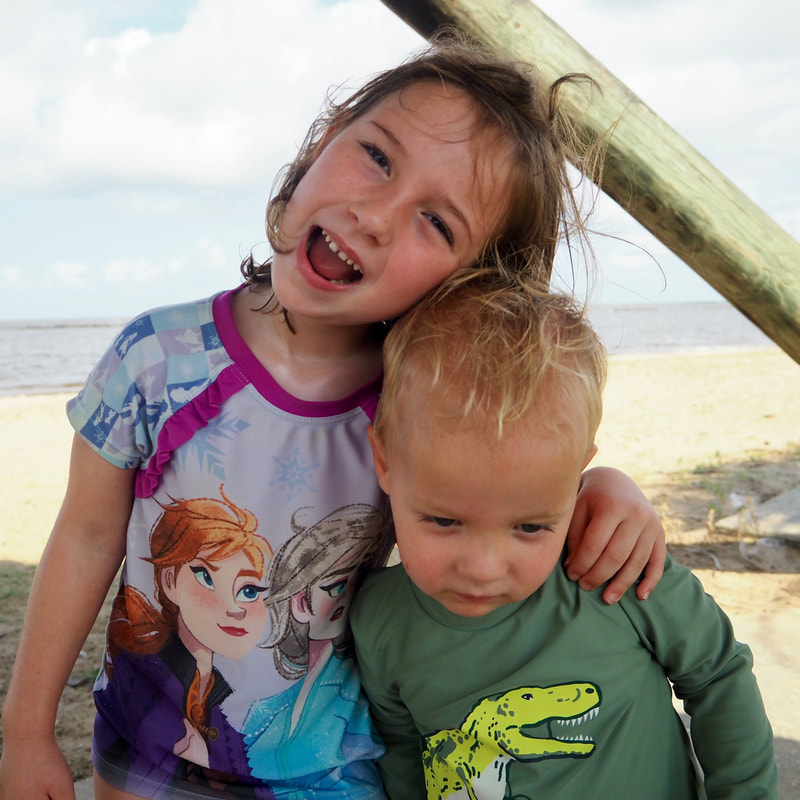
 My family and I had a great time at the far north end of Point Reyes National Seashore! Click "read more" to see maps, trail descriptions, and more photos after the jump.
0 Comments
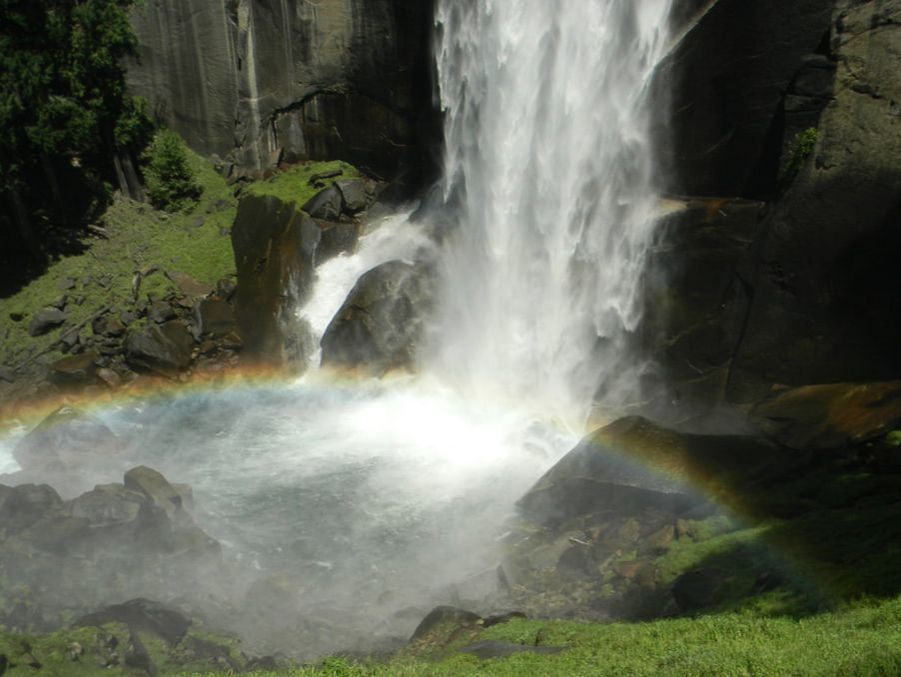 I've been sprucing up the website over the past month, and while doing that I stumbled upon some photos of Yosemite from 2011. The waterfalls that year were so nice, that I thought I would post a throwback blogpost!
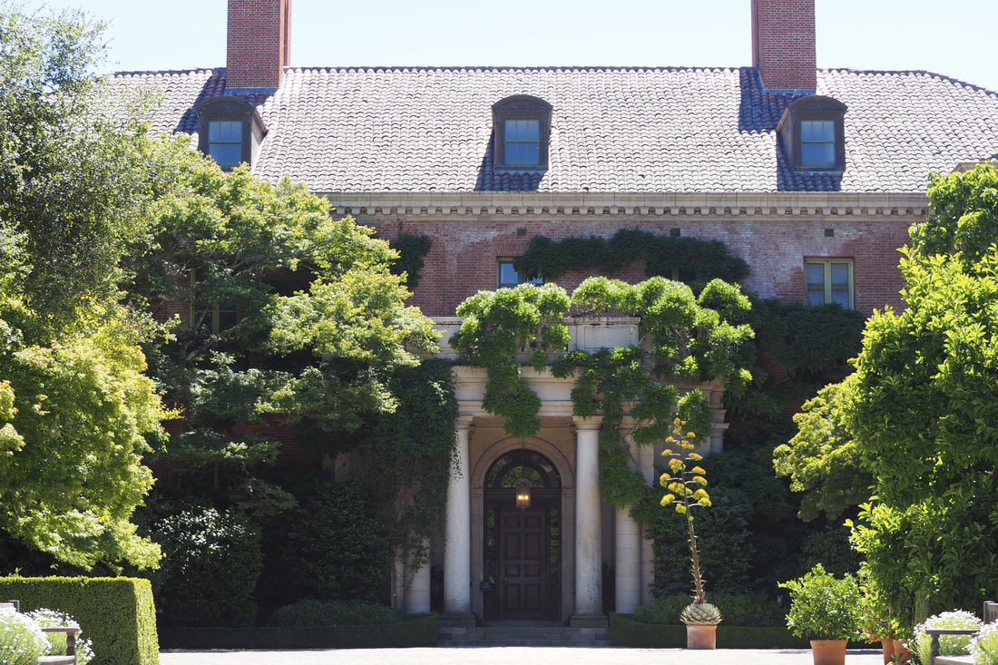 Filoli is a living museum of an early twentieth-century "country estate" that was built by a man who became enormously rich from owning the Empire Mine, one of the most successful gold mines in California. He went on to become a captain of industry in other ways too (shipping companies and water companies, etc.). The enormity of his wealth is apparent in this summer home that he built for his family. The majority of the museum is focused on the house and especially the fabulous gardens, but there is a truly lovely one-mile nature hike that is worth checking out too!
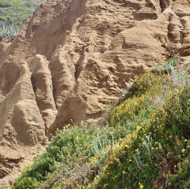
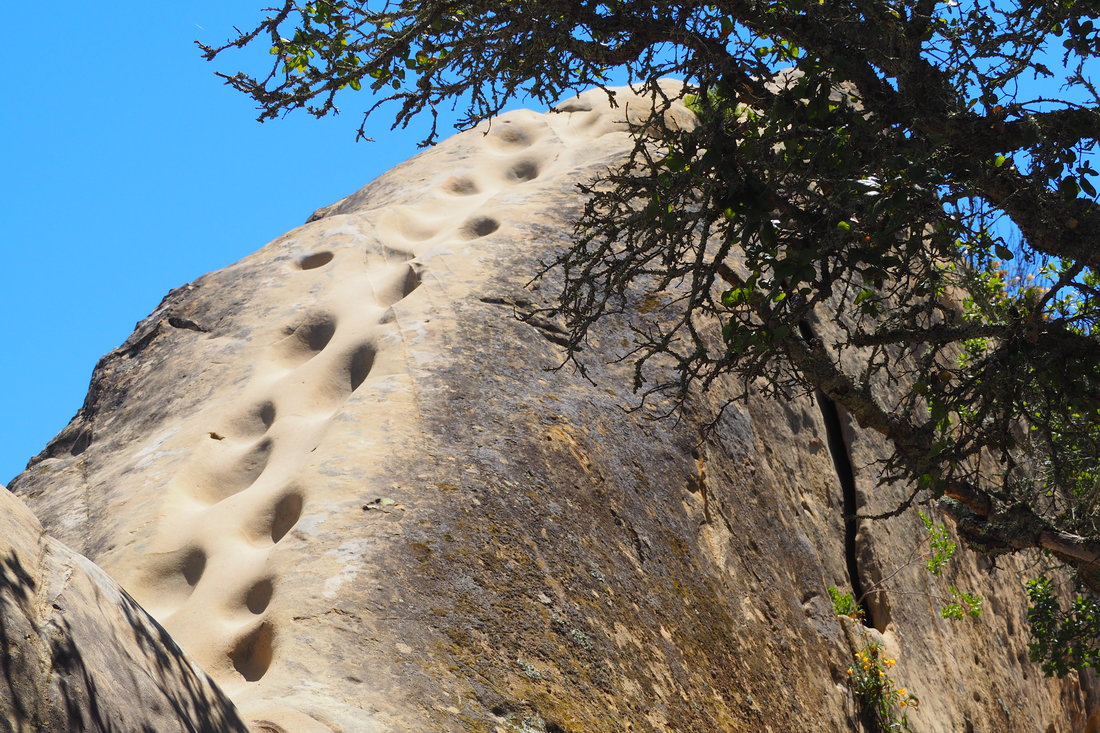 Footholds carved into the soft sandstone after repeated use Mount Diablo is an incredible state park in the east bay. The State Park service has the following write-up about the mountain on their website:
At the eastern fringe of the San Francisco Bay Region, Mount Diablo, elevation 3,849 feet, stands alone on the edge of California’s great Central Valley. At this point, the Coast Range consists only of low hills, none high enough to block the view from the upper slopes of the mountain. As a result, the view is spectacular… you can look to the west, beyond the Golden Gate Bridge, to the Farallon Islands; southeast to the James Lick Observatory on Mount Hamilton at 4,213 feet elevation; south to Mount Loma Prieta in the Santa Cruz Mountains at 3,791 feet elevation; north to Mount Saint Helena in the Coast Range at 4,344 feet, and still farther north to Mount Lassen in the Cascades at 10,466 feet. North and east of Mount Diablo, the San Joaquin and Sacramento Rivers meet to form the twisting waterways of the Delta. To the east beyond California’s great Central Valley, the crest of the Sierra Nevada seems to float in space. With binoculars, you may even be able to pick out Half Dome in Yosemite National Park. My daughter and I did go to the summit, but it was too hazy to see the views described above (which are probably most visable on a clear winter day after a rain storm). Instead, we spent the majority of our time at the fabulous "Rock City" near the southern gates of the park. These are large outcroppings of ancient sandstone that have been carved into fabulous shaped by wind erosion and human use (including Miwok grinding stones). The aptly named "Trail Through Time" takes you on a great tour of these awesome rocks. 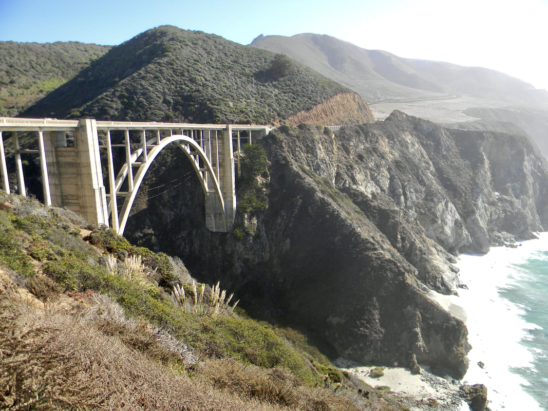 Not a hike, but a stop along the coastal highway along Big Sur, Bixby Bridge is a photogenic site to take in the beauty of the central coast.
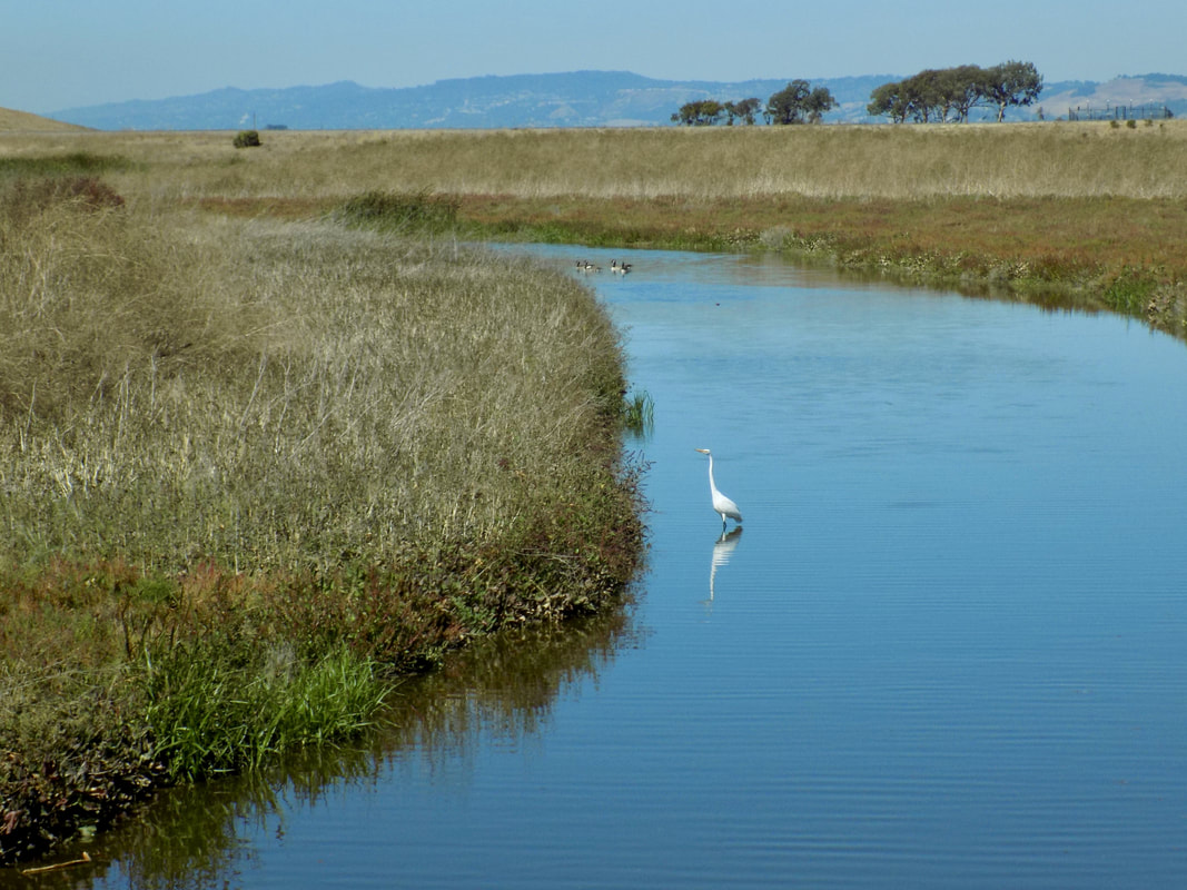 Coyote Hills Regional Park is a 1,266-acres park comprised of marshland and rolling grassland covered hills. It is near the towns of Fremont and Newark, just off of the Dumbarton Bridge on highway 84. It is a gorgeous park, and I am kicking myself that I was so slow to visit it! I thought that it would be too noisy from the traffic noise, which was what I thought of Ravenswood Open Space Preserve, on the west side of the bay. But a huge part of the park is pretty far removed from Highway 84, so your experience is a tranquil one.
The park does charge an entrance fee of $5, but you get a lot of bang for your buck. The 3-mile loop that I did had three main attractions to it: 1) the butterflies at the Nectar Garden near the Visitor's Center, 2) the panoramic views of San Francisco Bay from the hilltops of the park, which overlook the Don Edwards San Francisco Bay National Wildlife Refuge, and 3) the marshes teeming with birds and rich with history--the site of a 2,000-year old Ohlone village. Read more to see pictures from each section of the hike along with a map of the route I took.  This was a return visit for me to Lands End, part of Golden Gate National Recreation Area. Last time I was here, I walked along the Coastal Trail to the Eagles Point Overlook and back. This time, my friends and I walked past Mile Rock Overlook to Mile Rock Beach and Lands End Point and back. Then we explored the ruins of the Sutro Baths and had lunch at the Cliff House.
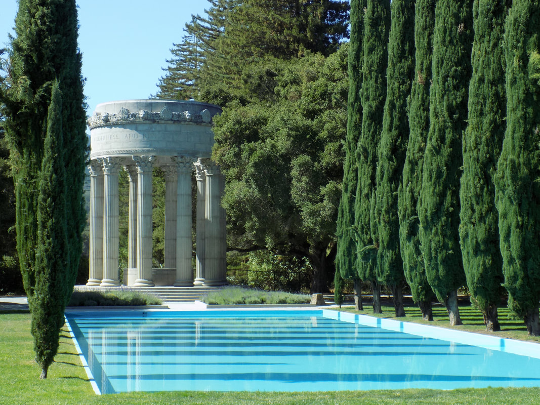 The Pulgas Water Temple was constructed in 1934 after the completion of the aqueduct that brought water from Hetch Hetchy in Yosemite all the way to the San Francisco Bay Area. It is now part of the Crystal Springs Regional Trail, and can be accessed easily off of Cañada Road.
 Milagra Ridge is part of the Golden Gate National Recreation Area. It is an island of reclaimed wildlife in San Mateo County that is surrounded by the urban developments of Pacifica and San Bruno. Here is the blurb about the park on the National Park website:
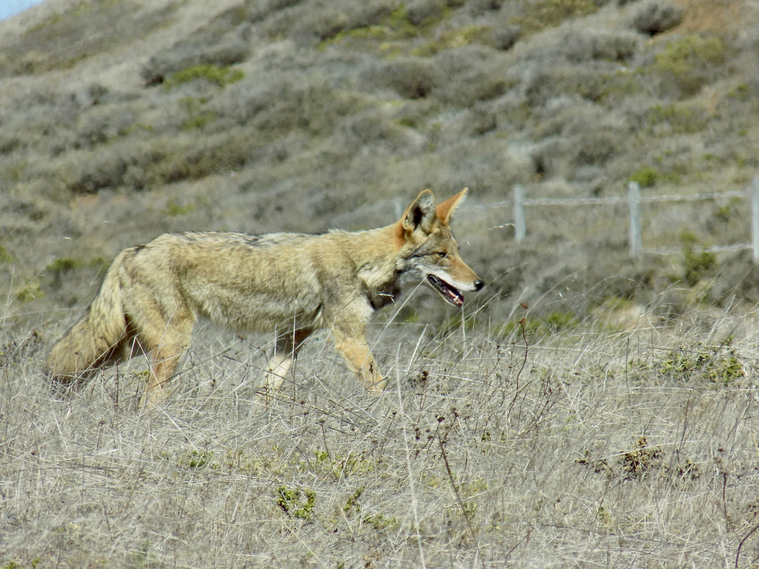
Surrounded by urban development, Milagra Ridge forms what biologists call an island ecosystem. Here, wildlife is isolated from other habitats, feeding and migration corridors are compromised and exotic species can easily invade native habitat. Despite this isolation, Milagra Ridge hosts a surprising number of threatened and endangered species including Mission blue and San Bruno elfin butterflies and the California red-legged frog. I did not see any of those species, but I did see a coyote up close and personal! I also saw a brush rabbit and several hawks, one perched close to me (probably hunting rabbits!). In addition to its natural beauty, Milagra Ridge offers a link to history: In the late 1930s, the United States Army acquired Milagra Ridge as part of a project to defend the San Francisco Bay... In 1956, Nike Missile Site SF-51 was established at Milagra Ridge. These surface-to-air missiles were protection against attacking aircraft during the Cold War. The site was converted to the nuclear-capable Nike-Hercules system in 1958. You can see the batteries where the WWII guns were once mounted and the bunkers where soldiers and lookouts waited. Also, the sites of the Cold War nuclear missile launchers are visible, although there is not much left there. Read more to see photos and a trail map!  This was a spring return visit to Rancho San Antonio Open Space Preserve. The last time that I visited, my GPS routed me to the wrong entrance point of the park; this time my husband and I did manage to find the correct entrance, where there is ample parking for this extremely popular park (Take the Foothill Boulevard exit from I-280 and proceed south on Foothill Boulevard approximately 0.2-mile to Cristo Rey Drive, then follow the signs).
We went on one of the first fine weekend days in spring, and there was a pretty big rush of people there; however, it was mostly families with young children who were walking to the historic Deer Hollow Farm to see the newborn goat kids. It was very sweet to see both the cute goat kids and the adorable human kids having so much fun. So while it was not a hike filled with natural wonder and solitude, it was still a very enjoyable hike to celebrate the arrival of spring! This is a great, flat hike for families with young children, but adult hikers can also push beyond the crowd at Deer Hollow Farm to explore deeper into the park. |
Archives
December 2020
Categories
All
|
 RSS Feed
