 My family and I had a great time at the far north end of Point Reyes National Seashore! Click "read more" to see maps, trail descriptions, and more photos after the jump.
0 Comments
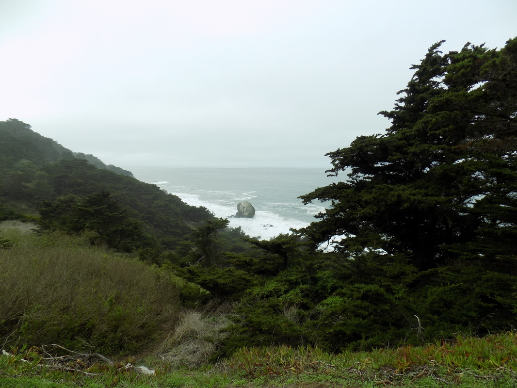
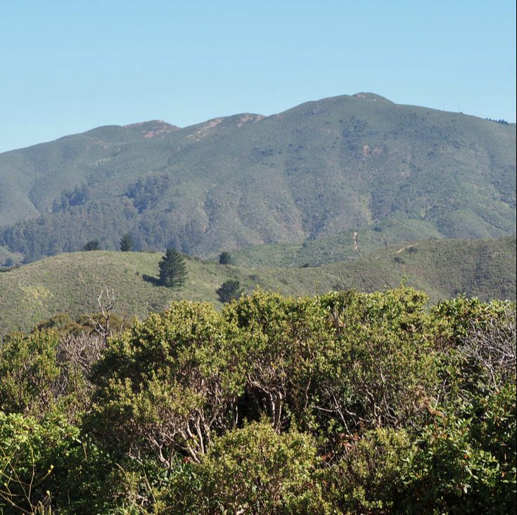
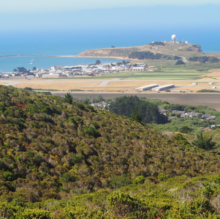
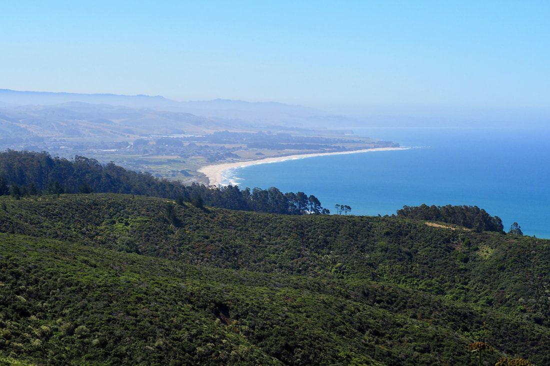 Rancho Corral de Tierra is part of Golden Gate National Recreation Area (GGNRA), which is managed by the National Parks Service. This 4,000-acre parcel of land is the newest acquisition to the GGNRA, and it features both stunning vistas of the San Mateo County coast and prominent views of Montara Mountain, which dramatically rises 2,000 feet in just over 1 mile. The National Park Service explains the name of the park on its website: Historically known as "Rancho Corral de Tierra Palomares" (Earthen Corral), the property encompasses the majority of the 1839 Mexican Land Grant to Francisco Guerrero y Palomares where he built the first adobe on the San Mateo Coast at Denniston Creek. I have been putting off visiting this park for a while now, mostly because it's not precisely clear from the NPS website or the GGNRA website (link here) about where you can park to access the trails of the park. Because the park is so new, the trails, signage, and parking are all poorly communicated. I found a nice write-up about a hike on the POST website (link here), and decided to give that a try--I ended up rerouting when I arrived at the parking spot that POST recommends, and I chose to access the park instead from Coral Reef Rd. in El Granada. It was actually quite easy! I just drove to the end of the road, and there was parking near the sign making the end of the county maintenance. I am kicking myself now that I waited so long to visit this park. This was one of the best hikes I have been on in a very long time! See a map of my trip and loads more photos after the jump.
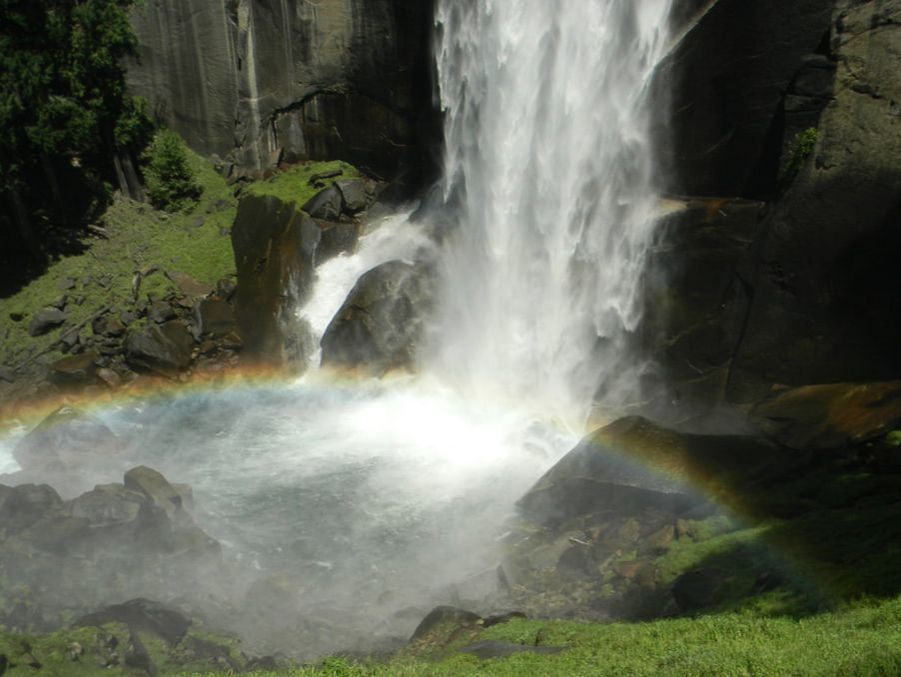 I've been sprucing up the website over the past month, and while doing that I stumbled upon some photos of Yosemite from 2011. The waterfalls that year were so nice, that I thought I would post a throwback blogpost!
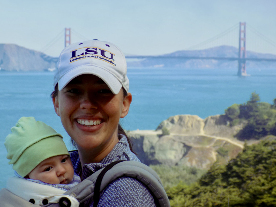
 This was my daughter's first trip to a National Park! I'm glad it was such a good visit. Photos of the park and of my cute baby after the jump.
 This was a return visit for me to Lands End, part of Golden Gate National Recreation Area. Last time I was here, I walked along the Coastal Trail to the Eagles Point Overlook and back. This time, my friends and I walked past Mile Rock Overlook to Mile Rock Beach and Lands End Point and back. Then we explored the ruins of the Sutro Baths and had lunch at the Cliff House.
 Milagra Ridge is part of the Golden Gate National Recreation Area. It is an island of reclaimed wildlife in San Mateo County that is surrounded by the urban developments of Pacifica and San Bruno. Here is the blurb about the park on the National Park website:
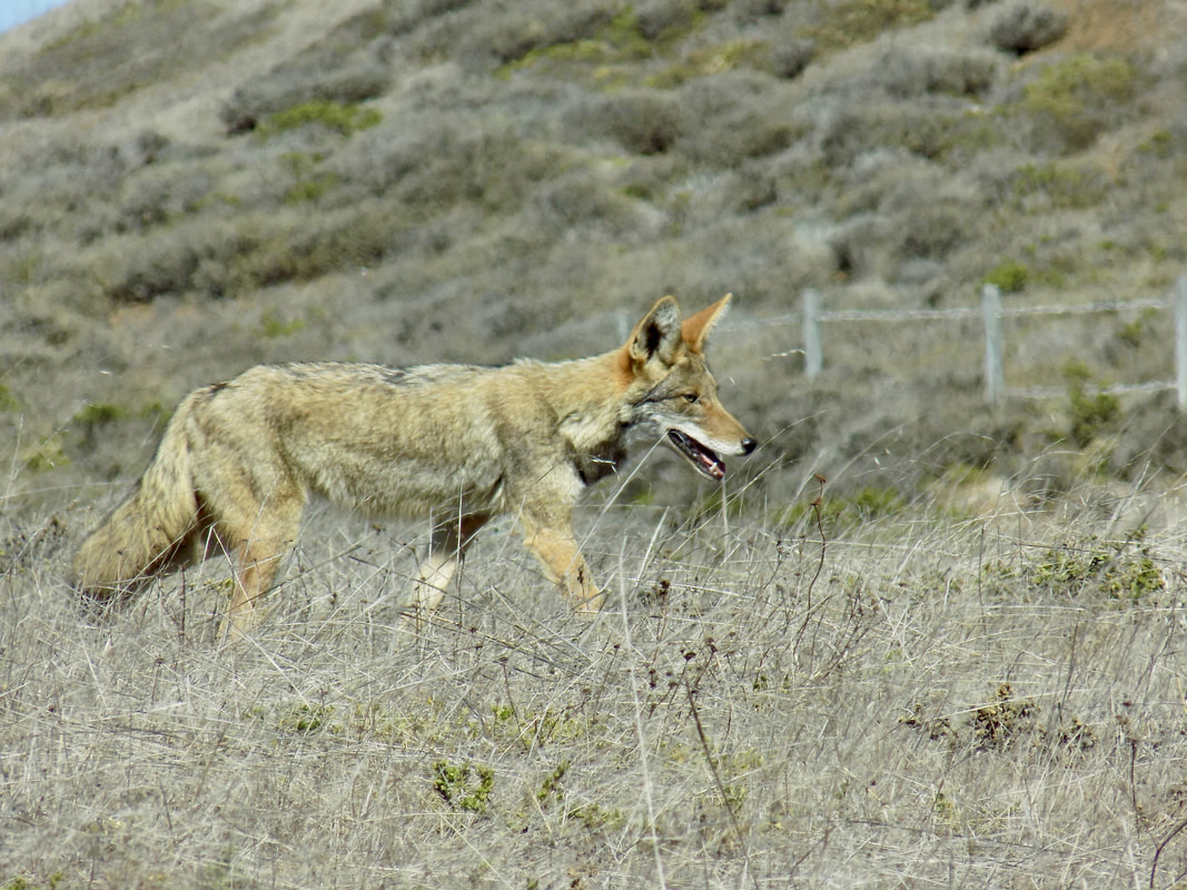
Surrounded by urban development, Milagra Ridge forms what biologists call an island ecosystem. Here, wildlife is isolated from other habitats, feeding and migration corridors are compromised and exotic species can easily invade native habitat. Despite this isolation, Milagra Ridge hosts a surprising number of threatened and endangered species including Mission blue and San Bruno elfin butterflies and the California red-legged frog. I did not see any of those species, but I did see a coyote up close and personal! I also saw a brush rabbit and several hawks, one perched close to me (probably hunting rabbits!). In addition to its natural beauty, Milagra Ridge offers a link to history: In the late 1930s, the United States Army acquired Milagra Ridge as part of a project to defend the San Francisco Bay... In 1956, Nike Missile Site SF-51 was established at Milagra Ridge. These surface-to-air missiles were protection against attacking aircraft during the Cold War. The site was converted to the nuclear-capable Nike-Hercules system in 1958. You can see the batteries where the WWII guns were once mounted and the bunkers where soldiers and lookouts waited. Also, the sites of the Cold War nuclear missile launchers are visible, although there is not much left there. Read more to see photos and a trail map! 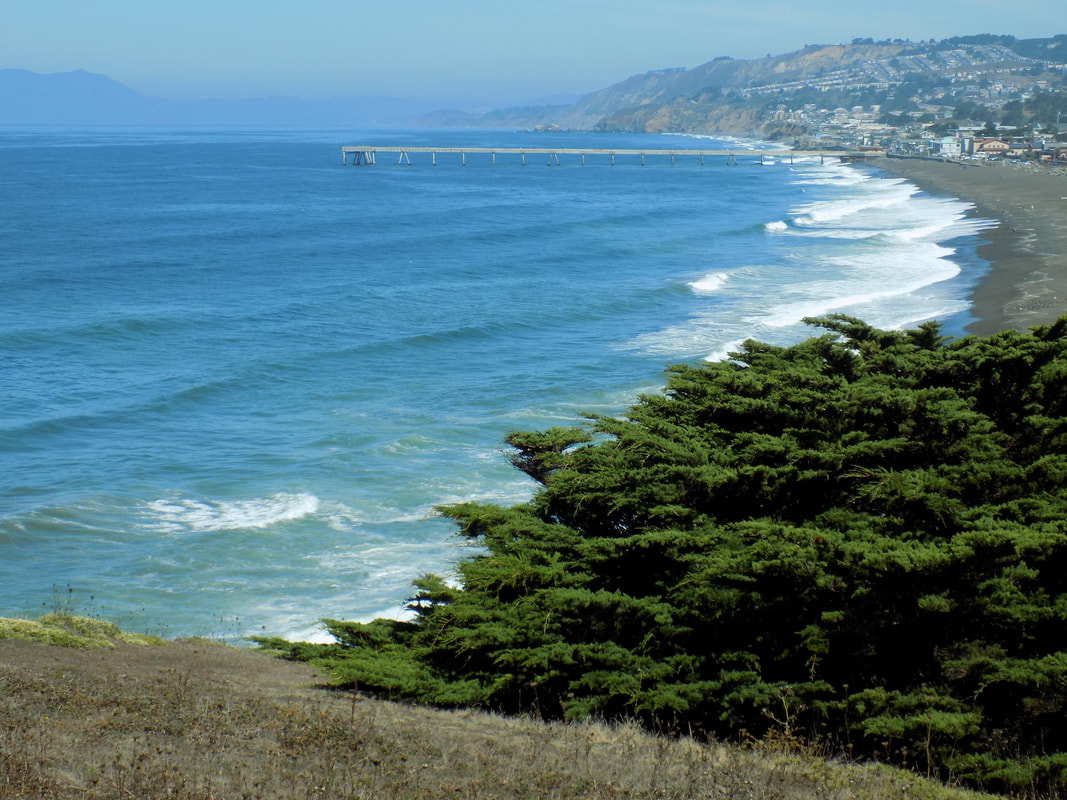 Mori Point is part of Golden Gate National Recreation Area in the town of Pacifica, next to Sharp Park. It has a 0.5-mile handicapped-accessible trail to the bluffs overlooking the black sands of Sharp Park Beach but there are also more challenging trails the climb up to the peaks of the ridges that form Mori Point.
 Lands End is one of the many lovely parks that is incorporated into Golden Gate National Recreation Area. This national park is broken into smaller campuses that are all over the San Francisco Peninsula and Marin County. This out-and-back hike is about 3 miles (~1.5 miles each direction). You can start from the Lands End Parking lot (680 Point Lobos Ave, San Francisco, CA 94121). Jane Huber, the author of the blog Bay Area Hiker, has a really nice write-up of the hike here, and the department of tourism has a gorgeous photo spread here, along with some information about the nearby historic site of the Sutro Baths ruins. See a map and some more photos after the jump.
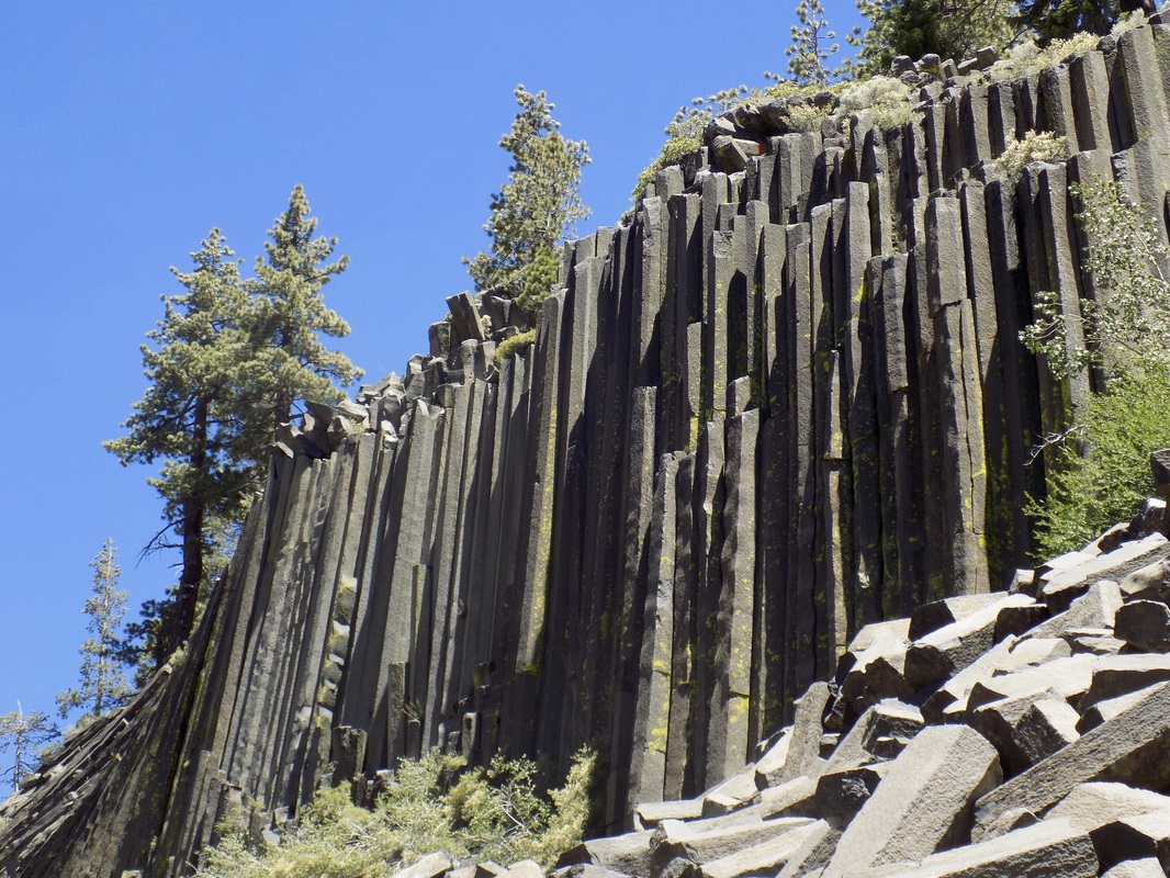 Devils Postpile National Monument is run cooperatively with the National Parks Service and the National Forest Service. It is in the Eastern Sierras near the ski resort area of Mammoth Lakes. The monument is a rare and fascinating geological formation that is the result of ancient volcanoes and glaciers--a landscape of fire and ice.
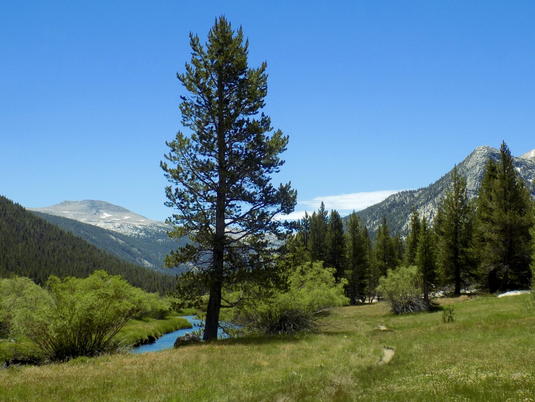 We passed through Tuolumne Meadows three times on our camping trip to the Eastern Sierras, and each visit offered us something new. When you enter Yosemite National Park, ask the ranger for information on Tuolumne Meadows, or download their pdf map here. If you are doing more substantial hiking, then you will definitely want to purchase a better map before you go. This was a wonderful new experience for us; previously, we had really restricted ourselves to Yosemite Valley. We really enjoyed trying out this new area of the park!
|
Archives
December 2020
Categories
All
|
 RSS Feed
