 Today I took a rejuvenating morning hike at Reinhardt Redwood Regional Park. I took a loop that was new to me, the 5.7-mile loop (with about 600' elevation gain) of East Ridge and Stream Trails. This loop combined a chaparral landscape along the ridge top with a riparian redwood forest in the valley below. And I was treated to a display of ladybugs!
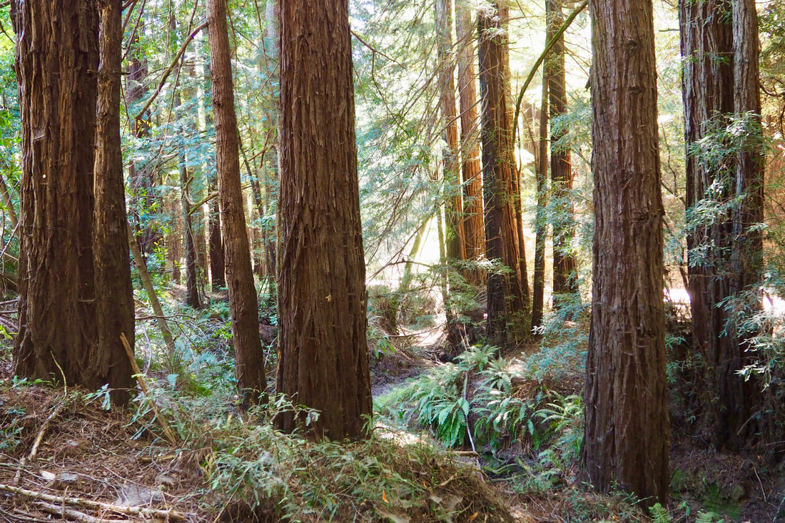
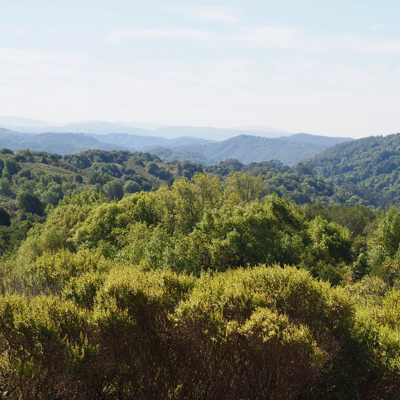
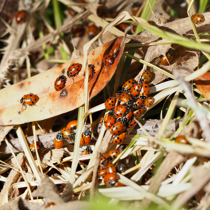
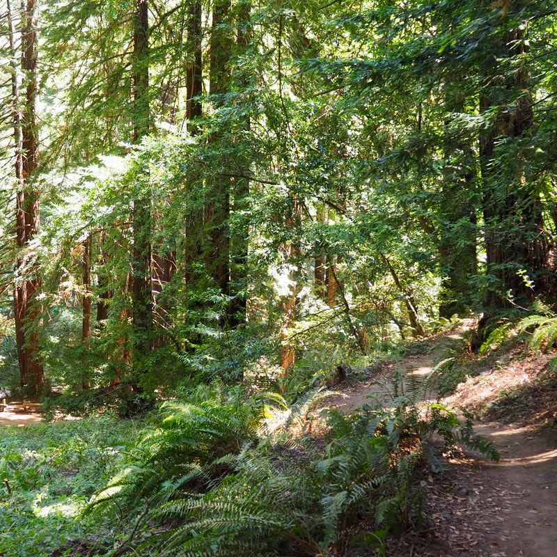
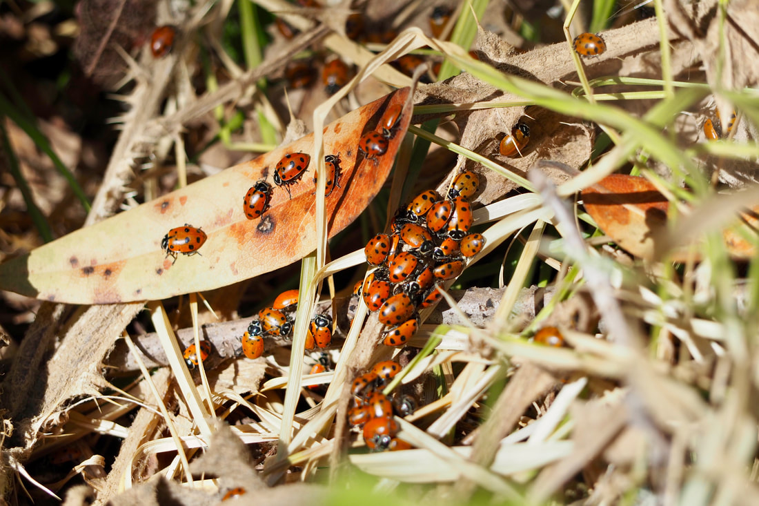
 Starting from the Redwood Gate Staging Area, I took the Canyon Trail up to the East Ridge. This part of the trail was the steepest and the hardest. Once I made it to the ridge top there was a still little bit more climbing, but it was easy and well graded after that initial hard ascent. This part of the trail is relatively exposed, so I recommend that you bring a hat and wear sunscreen. In the early morning, the sun is to your back, which makes a difference. There are intermittent views of the mountains to the east (surrounding Upper San Leandro Reservoir and extending as far as Mount Diablo) and to the west (especially the West Ridge of the park and the valley below that contains Redwood Creek). Occasionally, you can see some impressive views to the south, which are probably some of the ridges of Anthony Chabot Regional Park. I opted to take the Phillips Loop down hill (to the left) to join with the Eucalyptus Trail. I had taken this route on a different loop last year, and I knew that I liked the trail. I took this trail to its tee with Stream Trail and then turned left, following along the steep canyon lined with redwoods. It's a hot day today, and it was nice to have the remainder of my loop in the deep shade of the redwoods. This was really a great route for the weather today. The Stream Trail is a wide fire road (probably a former logging route), and I took this popular trail almost all the way back to the staging area. I saw the cluster of ladybugs right after the junction with the Prince Trail along this trail. Reinhardt Redwood Regional Park is famous for being a wintering spot for lady bugs. I was not at all expecting to see them in the summer, so I was so surprised and excited to see them. This was really one of the coolest things that I have ever seen on a hike--unlike anything else I have experienced before. Here is more information about ladybugs from KQED, and they even name-check Reinhardt Redwood (using its old name of Redwood Regional Park). I suspect that this particular spot--near the junction of Stream Trail and Prince Trail--is a fairly common spot to find the cute little bugs. The EBRPD even had an informational plaque up about the insects, a type of beetle. I hope to bring my daughter back here in the winter so that she can see them at their peek. She really likes lady bugs. This trail is very popular with families because it is fairly flat and easy to push a stroller on. Although everyone was being very good about their COVID-19 precautions (almost everyone had a mask), I just found myself wishing for some more solitude. About this time, I noticed on the map that the Bridle Trail parallels the busy Stream Trail. I found a connector trail to get up to it, and took this single-track trail all the way until Fern Dell. Here it widened a bit, and I stayed on it still as far as the Fishway Interpretative Site, where I completed my loop. This was a great route for a moderate hike on a warm day.
0 Comments
Leave a Reply. |
Archives
December 2020
Categories
All
|


 RSS Feed
