Lonely Hiker
  • Home
  • About
  • Regions
  • Parks
  • Trails
  • Photography

Trails

Malakoff Diggins State Historic Park

6/25/2016

0 Comments

 
Picture
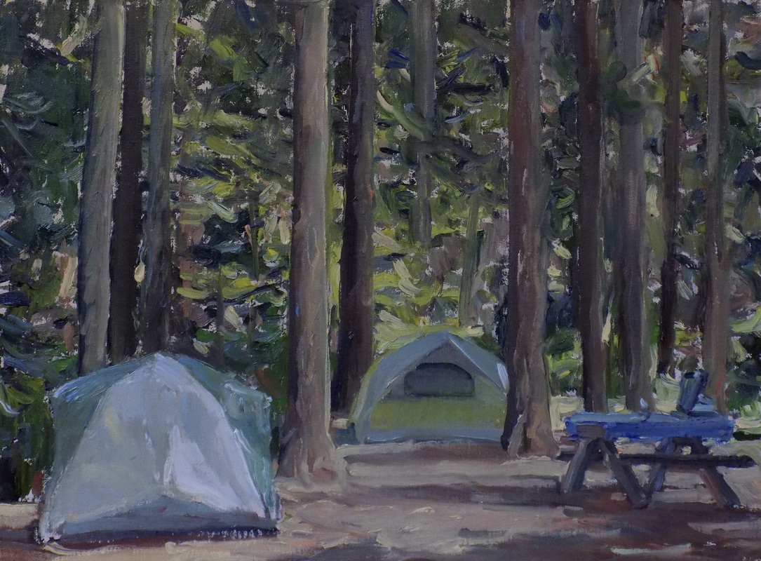
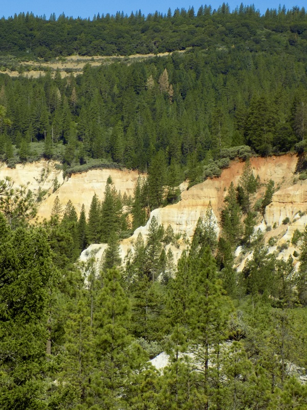
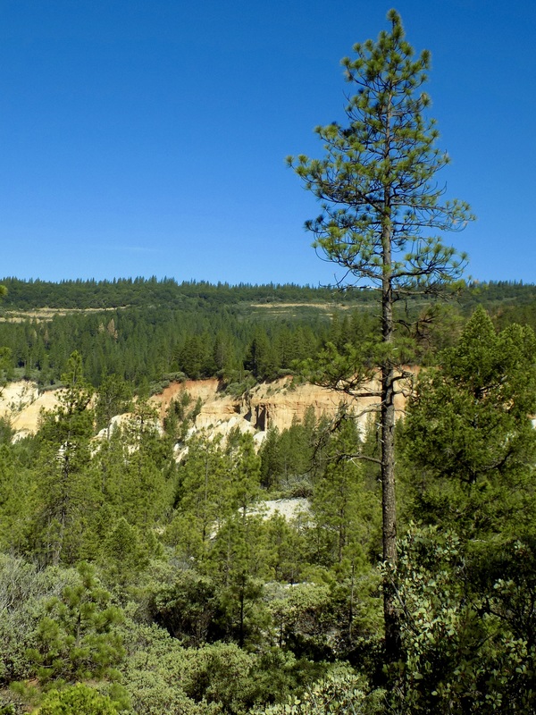
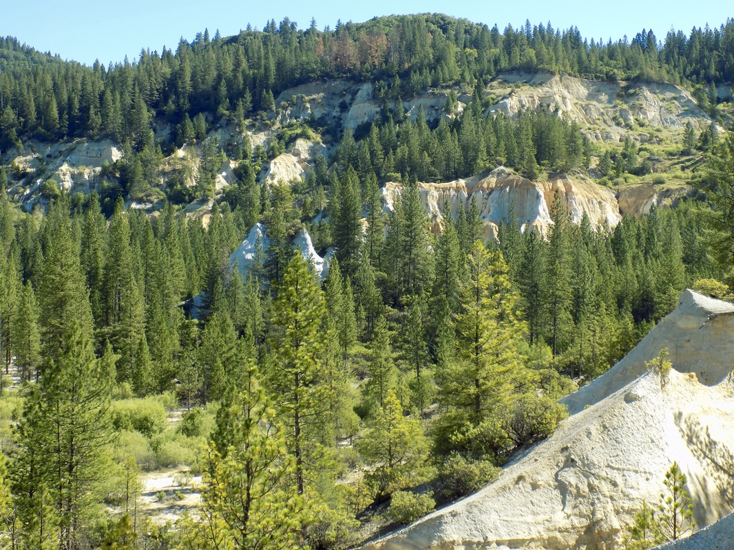
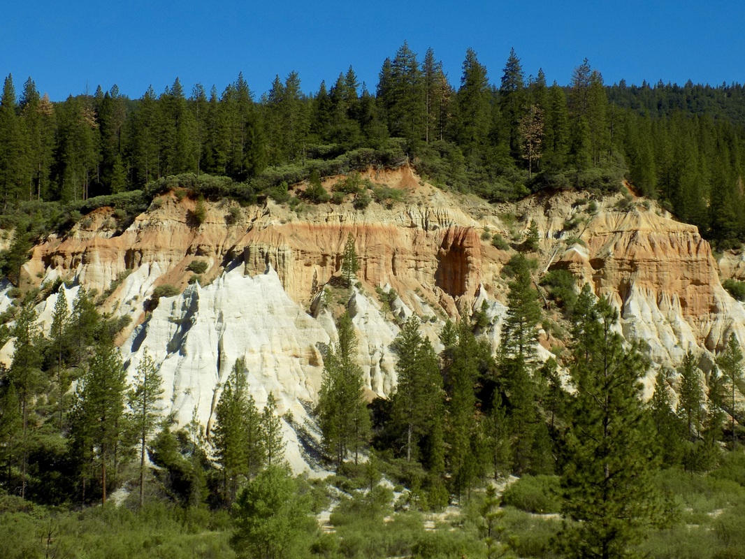
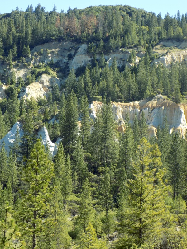
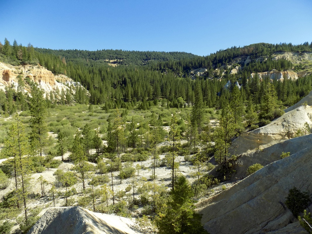
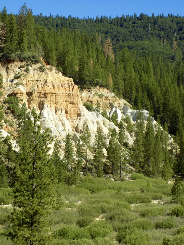
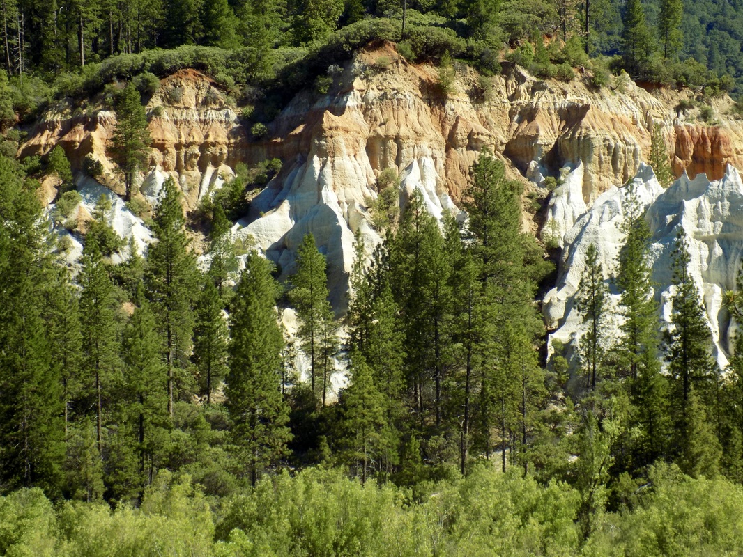
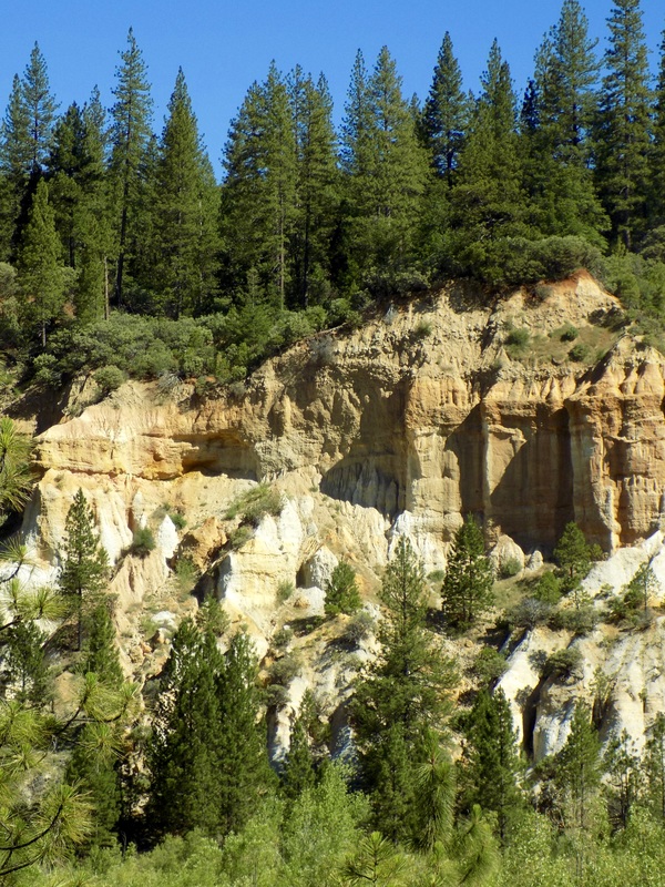
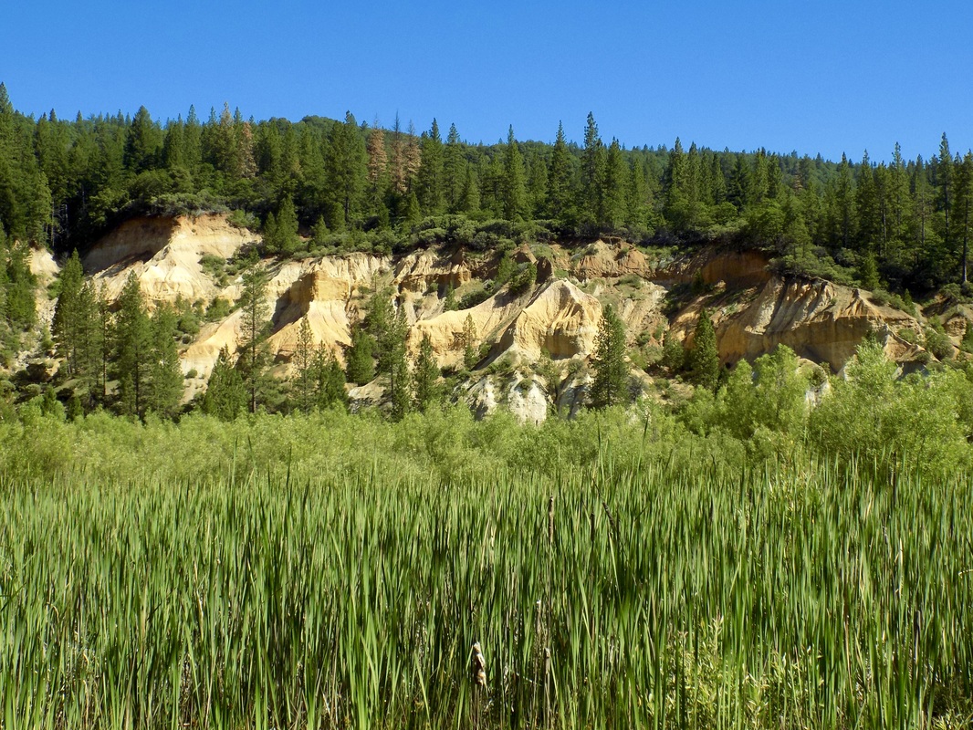
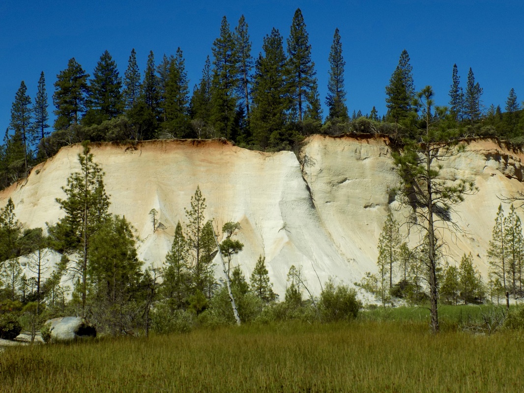
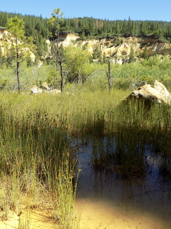
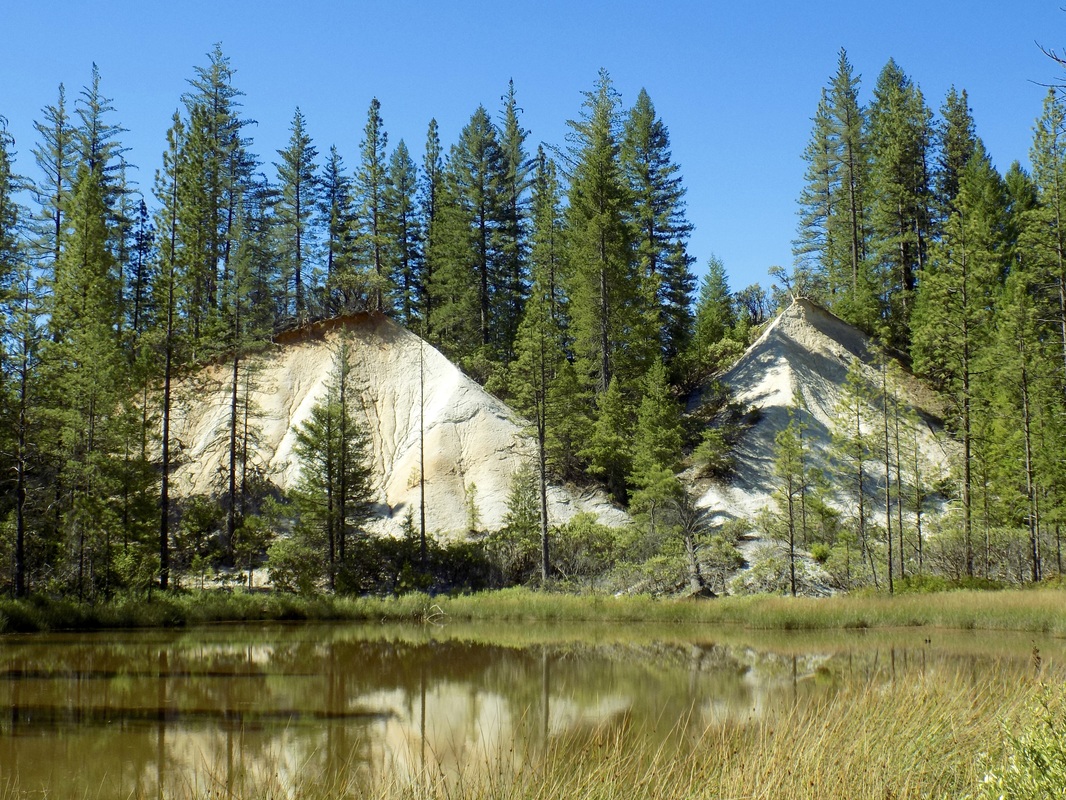
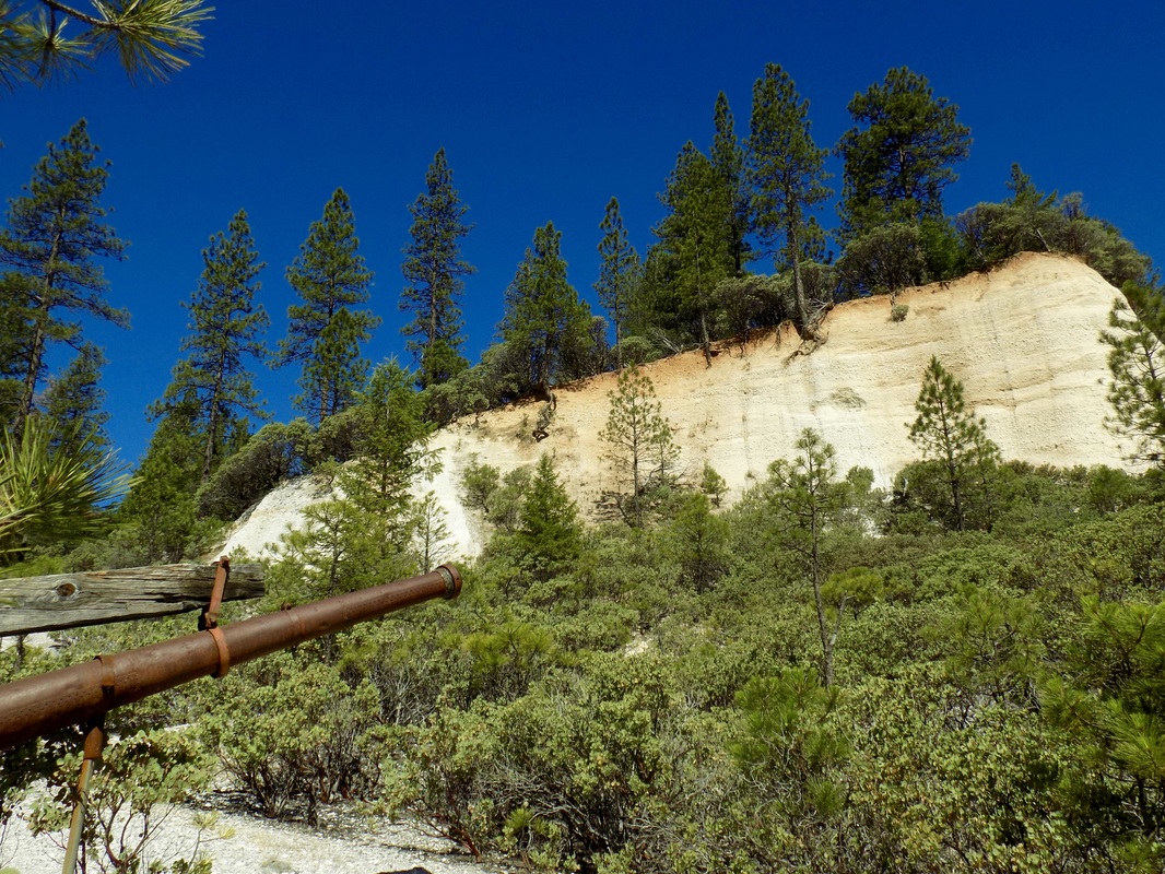
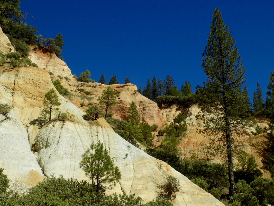
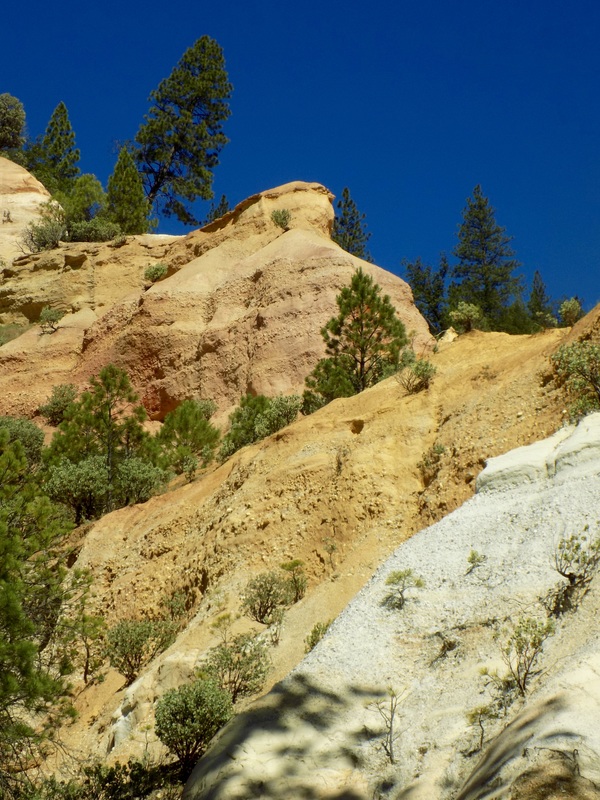
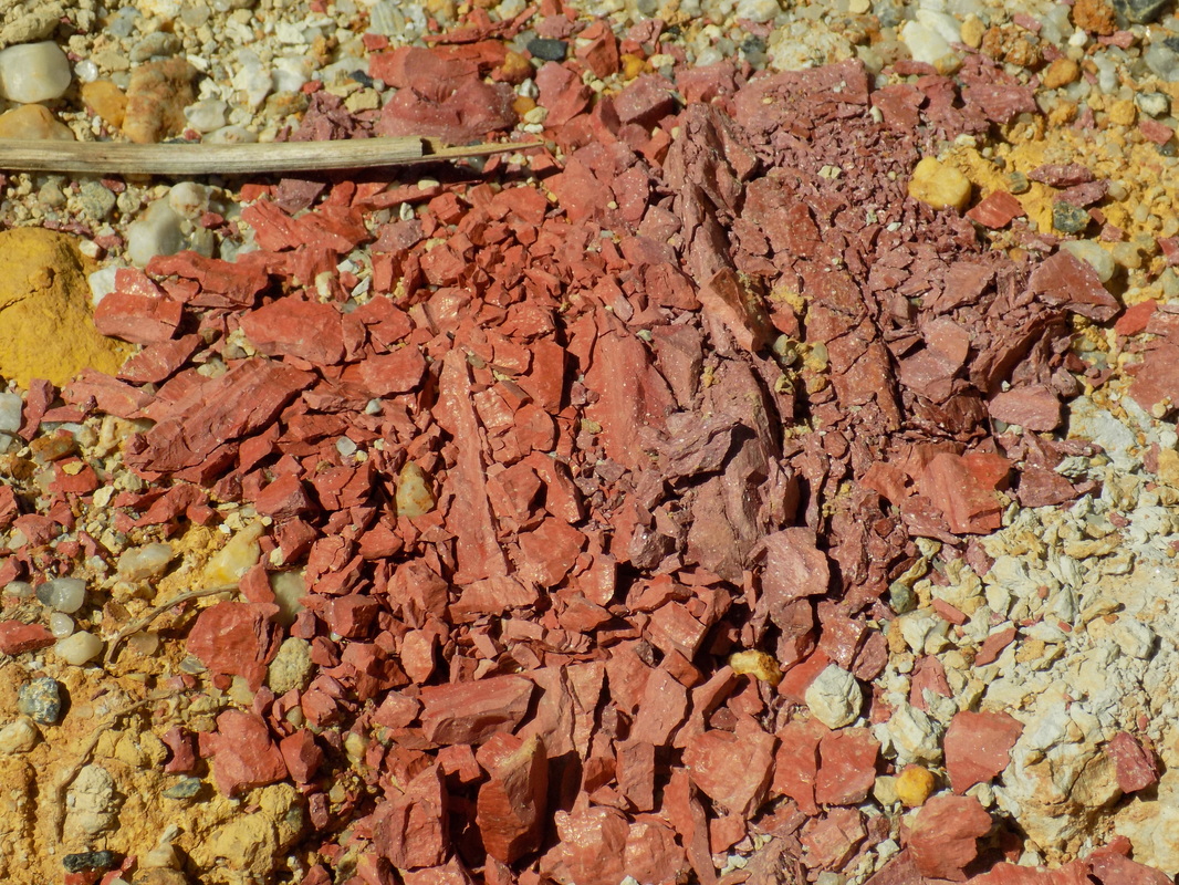
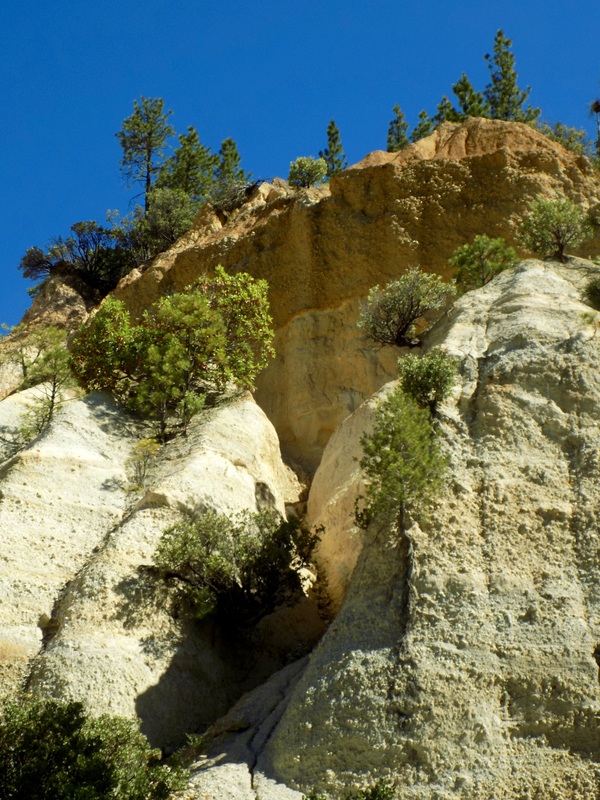
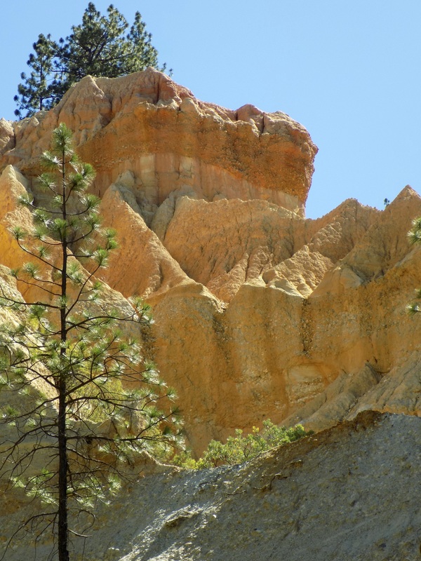
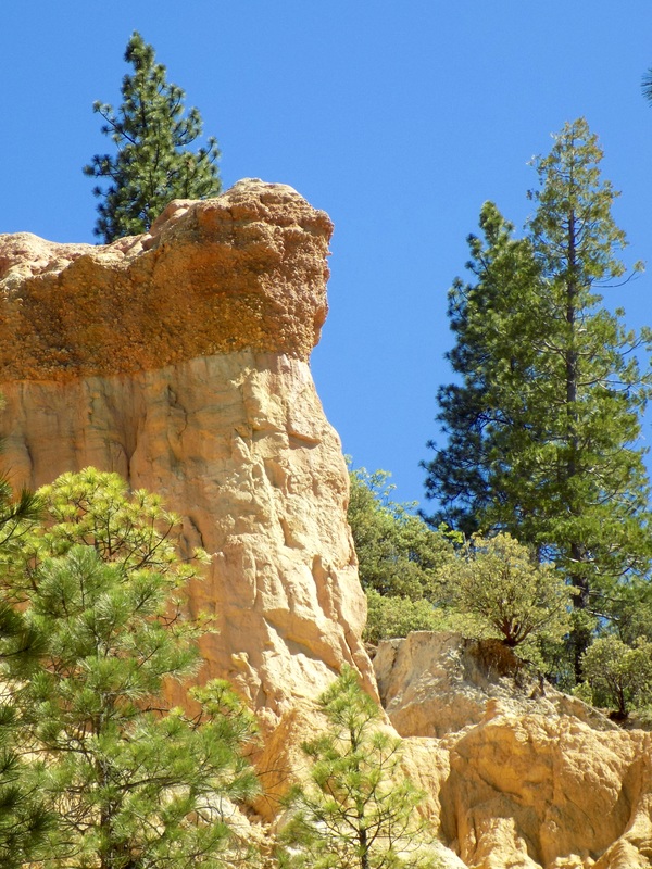
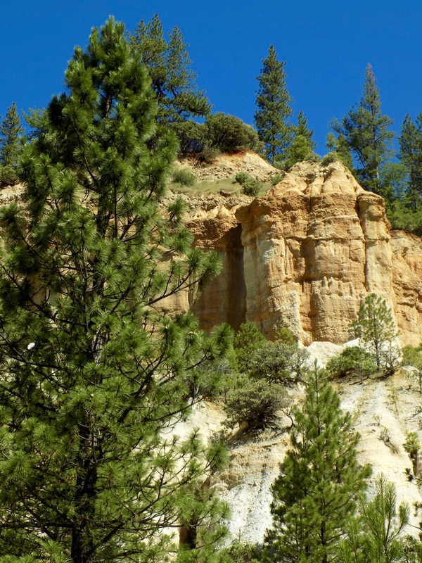
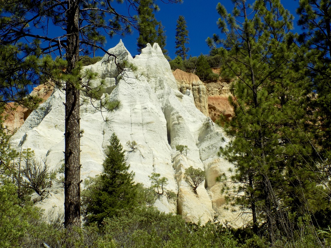
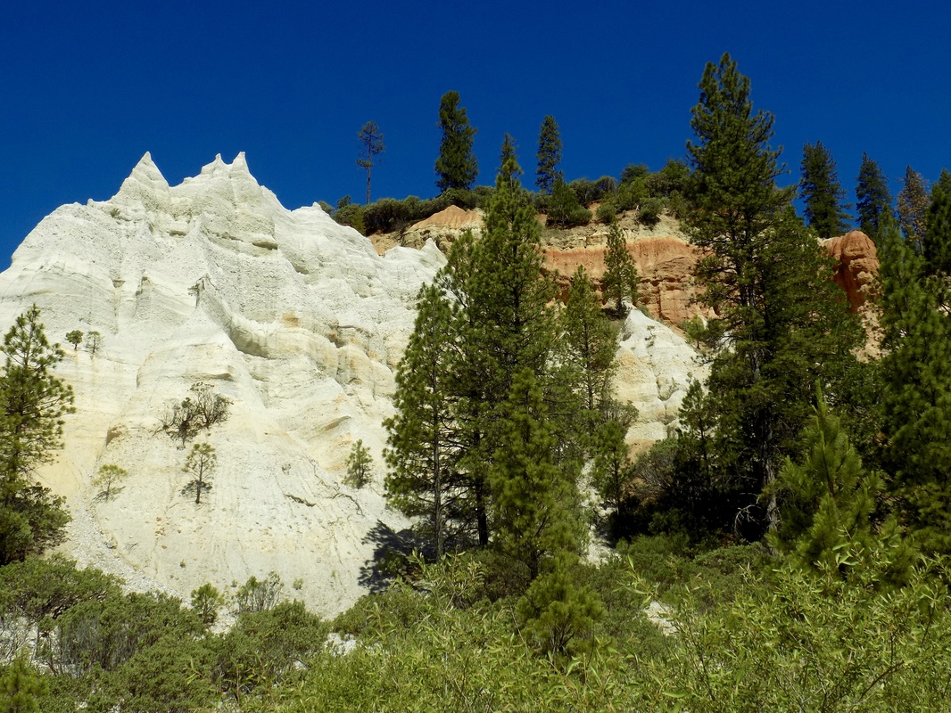
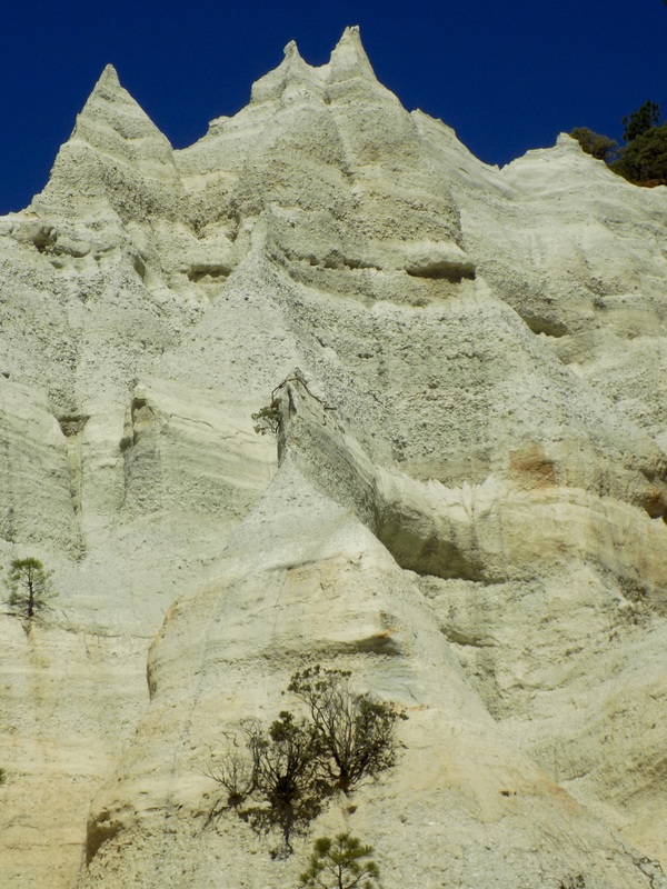
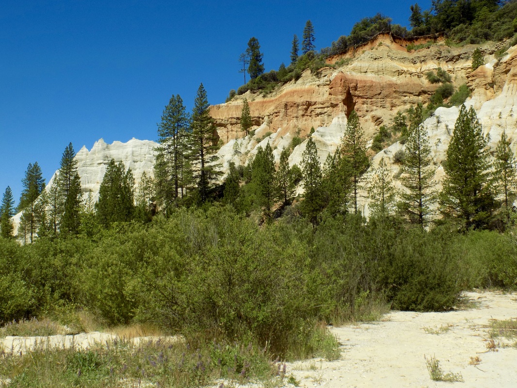
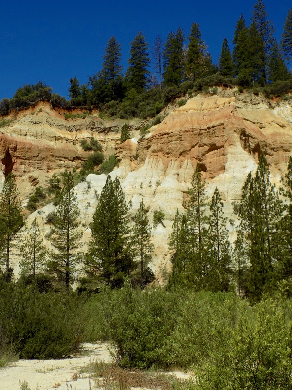
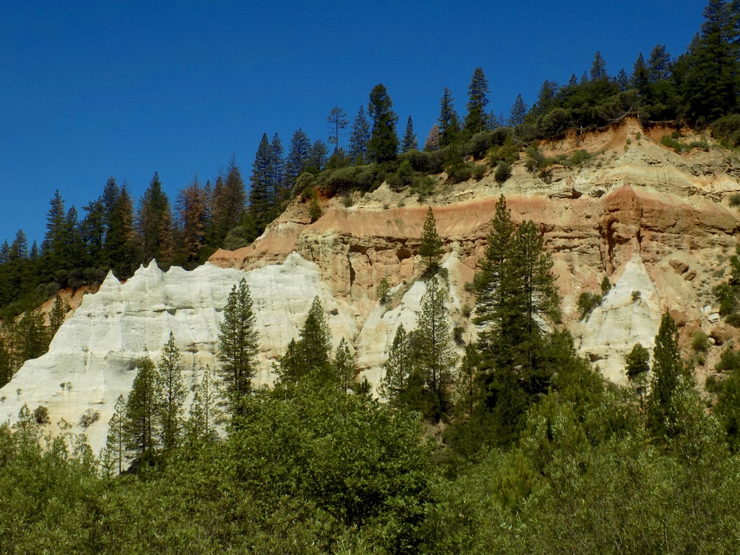
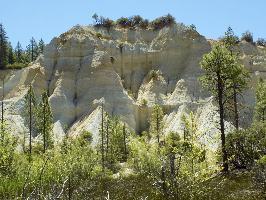
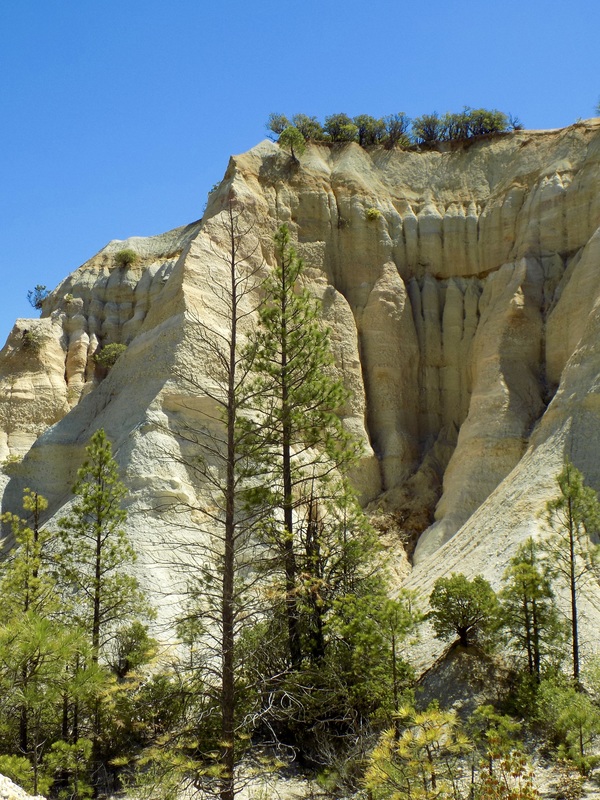
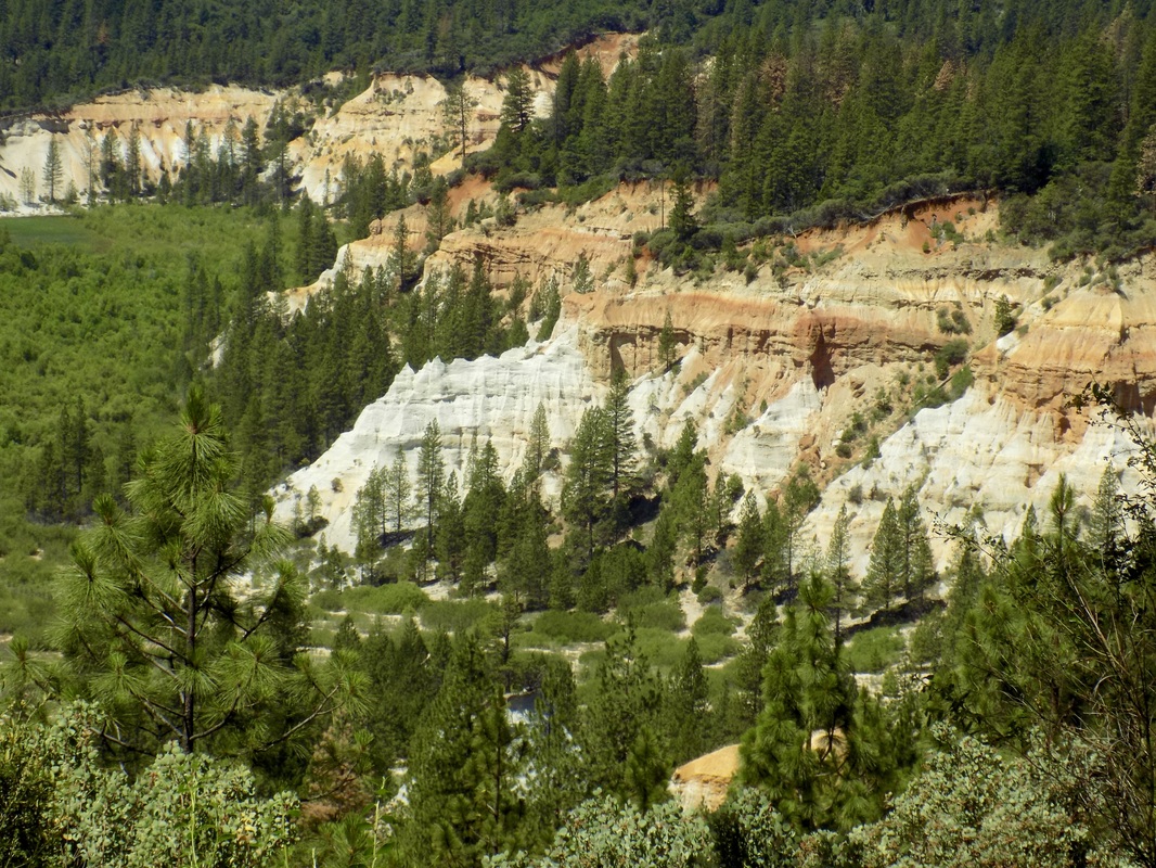
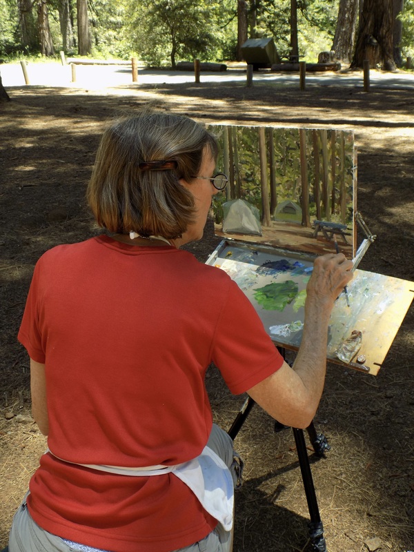
Malakoff Diggins State Historic Park is a fascinating park that offers visitors a peak back in time to the highs and lows of California's gold mining heyday. Here is a helpful blurb from the state park website:

Malakoff Diggins State Historic Park is the site of California's largest "hydraulic" mine. Visitors can see huge cliffs carved by mighty streams of water, results of the gold mining technique of washing away entire mountains to find the precious metal. Legal battles between mine owners and downstream farmers ended this method.

The Diggins themselves are really beautiful. They look like some of the red rock formations in Utah. It is weird to see such formations in Northern California, especially because some of the grounds near the foot of the Diggins are still boggy and marshy. The greatest environmental impact was further downstream from the Yuba River, particularly in Marysville where people died because of flooding. It is easy to forget how devastating the pollution from mining was when what remains of this mine is actually very beautiful.

The park also has what is more or less a ghost town. It is definitely worth it to take the ranger-led tour of North Bloomfield so that you can go inside some of the old buildings like the saloon, pharmacy, general store, and a residence. Plus, the park rangers here are the friendliest park rangers I have ever met!

See my mom's painting of Chute Campground and my photos of the Diggins after the jump.
Picture
Picture
A happy camper in her natural environment; also, protecting our campsite from BEARS!
Picture
Picture
Picture

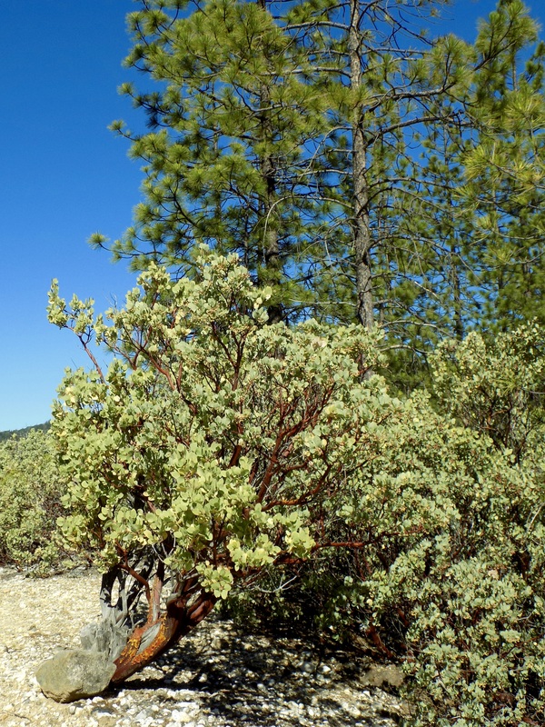
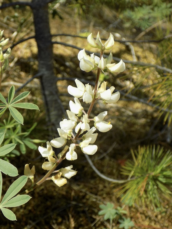
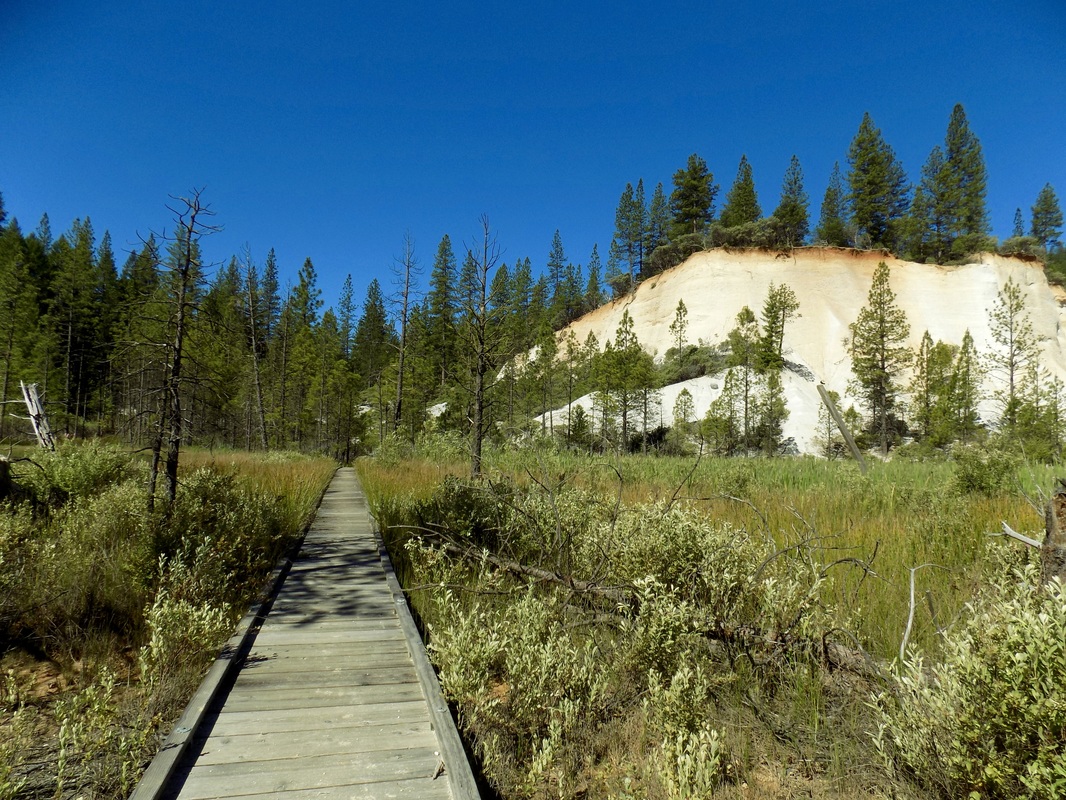
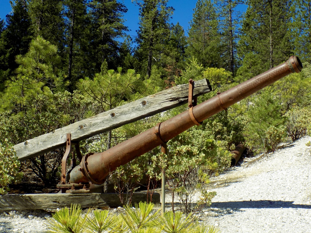
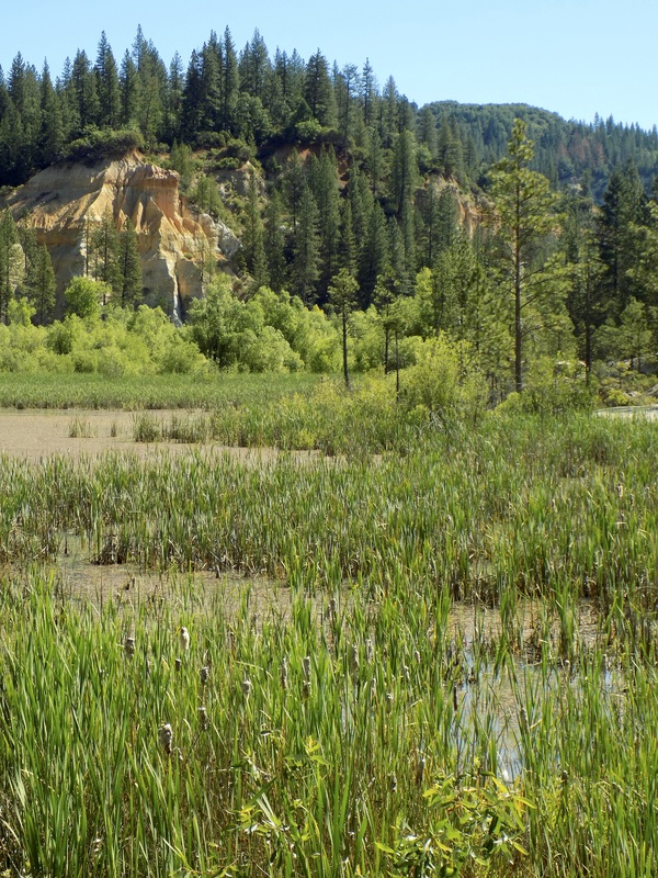
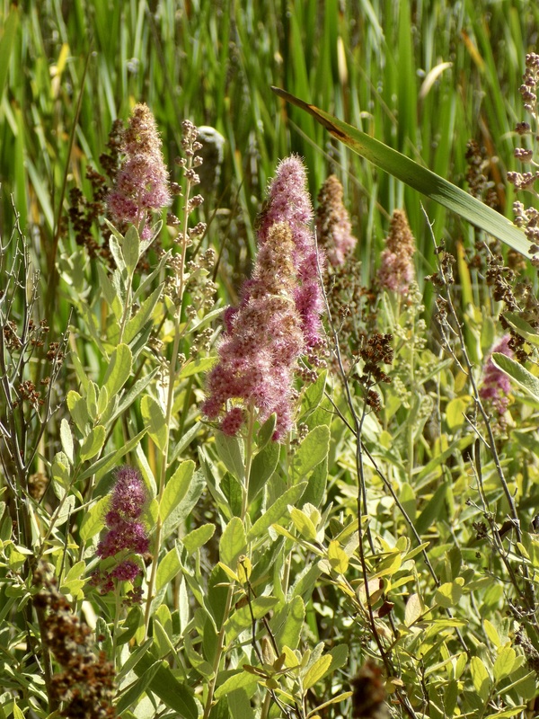
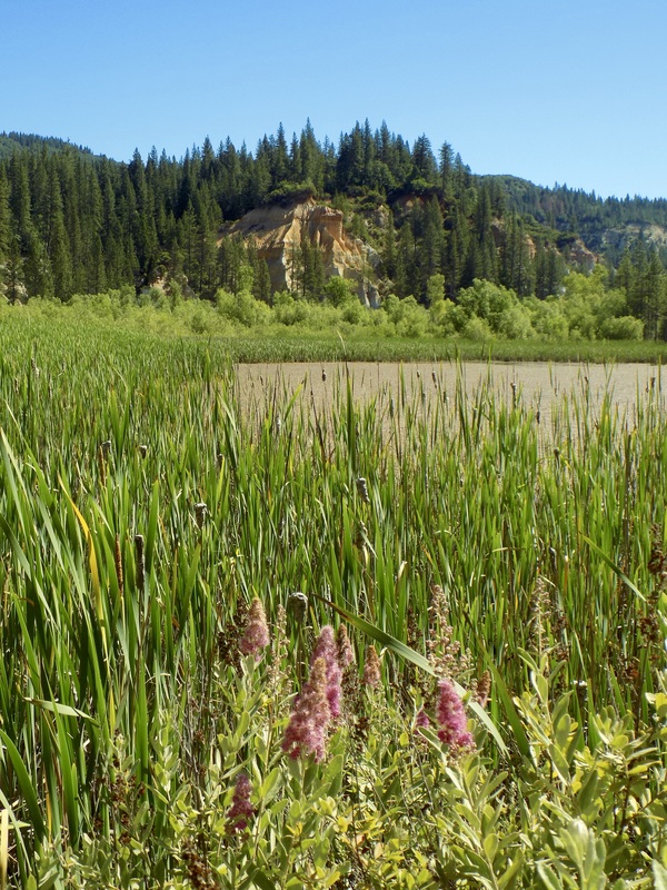
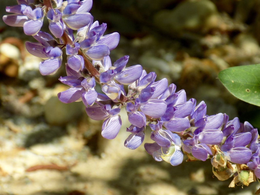
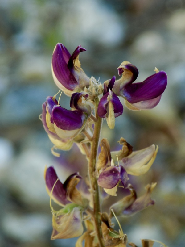
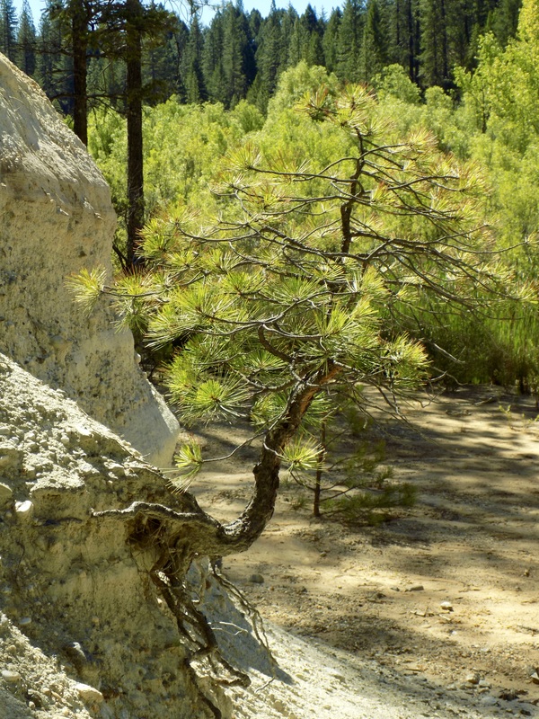
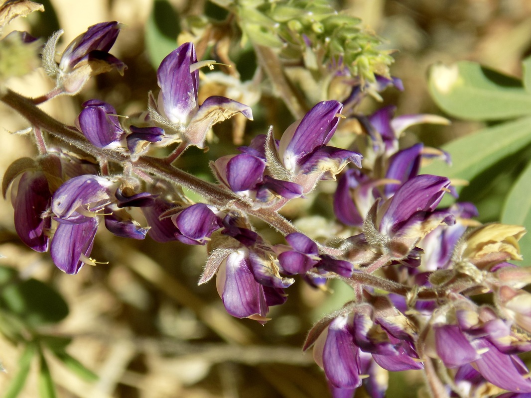
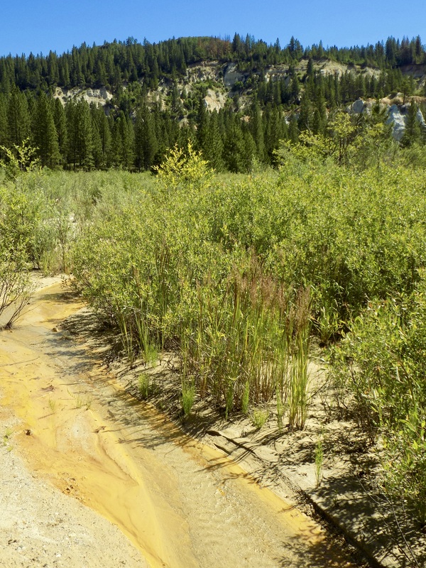
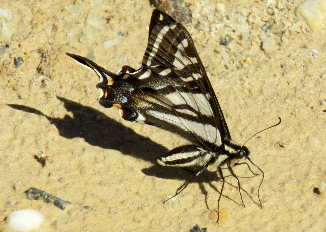
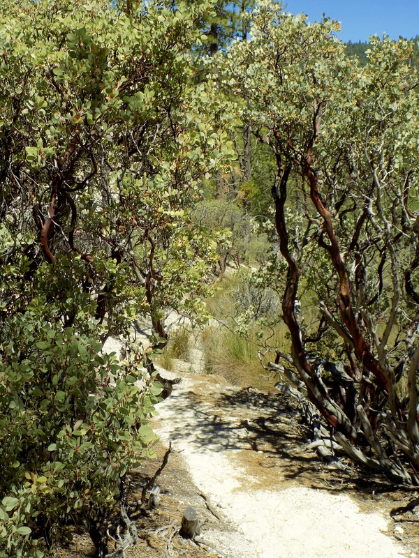
Slaughterhouse to Diggins Loop Trails

Picture
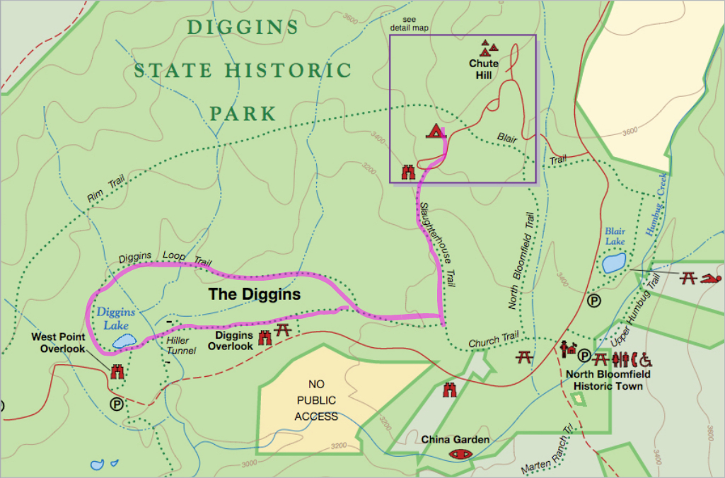
I took the Slaughterhouse Trail from Chute Campground through a mixed forest of Ponderosa Pine, incense cedars, and manzanita down to the access to Diggins Loop Trail. I took the south rim of the trail around Diggins Lake and then looped back along the north rim. The south rim of the trail offers better vantage points for photographs, but the north rim allows you to get closer to the Diggins to see the rocks up close.

Diggins Lake was really more of a marsh. There was a loud chorus of bullfrogs croaking away when I was there, and one of the original water canons & monitors is still pointed at the chalky cliffs, left behind after the mine was forced to shut down its operations. There was a proliferation of lupine blooming along the trail, and there were butterflies everywhere.

It was much hotter in the sunny pit of the Diggins than it was in the shady ridgetop campground. Definitely start your hike in the cool of the morning if you can; wear sunscreen or a hat, and bring lots of water. When you finish your hike, you can cool off by swimming in Blair Lake just north of historic North Bloomfield. The hike I took (in pink on the map above) was more or less 5 miles, round trip; however, it felt more strenuous than that because of the heat in the Diggins. The climb back up Slaughterhouse Trail was significant, but it wasn't too bad because the trail is pretty short.

Two things to note:
  1. The nearby South Yuba River State Park looks really awesome, and I want to go swimming there if I can make it back to Malakoff Diggins.
  2. The GPS gives terrible directions. Do not take either Relief Hill or North Bloomfield Roads. Follow the directions on the state park website: From Nevada City, travel 11-miles north on highway-49 toward Downieville. Turn right on Tyler Foote Rd. turnoff from Highway 49 and follow the main paved road to the park. The main road changes names a few times (Cruzon Grade Road, Back Bone Road, Derbec Road, North Bloomfield Road). You will stay on paved roads all the way to the park.  These are not high-speed roads. The park is 26-miles (50 min drive time) from Nevada City.
0 Comments


Leave a Reply.

    Archives

    December 2020
    November 2020
    October 2020
    September 2020
    August 2020
    July 2020
    June 2020
    May 2020
    April 2020
    March 2020
    February 2020
    January 2020
    December 2019
    November 2019
    October 2019
    September 2019
    August 2019
    July 2019
    June 2019
    May 2019
    April 2019
    March 2019
    February 2019
    January 2019
    December 2018
    November 2018
    October 2018
    September 2018
    August 2018
    July 2018
    June 2018
    May 2018
    April 2018
    March 2018
    February 2018
    January 2018
    November 2017
    October 2017
    September 2017
    August 2017
    April 2017
    March 2017
    February 2017
    January 2017
    November 2016
    October 2016
    September 2016
    August 2016
    July 2016
    June 2016
    May 2016
    April 2016
    March 2016
    February 2016
    January 2016
    December 2015
    November 2015
    October 2015
    September 2015

    Categories

    All
    Art Expedition
    Bay Laurel Trees
    Bayside
    Beaches
    Berkeley City Parks
    Bureau Of Reclamation
    Camping
    Cliffs
    Coastside
    Contra Costa Water District
    Creeks
    Deserts
    East Bay Municipal Utility District
    East Bay Regional Park District
    EBRPD Trails Challenge
    Eucalyptus
    Flat Hikes
    Gulf Coast Family Vacation
    Historical Sites
    Kid Friendly
    Lakes
    LARPD
    Length: 10 To 15 Miles
    Length: 15+ Miles
    Length: 1 To 5 Miles
    Length: 5 To 10 Miles
    Madrones
    Manzanita
    Maples
    Marin County Parks
    Midpeninsula Regional Open Space Preserves
    Mountains
    Museums
    National Forest Service
    National Parks
    National Wildlife Refuge
    Oakland City Parks
    Oaks
    Palo Alto & Atherton Parks
    Peninsula Open Space Trust
    Pleasanton City Parks
    Portola Valley Town Trails
    Redwoods
    Rocks
    San Francisco City Parks
    San Mateo County Parks
    Santa Clara County Parks
    Santa Cruz City Parks
    Sierras
    Stanford
    State Parks
    Swimming Holes
    Sycamores
    Trains
    Tri-Valley
    UC Berkeley
    UC Davis
    Walnut Creek Parks
    Wetlands
    Wildflowers
    Wildlife
    Zoos Farms & Wildlife Preserves

    RSS Feed

Powered by Create your own unique website with customizable templates.
  • Home
  • About
  • Regions
  • Parks
  • Trails
  • Photography