Lonely Hiker
  • Home
  • About
  • Regions
  • Parks
  • Trails
  • Photography

Trails

Ohlone Wilderness, Williams Gulch

1/31/2020

0 Comments

 
Picture
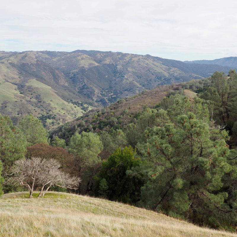
Last Saturday was a particularly mild January day, so I went out to a park that I've long wanted to visit: Ohlone Regional Park. Part of the appeal of this park is that it is so remote. Here is a blurb from the EBRPD website:

You have to hike or ride horseback to see this magnificent 9,737-acre parkland, accessible only by way of the Ohlone Wilderness Trail. Its centerpiece is 3,817-foot Rose Peak, just 32 feet lower than Mount Diablo. Surrounding Rose Peak are grassy ridges, profusely flowered in season. The abundance of wildlife includes golden eagles, mountain lions, and tule elk. 

Murrietta Falls, the tallest waterfall in the Bay Area can be found at this park, but the hike to get there is a real butt-kicker, and the waterfall is only seasonal--there is no guarantee that you will actually see it once you've gone all the way out there. On my hike on Saturday, I only went about halfway to Murrietta falls, to the scenic Williams Gulch. It was such a pleasure!
Picture
Picture
Picture
Picture
I estimate that I hiked about 6 miles in this in-and-out route, climbing at least 1,500 feet. Although the park rangers recommended that I start on the Ohlone Wilderness Trail from Lichen Bark Picnic area on the western shore of Lake Del Valle, I opted instead to take the Vallecitos Trail from the family campground. Be advised that parking there is a little tricky. I parallel parked along the road, because the lot there is for campers only. I really liked the single-track Vallecitos trail: it was one of my favorite parts of the hike, and I would go back to Del Valle just to do this leg of the hike!
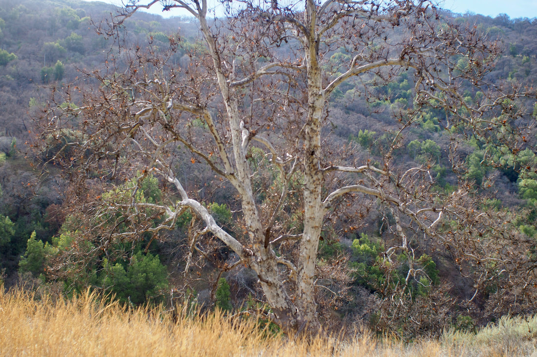
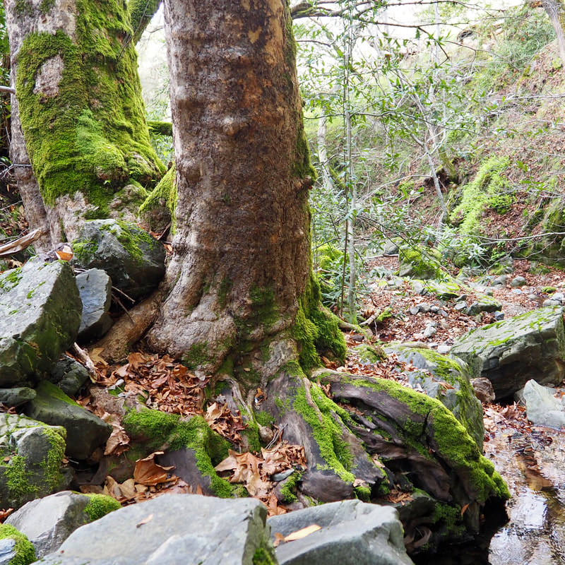
Vallecitos trail winds through a fairly steep valley, and the trees on either side offer nice shade. Once you intersect with the Ohlone Wilderness Trail, be sure to sign in. Note that you need to purchase a wilderness permit, but they are only $2 per person and they are good for a year (plus the permit is also your map).

This portion of the Ohlone Wilderness Trail was the hardest portion of the hike because of its steepness; both going up and coming down were hard. I brought a hiking stick for this hike, and I was really glad that I had it specifically for this section. After I made it to Boyd Camp, the hike was really not that bad. The Sycamore Flats area was gorgeous, and I loved how dramatically the landscape changed as I descended from the ridge top of Rocky Ridge to the deep valley of Williams Gorge.

Even with the tough section from the sign-in to Boyd Camp, I really loved this hike and I would do it again. I kind of feel like it might be doable to go all the way to Murrietta Falls as long as I pace myself and start off early enough in the day. I was surprised at how well traveled this hike was considering its remoteness. There were plenty of people who were either on their way to or coming back from the falls. I guess that people were really hoping to see the waterfall after a week of rainy weather!

As a side note, this trail is really only appropriate in the winter and early spring. Because so much of it is exposed, and because it can get so hot out here, it's just not safe to hike this strenuous hike during the warmer months.
0 Comments


Leave a Reply.

    Archives

    December 2020
    November 2020
    October 2020
    September 2020
    August 2020
    July 2020
    June 2020
    May 2020
    April 2020
    March 2020
    February 2020
    January 2020
    December 2019
    November 2019
    October 2019
    September 2019
    August 2019
    July 2019
    June 2019
    May 2019
    April 2019
    March 2019
    February 2019
    January 2019
    December 2018
    November 2018
    October 2018
    September 2018
    August 2018
    July 2018
    June 2018
    May 2018
    April 2018
    March 2018
    February 2018
    January 2018
    November 2017
    October 2017
    September 2017
    August 2017
    April 2017
    March 2017
    February 2017
    January 2017
    November 2016
    October 2016
    September 2016
    August 2016
    July 2016
    June 2016
    May 2016
    April 2016
    March 2016
    February 2016
    January 2016
    December 2015
    November 2015
    October 2015
    September 2015

    Categories

    All
    Art Expedition
    Bay Laurel Trees
    Bayside
    Beaches
    Berkeley City Parks
    Bureau Of Reclamation
    Camping
    Cliffs
    Coastside
    Contra Costa Water District
    Creeks
    Deserts
    East Bay Municipal Utility District
    East Bay Regional Park District
    EBRPD Trails Challenge
    Eucalyptus
    Flat Hikes
    Gulf Coast Family Vacation
    Historical Sites
    Kid Friendly
    Lakes
    LARPD
    Length: 10 To 15 Miles
    Length: 15+ Miles
    Length: 1 To 5 Miles
    Length: 5 To 10 Miles
    Madrones
    Manzanita
    Maples
    Marin County Parks
    Midpeninsula Regional Open Space Preserves
    Mountains
    Museums
    National Forest Service
    National Parks
    National Wildlife Refuge
    Oakland City Parks
    Oaks
    Palo Alto & Atherton Parks
    Peninsula Open Space Trust
    Pleasanton City Parks
    Portola Valley Town Trails
    Redwoods
    Rocks
    San Francisco City Parks
    San Mateo County Parks
    Santa Clara County Parks
    Santa Cruz City Parks
    Sierras
    Stanford
    State Parks
    Swimming Holes
    Sycamores
    Trains
    Tri-Valley
    UC Berkeley
    UC Davis
    Walnut Creek Parks
    Wetlands
    Wildflowers
    Wildlife
    Zoos Farms & Wildlife Preserves

    RSS Feed

Powered by Create your own unique website with customizable templates.
  • Home
  • About
  • Regions
  • Parks
  • Trails
  • Photography