Lonely Hiker
  • Home
  • About
  • Regions
  • Parks
  • Trails
  • Photography

Trails

Morgan Territory-Mount Diablo Loop

5/9/2020

1 Comment

 
Picture
As a treat to myself this weekend (ahead of Mother's Day), I decided to take a nice hike on a loop that winds in between Morgan Territory and Mount Diablo State Park. I loved this 8-mile route, and plan to do a variation of it again next spring! Click "read more" to see my loop and more photos.
Picture
Picture
Picture
Picture
Map is from redwoodhikes.com
The last time I took a more serious hike at Morgan Territory, I noticed on the map the trailhead off of Old Finley Road and planned to hike in this part of the park for an upcoming visit. I did not realize at the time how integrated the trail system is between Morgan Territory and Mount Diablo State Park.

I found this excellent write up by Dave Baselt at one of my all-time favorite hiking blogs, redwoodhikes.com. I opted to do the route that he recommends based on the strength of his praise for the trail. Do visit his site for a full description--it's very clear and accurate.

His map is really good (as are all his maps), and I recommend either buying an official copy for multiple uses or printing this one out for a single-use.
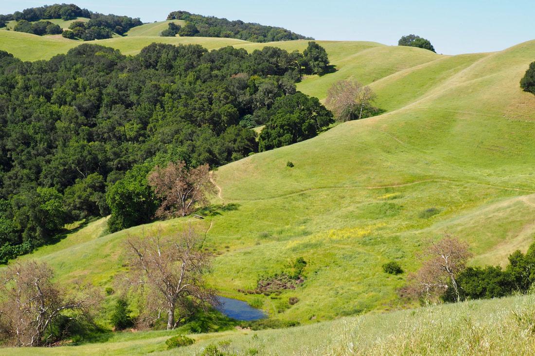
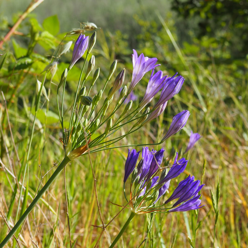
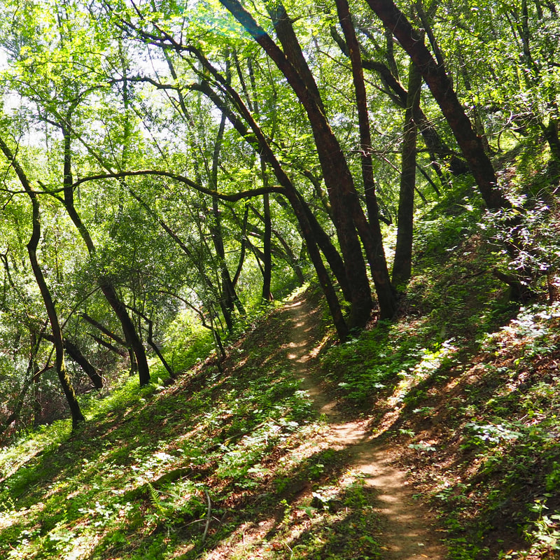
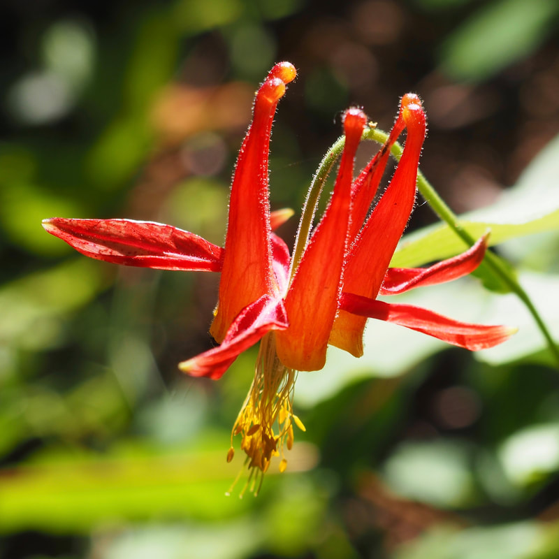
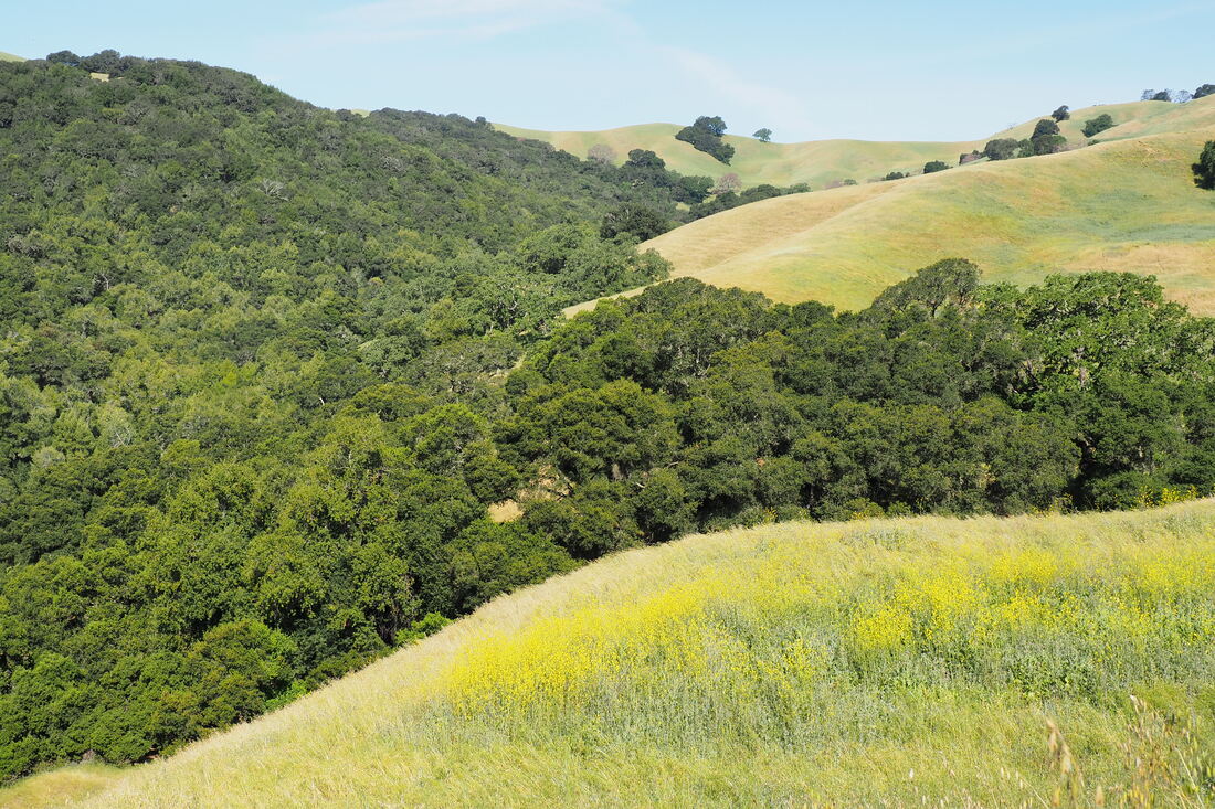
The EBRPD map of Morgan Territory does not give adequate detail about the trails that are part of the state park system, and the map on the brochure for Mount Diablo State Park is entirely inadequate for actually hiking the park. This makes his map really very useful!

The hills in the Tri-Valley are mid-way between green and gold right now, and the summer gold color is taking over bit by bit every day. I was so delighted by how green the hills were relative to what they could have been, but I also found myself wishing that I had done this hike earlier in the spring when the green was at its most vibrant emerald. Hopefully next year, the pandemic will be behind us and hiking will be less fraught. I would love to do this hike in April!

Even though the green of the hills was past its peak, it was still an amazing (and much-needed) hike. I saw several deer, a rattlesnake, and several turkey hens with broods of chicks. I saw California quail, lots of smaller garter snakes, and various birds including one very close encounter with a turkey vulture. The wildflowers were blooming in abundance! The most spectacular by far was the Ithuriel's spear or brodiaea (Triteleia laxa, link) blooming along the open grassy hillsides, but the columbine (Aquilegia formosa, link) in the forested parts of the hike was a real treat for me too. It was so lovely to see the flowers blooming in such abundance.

The trail was not crowded in the more remote parts of the parks, but it was a little crowded closer to the trailhead. I recommend going as early in the morning as possible or midweek to maintain social distancing. Although it might work to bring young children up to the abandoned house on Old Finley Road, I think that it might be hard to bring them past there when the trails start to climb up--and this is certainly the most crowded part of the hike. Next spring, I plan to try out this trail as a variation of this hike, and I will do that one without bringing my daughter with me.
1 Comment
Shea Lance
3/12/2021 08:22:22 pm

Thanks for this recommendation, it was beautiful! I tried to hike it a few times over the past year, but the trailhead was closed after the intense fire season. My husband and I were so happy to find the trailhead open this morning! We followed your route today and really enjoyed it in the perfect weather. We didn’t see any other hikers on the trail.

Reply


Leave a Reply.

    Archives

    December 2020
    November 2020
    October 2020
    September 2020
    August 2020
    July 2020
    June 2020
    May 2020
    April 2020
    March 2020
    February 2020
    January 2020
    December 2019
    November 2019
    October 2019
    September 2019
    August 2019
    July 2019
    June 2019
    May 2019
    April 2019
    March 2019
    February 2019
    January 2019
    December 2018
    November 2018
    October 2018
    September 2018
    August 2018
    July 2018
    June 2018
    May 2018
    April 2018
    March 2018
    February 2018
    January 2018
    November 2017
    October 2017
    September 2017
    August 2017
    April 2017
    March 2017
    February 2017
    January 2017
    November 2016
    October 2016
    September 2016
    August 2016
    July 2016
    June 2016
    May 2016
    April 2016
    March 2016
    February 2016
    January 2016
    December 2015
    November 2015
    October 2015
    September 2015

    Categories

    All
    Art Expedition
    Bay Laurel Trees
    Bayside
    Beaches
    Berkeley City Parks
    Bureau Of Reclamation
    Camping
    Cliffs
    Coastside
    Contra Costa Water District
    Creeks
    Deserts
    East Bay Municipal Utility District
    East Bay Regional Park District
    EBRPD Trails Challenge
    Eucalyptus
    Flat Hikes
    Gulf Coast Family Vacation
    Historical Sites
    Kid Friendly
    Lakes
    LARPD
    Length: 10 To 15 Miles
    Length: 15+ Miles
    Length: 1 To 5 Miles
    Length: 5 To 10 Miles
    Madrones
    Manzanita
    Maples
    Marin County Parks
    Midpeninsula Regional Open Space Preserves
    Mountains
    Museums
    National Forest Service
    National Parks
    National Wildlife Refuge
    Oakland City Parks
    Oaks
    Palo Alto & Atherton Parks
    Peninsula Open Space Trust
    Pleasanton City Parks
    Portola Valley Town Trails
    Redwoods
    Rocks
    San Francisco City Parks
    San Mateo County Parks
    Santa Clara County Parks
    Santa Cruz City Parks
    Sierras
    Stanford
    State Parks
    Swimming Holes
    Sycamores
    Trains
    Tri-Valley
    UC Berkeley
    UC Davis
    Walnut Creek Parks
    Wetlands
    Wildflowers
    Wildlife
    Zoos Farms & Wildlife Preserves

    RSS Feed

Powered by Create your own unique website with customizable templates.
  • Home
  • About
  • Regions
  • Parks
  • Trails
  • Photography